trackersacker
Member
Icon was ready to cook at the end there. You probably would have been able to wrap enough cold air into an orientation like that to get a pasty wet snow event for TN valley and Southern Apps into Mid-Atlantic
Idk what that was. One of the more ridiculously oriented displays of modeled cold dump I’ve seen in some time. I’ll believe it when I see it. Although my hope is for some middle ground and just enough WAR to let something big pop off for the boardDid the cold dump out west first?
It does suck there. The question is......is it correct? We're going to have a battle over the SE, and we don't know for sure how it's going to turn out. It could be SE ridgy....or it could be the opposite - big Arctic blast and cold to very cold.I’m just a guy but that ridging back west kind of sort of sucks with this orientation.. it’s Aleutian low or bust I feel likeView attachment 181476
And as bad as that run appeared to be for the board, this is still not a safe look for power companiesIt does suck there. The question is......is it correct? We're going to have a battle over the SE, and we don't know for sure how it's going to turn out. It could be SE ridgy....or it could be the opposite - big Arctic blast and cold to very cold.
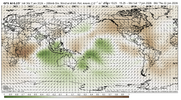
One thing the GFS AI is doing is trying to re-fire convection back across the Maritime Continent and E Indian Ocean - so that 'may' help to explain the SE ridge issue....but the runs fluctuate
View attachment 181481
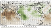
Most modeling is progressing that VP signal east, more in the position where you would typically see for +TNH / -EPO ridging. Here is the Euro, same timeframe
View attachment 181482
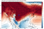
Brother we will all passView attachment 181483
Interesting!
Reg GFS coming inView attachment 181485
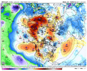 east asia looks way better on the regular GFS as well, also look at all the subtropical troughing in the pacific lol
Man it genuinely sucks that this period of favorable trough orientation has to feature a crappy “leftovers” caliber of cold air source. By the time we introduce real cold into the conus we have to decide how much of an eastern ridge we get to deal with.The GFS OP with an upper air pattern that screams frigid, but with a scoured-out Canada, temperatures are just chilly. Cross-polar flow is just getting going on the model, so at a minimum, we should recharge the cold to our north.
View attachment 181486
View attachment 181487
Give it a go, sirView attachment 181489
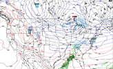
Flat pass. But maybe a late phase coming hereView attachment 181494
It is miss a phrase or something?
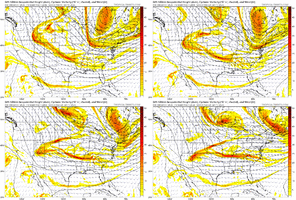
Ridge keeps getting better out west!!! With that look, you have to have suppression in the back of your mind, but as RC would say” get me the cold first” TMCanadian Vortex trending strongerView attachment 181474
Looks to me like a weaker version of Feb 8, 2020 which did put down good snows for some
Gotta love the digging right down the chimney! Things are definitely looking brighter!Flat pass. But maybe a late phase coming hereView attachment 181495
stovepipe drop. She was going to at least try for usGEM looks much better around that timeframe, energy digging in the SW, with a train of HP coming out of Canada and still enough troughing over the Aleutians to hold the fort out west View attachment 181497

Yeah that’s the evolution I like, I think the key here around that timeframe if we want a storm will be trying to retrograde the ridge to Alaska to get the cold air tap/deep TPV around the Great Lakes and finally get a legit Arctic tap, and also dig energy in a ideal location, but at the same time slow down the retraction of the jet to hold the ridging in Alaska/western Canada rather then a GOA/AK ridge. If we can do the in between, we probably are in good shapestovepipe drop. She was going to at least try for usView attachment 181499
I must say I am quite satisfied with what I see as most of these cold shots and moisture systems are at a safe range where they can trend snowier with time, not to mention there are numerous opportunities as it would appear now. Of course they could trend drier and not in our favor, but I always like to hope, and these past few days have been the best looking long-range I’ve seen off the GFS this year, especially considering the upcoming pattern change supported by other model guidance.I think the GFS run is going to look OK out in far fantasy range. Arctic high dropping down to reinforce the in situ cold air and an overrunning pattern with three pieces of energy on the west coast.
View attachment 181498
Always worry about the cold first, ALWAYS!It’s weird bc both the GFS and CMC have a wave dropping verical out of Idaho at roughly the same timeframe.
Don’t they say you can see the big ones coming from a mile away
Don’t worry about the cold. Like RC always says “get the stovepipe wave first then worry about the cold”
If this is the pattern we are working with the next month or so, exciting times coming, gonna be no shortage of boring weather, times where pac jet is retracted and we torch and probably get severe weather thanks to the polar jet being highly involved from the TPV, oth get some bouts of extension and you suddenly get a winter storm. Very 2014 esque. Something we throw in with February as well is the PMM likely becoming more positive, which should wake up the subtropical jet, and could also contribute to a more active Dixie season this spring
