• Hello, please take a minute to check out our awesome content, contributed by the wonderful members of our community. We hope you'll add your own thoughts and opinions by making a free account!

Wintry January 29th-30th ARCC Slam Dunk Winter Weather Threat

We still have couple of days for it to trend either way. I'm not worried, watching the models all day long is insane but I love it. I'll see yall at 18z

To me, as long as we have the precip, we're fine, if it's heavy enough it can change over. We cant afford for models to get any warmer though, hopefully it's a blip and not a trend.
 
To me, as long as we have the precip, we're fine, if it's heavy enough it can change over. We cant afford for models to get any warmer though, hopefully it's a blip and not a trend.
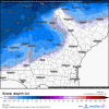
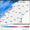
I think we will be fine to be honest, they may be trending to a 1-2" solution now and finally some agreement, but I still can see isolated 3s or higher with heavy prcip bands.
 
The rain behind the snow to me implies that the moisture in the snow growth region is pretty much non existent at that point.

I dont think it necessarily changes over to rain, it's just a problem with that map, I've noticed it in previous runs showing rain with temps in the 20s well behind the front.
 
I dont think it necessarily changes over to rain, it's just a problem with that map, I've noticed it in previous runs showing rain with temps in the 20s well behind the front.
I don’t either but that’s prob that model saying hey moisture is shallow and it’s only going to be drizzle or ZR
 
I dont think it necessarily changes over to rain, it's just a problem with that map, I've noticed it in previous runs showing rain with temps in the 20s well behind the front.

Part of the problem is like we talked about the other night is the dominant precip chart is determining the precip if it fell the time the chart was made. The QPF is from the hours previous thus the overlap. Like I said, a worthless chart.
 
Last edited:
The rain behind the snow to me implies that the moisture in the snow growth region is pretty much non existent at that point.

I was going to post the same thing. Weak moisture in the snow growth region... I bet a sounding would show exactly that.
 
Hopefully the EPS holds its own here in a few. Someone who has the earlier access to it, please post. Will it be out around 1:30?
 
Yep you can clearly see it in the chart above. The heaviest accumulations is perfectly in line with the ridge and mountain tops with Cheaha seeing the max.

This is exactly right. That ridge, although lower than Cheaha extends into northwest Georgia for areas that range from 1100'-1400' elevation. I've seen those areas in Paulding and Haralson counties get minor dustings in situations like this, whereas the surrounding areas get nothing.
 
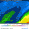
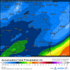
Latest day 3 QPF from the WPC for Monday night into Tuesday is pretty much the same. Less for west TN, more for GA and western NC/SC, but otherwise consistent with earlier forecasts. We're inside 72 hours with a consistently modeled threat that all models show to one degree or another. Time to sit back and relax. At least this isnt day 7 or 10 or 15 lol. :cool:

fill_99qwbg (1).gif
 
Not the greatest run for any of us but only 1 to 2/10th in. of QPF could make all the difference for some areas. Almost impossible for the models to have that exact QPF output completely accurate when we are still talking about Tuesday. (eternal optimist, for now!)
Your right, still little way to go. The rain system we had the other day was over performer, flooded my town. Shows you right there that no models or people will figure out the QPF until radar watch lol
 
At what point do we start paying more attention to the short range models instead of the globals?


Sent from my iPhone using Tapatalk
 
Already have been...riding the NAM and to a lesser extent, the SREF. NAM does great in winter. I'd believe it much more than the GFS/Fv3/ICON/ CMC/
Isn't it the short range NAM that does better ? I'm not sure the NAM is in its good range yet is it ?
 
Latest day 3 QPF from the WPC for Monday night into Tuesday is pretty much the same. Less for west TN, more for GA and western NC/SC, but otherwise consistent with earlier forecasts. We're inside 72 hours with a consistently modeled threat that all models show to one degree or another. Time to sit back and relax. At least this isnt day 7 or 10 or 15 lol. :cool:

View attachment 13557
I have been seeing about a quarter of an inch of QPF in MBY from most of the models over the last 36 hours. However, the degree of cold air that gets involved is what our area, east of the mountains, needs to resolve. We have gone back and forth on snow totals and as it stands right now, the cold air will not be deep enough for anything substantial before things dry out. Need that wave to develop on the front at just the right time to slow this thing down.
 
44e849f8919ae1f4a476503bce8ef95a.jpg


12z eps


Sent from my iPhone using Tapatalk
 
Good luck to y’all west off the apps, y’all really do need this after December, like I’ve said ensembles smooth the precip out/broaden it but there could be some hefty bands embedded in the broader band of precip, those bands could give 3+ if your in the right spot, that’s why I would not freak out, just wait till the short range models come in then get worried
 
Latest day 3 QPF from the WPC for Monday night into Tuesday is pretty much the same. Less for west TN, more for GA and western NC/SC, but otherwise consistent with earlier forecasts. We're inside 72 hours with a consistently modeled threat that all models show to one degree or another. Time to sit back and relax. At least this isnt day 7 or 10 or 15 lol. :cool:

View attachment 13557
With that broad of precip footprint, there has to be a low forming!? Has it been on the models? I know there was a few blips showing one, and WPC is pretty good
 
With that broad of precip footprint, there has to be a low forming!? Has it been on the models? I know there was a few blips showing one, and WPC is pretty good

The Euro has been the one trying to form one and the other models are trending that way. But it wouldn't be in the gulf if it does form.
 
Lol it doesn't matter if it's very light. I was sitting at 32 with light rain/sleet because the precip wasn't very heavy in La Fayette after the Christmas snow moved out. Yes, plain rain outside of the sleet at freezing.
Sorry if this is banter, but are you referring to the Christmas 2004 snow in south Louisiana? I remember that the snow missed MBY to the south that time. Back to topic, I agree rates could very well play a factor for many.

Sent from my SM-G950U using Tapatalk
 
This is what FFC says:

Snow fall amounts will vary from 3-6 inches in the
higher elevations of the mountains to less than a half inch across
the rest of north GA. This is still on day 4 so there is still
some uncertainty and changes in snow amounts can be expected.
 
I really think a couple of inches around where I am at (over 1800ft) but FFC is always wiling to call accumulations here and not so much anywhere else. As we get closer, they will certainly adjust.
I like my chances down below you too. We usually fair better than others with this setup.
 
Back
Top