-
Hello, please take a minute to check out our awesome content, contributed by the wonderful members of our community. We hope you'll add your own thoughts and opinions by making a free account!
You are using an out of date browser. It may not display this or other websites correctly.
You should upgrade or use an alternative browser.
You should upgrade or use an alternative browser.
Wintry January 21-23 2025
- Thread starter SD
- Start date
wow
Member
No it'll be freeeeezing rainI'm forecast for ~70hrs of below freezing straight next week. This better not turn to rain
Would take some work to wear down the 925sNo it'll be freeeeezing rain
If I had a nickel for how many times I had those 50-70% 1” snowfall yellows over my house 6 days before an event and ended up getting rained on..
Haha I feel you. Hopefully this time with temps not being as much or the problem they will be a little more usefulIf I had a nickel for how many times I had those 50-70% 1” snowfall yellows over my house 6 days before an event and ended up getting rained on..
rburrel2
Member
If the 18z Euro AI makes a similar sized jump that 18z Euro just did, It's gonna be back to showing 1 inch of liquid in the Upstate.
wow
Member
If the 18z Euro AI makes a similar sized jump that 18z Euro just did, It's gonna be back to showing 1 inch of liquid in the Upstate.
Don't jinx mama sita please.
I am feeling better than the NW trend could continue here as long as our wave dropping into the NW continue to trend stronger.
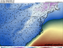
That would definitely drop temps back close to 20. This might be one of the rare times that roads are completely covered before the grass.Euro has temperature of 27 with dewpoint of 4 Tuesday at 4pm in CLT as snow is moving in lol
Mahomeless
Member
Not yet, but soon enoughGame on ladies and gentlemen
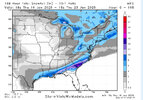
View attachment 164317
Not robbing the deep south of its snow but expanding the precip field further and further north.
packfan98
Moderator
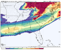
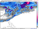
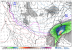
18z Euro AI looks a little better with the precip shield. Tick, Tick...
packfan98
Moderator
I noticed that it was 6-12 hours later. Wonder why? We need it early to keep more folks in the snow profile.Oh I think it's more than a little. But it's also later.
GeorgiaGirl
Member
If I'm reading the Euro AI correctly, it's suggesting a 24 hour event now.
I'll need the better maps though to make head or tail of p-type though probably.
I'll need the better maps though to make head or tail of p-type though probably.
Hard to know until we see the H5 maps. You were right too btw, it was just a tick.I noticed that it was 6-12 hours later. Wonder why? We need it early to keep more folks in the snow profile.
Not feeling it 77W very little precipitation back this way and a very dry air mass in place. I like how the precipitation field is correcting more NW. I guess we'll see. History tells me this a SE 85 storm.
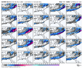
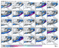
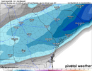
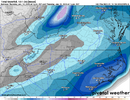
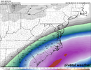
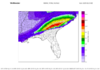
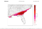
12z vs 18z EC AI QPF:


iGRXY
Member
UK ensembles are drier this run. Less digging of the N/S.
CNCsnwfan1210
Member

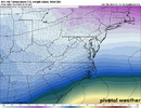
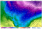
18z Euro AI 7pm Wednesday night I believe
Sent from my iPhone using Tapatalk
I hope so but back to back storms this way in my neck is very rare. As birdman says the sky's need time to healHistory absolutely says this trends NW
iGRXY
Member
Even if the precipitation shield shifts Northwest we have a very dry air mass in place whatever it shows you can cut those totals in half at least.
Blue_Ridge_Escarpment
Member
But on the contrary the ratios are going to be so high, it won’t take much to pile up.Even if the precipitation shield shifts Northwest we have a very dry air mass in place whatever it shows you can cut those totals in half at least.
I hope you're right but after studying the North Carolina State winter storm database history is not on our side I promise. I know history has nothing to do with model runs and were in a completely different climate now but it is a piece of the puzzle in my opinion.But on the contrary the ratios are going to be so high, it won’t take much to pile up.
QPF yes, but ratios being so high you can still get some good accumsEven if the precipitation shield shifts Northwest we have a very dry air mass in place whatever it shows you can cut those totals in half at least.
Models account for this already, I’m not sure why this myth is always repeatedEven if the precipitation shield shifts Northwest we have a very dry air mass in place whatever it shows you can cut those totals in half at least.
Hey man I work on Beech mountain I'm good I'm rooting hard for you guys.QPF yes, but ratios being so high you can still get some good accums
Blue_Ridge_Escarpment
Member
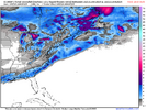
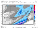
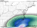
Latest GFS graphcast sizeable leap NW with precip shield
Wanna share with the group.Latest GFS graphcast sizeable leap NW with precip shield
Blue_Ridge_Escarpment
Member
Previous run the 0.5 qpf line was just west of I-95. This run it’s just west of I-85Latest GFS graphcast sizeable leap NW with precip shield
SimeonNC
Member
I'm pretty excited about this for the CLT area, especially for ppl like @Chazwin and @broken025. We won't see the big totals most likely but a good couple inches seems pretty possible imo
NBAcentel
Member
Even the ensembles favor SE of 85. There's only a very few that show a decent hit for the foothills. The mountains are another story. I'd like to see multi model support for the foothills.
Blue_Ridge_Escarpment
Member
The mountain snow totals are from Saturday/Sunday this weekend. If mtns are seeing snow from the Tues/Wednesday event, the foothills will be golden.Even the ensembles favor SE of 85. There's only a very few that show a decent hit for the foothills. The mountains are another story. I'd like to see multi model support for the foothills.

