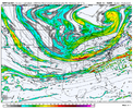
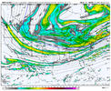
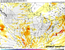
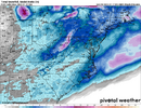
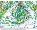
Put me down also as a hard pass on the slower solution. Let’s use this awesome cold source while we have it. If an inch or two of powder in the 20’s is all we get then so be it. But I really think if we can hold this look the short range guidance will pick up on more precip further NW with the overrunning
-
Hello, please take a minute to check out our awesome content, contributed by the wonderful members of our community. We hope you'll add your own thoughts and opinions by making a free account!
You are using an out of date browser. It may not display this or other websites correctly.
You should upgrade or use an alternative browser.
You should upgrade or use an alternative browser.
Wintry January 21-23 2025
- Thread starter SD
- Start date
Yeah likely one of those we won't know until day before
The northern most extent of the precip maybe, but by Sunday we will mostly know where this thing is going.
Man at the southern stream energy coming off pac into sw hour 54 on Nam.
Nice sharp ridging on the west coast. None of that mcdonalds arching shaped mess
Nice sharp ridging on the west coast. None of that mcdonalds arching shaped mess
SnowNiner
Member
Ok, sign me up for that. I don’t mean to be insensitive to folks in the south but that’s what I’m talking about. Go big! Let’s make best use of the cold. If that’s what it takes to get a 6+ storm, I’m all for it.
The anomalous cold air out front is what makes this setup unique (temperatures in the 20’s with low dewpoints as the precip arrives). How many times in your life are you going to see that kind of setup outside of the more hardcore wintry areas? Not many. So yeah, let’s take advantage of that if we canPut me down also as a hard pass on the slower solution. Let’s use this awesome cold source while we have it. If an inch or two of powder in the 20’s is all we get then so be it. But I really think if we can hold this look the short range guidance will pick up on more precip further NW with the overrunning
TWC is upping my totals to 3-5 inches. I'm pretty sure the ceiling could go higher than that for my location, just 100 miles from the Gulf. But I think a foot is too much to expect. The record for Baton Rouge is 12.5" in February 1895. So unless this storm takes on epic proportions, that ain't happening, lol.
iGRXY
Member
Shaggy
Member
We should recognize the rug on which we live on here on the coast. One hard yank and we have that rug pulled out from under us. Keep.these ensembles stable and get us under 72 hours and I'll get excited@Shaggy &
@lexxnchloe
look at these Ensembles, let's Cash~in & take too the bank..
(UNLESS) they get even better..
iGRXY
Member
I want snow as much as anybody else but I think some people are seriously underestimating the cold press here. What works for your backyard might not work for mine. I'll gladly eat crow!
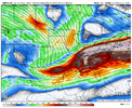
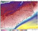
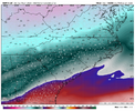 Because it's not just a "Hey it's really cold to our North that must mean it can't snow. It's all about your dynamics and can you create lift. You start mixing strong jet streams from SW to NE over the gulf into that cold air and you get big time precip shields. Hence why you get something like the Canadian run from earlier today. Temps are in the teens with 850's running nearly double digits below freezing. The colder air helps in this situation. It's all about how much digging you get with your trough regardless of how cold the air is to the north.
iGRXY
Member
I can honestly say that I have never seen a TWC point forecast for my area like there is for Tuesday night…. Snow Showers. Low 15. Snow accumulation 1-3 inchesThe anomalous cold air out front is what makes this setup unique (temperatures in the 20’s with low dewpoints as the precip arrives). How many times in your life are you going to see that kind of setup outside of the more hardcore wintry areas? Not many. So yeah, let’s take advantage of that if we can
Where can you find these maps (WxBlender)? Searched Google and found nothing.
It is my tool. Not available to the public quite yet, there are some testers (including some on this forum).Where can you find these maps (WxBlender)? Searched Google and found nothing.
Tokenfreak
Member
Yeah me either. Mine is saying 5-8" snow accumulation for my area.I can honestly say that I have never seen a TWC point forecast for my area like there is for Tuesday night…. Snow Showers. Low 15. Snow accumulation 1-3 inches
So, could this be the I-10 to I-20 special across the south? Does NOT happen often for sure...but, that arctic boundary is going to be crucial to see where the low travels.
Downeastnc
Member
Yeah NWS grids have low of 14 with snow here Tues night..never seen that before. I know in 1980 is was snowing with temps around 15 or 16 at some point. I am cautiously optimistic I end my 3 year snow drought next week.I can honestly say that I have never seen a TWC point forecast for my area like there is for Tuesday night…. Snow Showers. Low 15. Snow accumulation 1-3 inches
SnowNiner
Member
View attachment 164371Digging more this run for sure.
Threshold I think is the wave hitting the pacific coast. That’s where it was when we had better runs previously.
Yeah the two coldest storm in my memory are January 1988 with temperatures in the mid to upper teens during the day with snow and in January 2003, we fell into the the upper 10s as the snow was start to taper off. I was too young to remember the President’s Day storm in 1979 but my parents said that CLT fell into the lower teens during the height of that stormYeah NWS grids have low of 14 with snow here Tues night..never seen that before. I know in 1980 is was snowing with temps around 15 or 16 at some point. I am cautiously optimistic I end my 3 year snow drought next week.
Pops
Member
Man def digging west. Don’t know what that will change but there it is
Cad Wedge NC
Member
Yes, the coldest storm was the March 1980 storm. We had heavy snow here and 9 degrees at one point during the storm. Didn't think I would ever have a chance to see that again.Yeah the two coldest storm in my memory are January 1988 with temperatures in the mid to upper teens during the day with snow and in January 2003, we fell into the the upper 10s as the snow was start to taper off. I was too young to remember the President’s Day storm in 1979 but my parents said that CLT fell into the lower teens during the height of that storm
What is digging west? What are you looking at?Man def digging west. Don’t know what that will change but there it is
Yeah honestly I can't remember a forecast for all snow for my area before. When we've had snowstorms in the past, the temps were always marginal, and it would warm up right after that. The snow in January 2018 with that Arctic front was an exception, as that one was completely snow for the event and falling temps afterwards into the mid teens. But that snow was only about half an inch IMBY, and wasn't even in the forecast (just a mix as I recall). Incidentally that snow was the last time I've seen it IMBY. Last time I saw snow on the ground was in southeastern NC in January 2022, a storm which I'm sure many here would remember.
maybe nam?What is digging west? What are you looking at?
Pops
Member
NamWhat is digging west? What are you looking at?
Still on dial-up?
Pops
Member
Sorry typo
the wishful/wishcasting talk is getting a little out of hand.
we understand that there COULD be a northwest adjustment closer to verification time.
we don't need to hear the same thing 500 times a model run.
we understand that there COULD be a northwest adjustment closer to verification time.
we don't need to hear the same thing 500 times a model run.
Any ideas as to what an anomalously warm Gulf would do to this storm? Would it help amp things up better, better qpf, or no real difference?
Hey man I always enjoy your posts and I agree with you 100% I get most of y'all are excited about today's runs. I'm cautiously optimistic myself. But we need more agreement especially for my neck of the woods. I'm personally waiting until Sunday to get a better idea.View attachment 164368View attachment 164369View attachment 164370Because it's not just a "Hey it's really cold to our North that must mean it can't snow. It's all about your dynamics and can you create lift. You start mixing strong jet streams from SW to NE over the gulf into that cold air and you get big time precip shields. Hence why you get something like the Canadian run from earlier today. Temps are in the teens with 850's running nearly double digits below freezing. The colder air helps in this situation. It's all about how much digging you get with your trough regardless of how cold the air is to the north.
Cad Wedge NC
Member
Kinda of strange seeing the heaviest snow along the outer banks.
iGRXY
Member
A split of the Canadian ensemble (handles this kind of air mass/baroclinic better) and the EPS is what I think happens.
That's the one to put in your blender @bouncycorn. With the EPS weighted higher of course.
I'd assume mby gets 6 or 7 inches in that scenario and I'm all in
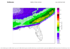
If the RDPS is any indication at hr 84, the Canadian will look stellar once again tonight
SimeonNC
Member
I'm not educated enough to say definitively but I feel like logic should say that more QPF, and I have a feeling that it may lead to more icing problems for certain areas right by the coast.Any ideas as to what an anomalously warm Gulf would do to this storm? Would it help amp things up better, better qpf, or no real difference?
Pops
Member
Will say Canadian has been consistentIf the RDPS is any indication at hr 84, the Canadian will look stellar once again tonight
i would imagine most if not all models have recent ocean temps priced in alreadyI'm not educated enough to say definitively but I feel like logic should say that more QPF, and I have a feeling that it may lead to more icing problems for certain areas right by the coast.
SimeonNC
Member
Are these WxBlender snowmaps 10:1 or Kuchera?

