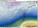
Would likely be close to 10"+ from CLT to RDU assuming an average of 15:1 ratios.
-
Hello, please take a minute to check out our awesome content, contributed by the wonderful members of our community. We hope you'll add your own thoughts and opinions by making a free account!
You are using an out of date browser. It may not display this or other websites correctly.
You should upgrade or use an alternative browser.
You should upgrade or use an alternative browser.
Wintry January 21-23 2025
- Thread starter SD
- Start date
WolfpackHomer91
Member
Previous run the 0.5 qpf line was just west of I-95. This run it’s just west of I-85
Need about 150 miles More and We’re in the Game here gimme 25 miles a day NW little LP
Sent from my iPhone using Tapatalk
CNCsnwfan1210
Member
Snow with temps in the low to mid 20s Wednesday night, you don’t see that too often in NC
Sent from my iPhone using Tapatalk
packfan98
Moderator
We're going to be fine.Even the ensembles favor SE of 85. There's only a very few that show a decent hit for the foothills. The mountains are another story. I'd like to see multi model support for the foothills.
Blue_Ridge_Escarpment
Member
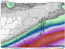
Very similar to graph cast, just about 50 miles further SEHere’s the Euro AI precip
View attachment 164354
It crosses FL at 1014mb by hour 150 , and is 1008mb by 162 per graphcast
Hey man after 20 years on these boards when you say we're fine it gives me hope!We're going to be fine.
Looks good for a lot of people. What are you thinking @Kylo?
ChattaVOL
Member
Chattanooga looks to be too far north.. cheering for y’all in the Deep South
Sent from my iPhone using Tapatalk
Sent from my iPhone using Tapatalk
NBAcentel
Member
Wow that’s a big shift. Is it overall just slower with the energy or does it spin for a bit in the Southwest before coming out?
I think Euro AI robs i-20 of course, with some 850 temp issues (sleet).. it's been the warmest of models i've noticed at that level
That Graphcast is 7.5- 9 inches snow here as the crow flies with .5 qpf and ratios
RollTide18
Member
I hope the NW trends slows down or stops or some of the coastal areas might not get snow and get freezing rain or just rain instead.
I’m fine with a NW trend of precip, just wish that could be possible without involving a furnace.
Last edited:
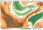
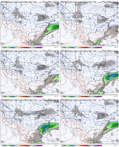
This storm looks to be 24hrs later than other models forecast.12z Graphcast during the core of the storm 850mb:
View attachment 164344
View attachment 164345
View attachment 164346
It very well could be but why would you say that now when things are actually trending better? This thing has looked a little better on every run today in my opinion.Chattanooga looks to be too far north.. cheering for y’all in the Deep South
Sent from my iPhone using Tapatalk
This storm looks to be 24hrs later than other models forecast.
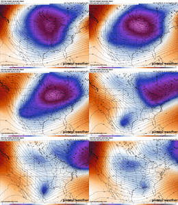
The Graphcast is completely on its own at 500mb from what frotho posted. Looked like it cutoff or something, idk.
packfan98
Moderator
NBAcentel
Member
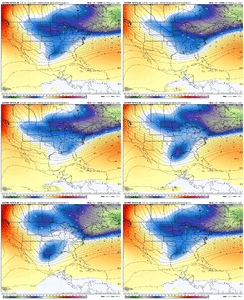
Graphcast loop. Thats a very interesting 500mb evolution View attachment 164355
*edit* the graphcast is also close to another miller A setup at day 9-10
At first I thought it was by itself at H5 but the AIFS isn’t far off either
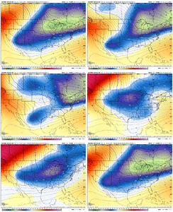
iGRXY
Member
Honestly with that H5 look I think you'd have quiet a bit more precip further north.At first I thought it was by itself at H5 but the AIFS isn’t far off either View attachment 164358
That was a different result, the overrunning largely misses us but that upper low in the west gets left behind and comes out and we get a weak miller A that slides off the coast. Like Feb 2014 but that had strong closed upper low.Well, the Euro AI being slower and NW looks to throw sleet into the mix for eastern regions I would think.
View attachment 164357
CNCsnwfan1210
Member
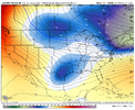
At first I thought it was by itself at H5 but the AIFS isn’t far off either View attachment 164358
2 separate events?
Sent from my iPhone using Tapatalk
Yeah this does appear it could be one of the rare times that being in the southeast part of CLT metro could be a good thing. Looking back at some of the old storm maps on Webb’s website, I wonder if we might end up with a snowfall footprint similar to 2/23-24/1989. That storm was more of a marginal set up with temperatures in the 50s the day before and in the low 30s during the event so with the high sun angle of late February we did lose a good bit of accumulation during the day to melting.I'm pretty excited about this for the CLT area, especially for ppl like @Chazwin and @broken025. We won't see the big totals most likely but a good couple inches seems pretty possible imo
@Shaggy &
@lexxnchloe
look at these Ensembles, let's Cash~in & take too the bank..
(UNLESS) they get even better..
NBAcentel
Member
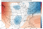
Interesting. So the AI and graphcast detatch the S/W from waveguide completely View attachment 164360
Has this happened on any other non AI run since we started tracking?
Good luck brother. You have waited a long time. I really think your area is money right now just with the absolute cold air mass, your rates could be insanity.Yeah this does appear it could be one of the rare times that being in the southeast part of CLT metro could be a good thing. Looking back at some of the old storm maps on Webb’s website, I wonder if we might end up with a snowfall footprint similar to 2/23-24/1989. That storm was more of a marginal set up with temperatures in the 50s the day before and in the low 30s during the event so with the high sun angle of late February we did lose a good bit of accumulation during the day to melting.
Yeah I want no part of that slower and warmer action. Keep it connected and bring it on out. May be good for the NW crowd though if it’s fairly strongInteresting. So the AI and graphcast detatch the S/W from waveguide completely. That explains the big warm nose on the AI as well, the WAR is nosing given the slowed wave. This type of solution is more boom potential but also riskier View attachment 164360
NBAcentel
Member
iGRXY
Member
Those east of 77 would be playing with fire big time if we start doing that. Back my way probably would love it depending on just how slow and amped it gets.Yeah I want no part of that slower and warmer action. Keep it connected and bring it on out. May be good for the NW crowd though if it’s fairly strong
Blue_Ridge_Escarpment
Member
Not surprisingly that 6Z run on the 14th was the best run yet for my area.The 06z GFS run from Jan 14th is the closest I can see to that View attachment 164361View attachment 164362
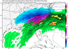
Talk of this storm is going to do this, and it’s going to hit here, and it’s not going to hit here is all a whole bunch of speculation. This is many days out. We can make guesses, but everybody’s in the game here. No one knows for sure how this is going to go down
Twister
Member
Yeah likely one of those we won't know until day beforeBut if enough people guess, someone is bound to be right, and they can see, "see, I told you so. I'm the smartest weather guy in the world."

