rburrel2
Member
The 84hr NAM looks like it was a perfect hook up with the northern and southern waves... Nice to have it in our camp even if it's the 84hr NAM.


Yeah, sometimes higher resolution != better forecasts when we are talking about little nuances that are being over amplified/keyed on out there by the higher resolution trouble areas. Especially in the SW.Climatologically the CFS does look spot on with this looking at the upper level, and the SLP low track as well. I think there will be a rise in the 5h heights ahead of the trough and bring this further north.
We have a lot more than that.
Yeah and it wasn’t so much about the snow footprint / snow maps etc, it was how it locked in early on the eventual 500mb wave evolution / interaction that was complex while the other modeling was bouncing around. It hasn’t been as stable for this stormit counts sleet as snow so it was actually spot on in SC/NC here. It did bust to low on the NW side of the storm for Northern Arkansas and Southeastern Kansas/Oklahoma though.
Hard to imagine a scenario where more people don’t win here. We’re dropping our wave west of Idaho and sharpening that western ridge while it digs. You would think this would have plenty of time to turn the corner. But maybe not I guessIcon looks like it’s not gonna be as left behind this run can already tell
Yeah...agreed...the models don't have a clue until Sunday or even Monday. By then we get the sampled stuff in and it will show huge event for the SE.Need to get this system out of here this weekend. See how far this cold air really pushes. Think models will have a good handle on this by Sunday morning or so. We know this song and dance.
Does it have any real support anywhere else? I'm open minded.We toss the ICON...it shows a miss.

 www.facebook.com
84 hours.How far does the 18z RGEM go out?
I was thinking about this earlier today but didn’t wanna say it becausethe last time the Canadian caught a dub was with the Jan 21st 2022 system which was northern stream dominated, it kept the wave in a better orientation and won that one out. Maybe it can do it again. But would love to see other guidance go its way
Yeah, wasn’t that one also in the low 20s during most precip like this one would probably be (if it happens)? And I think most modeling was too suppressed until close in unless I’m mixing it up with another similar system (like January 2014).I was thinking about this earlier today but didn’t wanna say it because
But yeah, that was a fairly cold event by our wintry standards and I remember the RGEM leading the way. I don’t recall if they had much similarity at h5
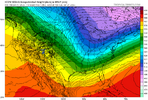
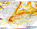
That's not even far off at H5 from what the CMC-GFS-EURO shown at 12z.ICON is the worst operational model and this just proves it. It's definitely trending in the right direction but it is awful.
View attachment 164696

How long can this model hang onto this outcome before it falls flat on its face?OH CANADA!! A THING OF BEAUTY!!
View attachment 164704
Eh I mean the idea is kinda there I guess. Prolly better analogs than that
NS too sharp compared to 2022. How's this compare to 2017? I think I saw a setup of it prior and it seems like a blend of the two.
Need to load up the base some more and slow it just a little bit. Not impossible at this stage. It’s moving that way

