• Hello, please take a minute to check out our awesome content, contributed by the wonderful members of our community. We hope you'll add your own thoughts and opinions by making a free account!

Wintry January 21-23 2025

Just for the newer members. We often do not distinguish between the the two, but the “NW trend” and “amping” are two different things.

The NW trend normally happens because the northern stream weakens as verification nears and allows the storm to move farther NW along with the increase of WAA. This may include amping or it may not.

However, here we all want this thing to amp it’s tail off in the GOM. Sure you will have this come NW a little, but with this cold air feed and the added precip you would trend even colder(ala CMC).
 
Fortunately, we're at a place where everything looks good on a broader scale. This disagreement is in the details where a lot can change well into the NAM range. If you recall, the mid-January 2018 storm in Central NC was 1-2" until about 48", and I got 7." Same thing with December 2017.
i especially think this is true on systems like these, when cyclogenesis occurs well into the gulf and features deep convection. the eventual surface low location will bounce around a little bit (10-20 mile adjustments) and likely won't be known until nowcast time imo (gulp). i think this is why precipitation got thrown further west than forecast in the early jan 2018 storm. deep convection will tug at the slp and stretch low level vorticity enough to have forecast impacts. i don't think the globals do a fantastic job of handling this, they can have convective feedback issues (haven't seen this yet though) and i always like to wait until i see what the CAMs show in these type of situations.
 
Just for the newer members. We often do not distinguish between the the two which isn’t necessarily true but the “NW trend” and “amping” are two different things.

The NW trend normally happens because the northern stream weakens as verification nears and allows the storm to move farther NW along with the increase of WAA. This may include amping or it may not.

However, here we all want this thing to amp it’s tail off in the GOM. Sure you will have this come NW a little, but with this cold air feed and the added precip you would trend even colder(ala CMC).
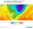
Yeah the best case scenario to not hose too many southern people would be a slight jog to the NW and more expansive Precip fields to NW combo. It would cause "some" mixing issues in the far south but stay limited hopefully make a much large swatch expanse of winter weather.
 
This is a tough one because so many have a shot because of the anomalous cold out front. Will be winners and losers unfortunately as long as we can keep the storm

Good discussion in here this AM. Here are the 3 key players as I see it at 500mb, with wave evolution and timing playing big parts:
1) How much lift do we get with the heights along the east coast? More lift, more storm
2) Does the shortwave in the southwest remain intact and kick east or get squashed and weakened?
3) How much and where does the northern TPV piece phase in? Farther to the south and west, more storm

View attachment 164498


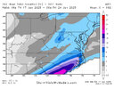
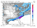
Here is today's 06z GFS run vs yesterday's

View attachment 164499
I don't really know why it is, but the models generally seem to re-find stronger shortwaves as we get closer.

You can see that illustrated in your comparison.

I expect we'll continue to see steps toward a more expansive precipitation shield over the next 24-48 hrs.
 
6z AI loop...still looks like the trailing upper low in the sw gets left behind and then swings through. Different than the other globals, I think. I haven't looked at all the 0z/6z runs last night. Still don't know how some of you get sleep.

View attachment 164500
Yeah the AI did leave the wave behind, but didn't bury it and weaken it....brings it out later, but more intact, but with it getting dampened as it moves thru the SE (it's warmer aloft thru SC - warmer risks with that scenario, but it's another option to watch)20250117133254-2608c8dcf179a325bb25ad3979185a8be5e7839f.png
 
NWS RAH put a chance of snow back in the point forecast here. Not sure I’ve ever seen a chance of snow with a low of 13 (!!!) here.

Tuesday Night
A chance of snow after 1am. Mostly cloudy, with a low around 13. Chance of precipitation is 30%.
RAH discussion says they basically went with chance POPS (30%) Hwy 1 and east with slight chance (20%) west of Hwy 1...for now
 
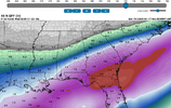
Frames 108 thru 132 QPF thru SE during this time other then onset a little further south is all below freezing down to GA/FL and Extreme SC coastline.

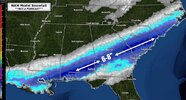
You have a much more expansive hit thru Birmingham/Atl I-20 corridor here with rates particularly higher. This is very GFS/CMC like solution by just eyeballs. I would have .19 QPF at a roughly 15:1 ratio for my area is still almost 3 inches
 

Attachments

  • 1737121249185.png
    1737121249185.png
    408.3 KB · Views: 122
I don't really know why it is, but the models generally seem to re-find stronger shortwaves as we get closer.

You can see that illustrated in your comparison.

I expect we'll continue to see steps toward a more expansive precipitation shield over the next 24-48 hrs.
…and the precip field will still be under modeled
 
Webber how much more of a North and West or more specifically an expansive precipitation field do you expect at this point?
 
Last edited by a moderator:
Frames 108 thru 132 QPF thru SE during this time other then onset a little further south is all below freezing down to GA/FL and Extreme SC coastline.

You have a much more expansive hit thru Birmingham/Atl I-20 corridor here with rates particularly higher. This is very GFS/CMC like solution by just eyeballs. I would have .19 QPF at a roughly 15:1 ratio for my area is still almost 3 inches
And only about 75 miles from an absolutely epic storm in ATL
 
The Euro AI is close to something special here... Has snow starting to break out at 4pm on Tuesday... then the light overrunning stalls just to the south of I-85 for a long time... then the final storm pivots through and ends precip at 4am on Thursday. One tiny tick north and/or stronger with the overunning shield and you're looking at a 30 hr steady event.
 
Webber how much more of a North and West or more specifically an expansive precipitation field to you expect at this point?
I’m not Webb, but I fully expect another 100+ mile jog north, maybe more, with the SLP. From there, expect another 100 miles or so of precip field expansion, although somewhat light…maybe .25” liquid equivalent or less. So essentially, if you are within 200 miles of the current northern fringes on the suppressed solutions, expect glory.
 
I was thinking about that one yesterday. It came just a few days after a major cold blast.

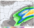
This was the NAM 3 days out before that storm which was close ish to consensus.

We’re in a fine spot.

This system is almost certain to trend north + west once the synoptic pattern settles down because of what’s actually forcing the precip here (warm advection and isentropic upglide). That’s virtually inevitable in this setup. It’s more of a question of how much it trends that way when we get closer

IMG_4433.jpeg
 
And only about 75 miles from an absolutely epic storm in ATL
Verbatim, this gives MBY ~0.15, but 0.40 is only 60-70 miles south-southeast. With ratios above 10:1, I remain steady in my thinking that Atlanta metro and North Georgia remains in play for a potentially significant winter storm.

—30—
 
This seems like a scenario where it could snow lightly for like 8-12 hours here and only add up to an inch or two of powder. That sounds like a dream to me, no complaints on that if it plays out that way.
You would be suprised at how efficiently light snow will accumulate at high ratios and temperatures in the 20s when falling for 12 hours.
 
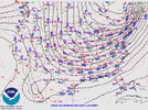
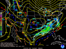
The overall depiction of this winter storm on the models at this range reminds me a lot of Jan 28-29 2014
Was kinda thinking this as well yesterday. That one continued to trend NW all the way to 0 hour and as we know caused massive problems. I don’t have any pretty h5 maps, but doesn’t look like it dug super deep? Just enough to produce WSW flow over top a cold airmass. Can’t help but feel like the ceiling is a lot higher with this current storm if we can get lucky.

IMG_2617.gif


IMG_2619.gif

That was a crazy day in Atlanta

IMG_0006.jpegIMG_0007.jpeg
 
This was the NAM 3 days out before that storm which was close ish to consensus.

We’re in a fine spot.

This system is almost certain to trend north + west once the synoptic pattern settles down because of what’s actually forcing the precip here (warm advection and isentropic upglide). That’s virtually inevitable in this setup. It’s more of a question of how much it trends that way when we get closer

View attachment 164509
Yep, I got an inch of cold powder from that one here in Clemson and I remember being tickled to come away with that when the models were showing basically nothing here.
 
This was the NAM 3 days out before that storm which was close ish to consensus.

We’re in a fine spot.

This system is almost certain to trend north + west once the synoptic pattern settles down because of what’s actually forcing the precip here (warm advection and isentropic upglide). That’s virtually inevitable in this setup. It’s more of a question of how much it trends that way when we get closer

View attachment 164509
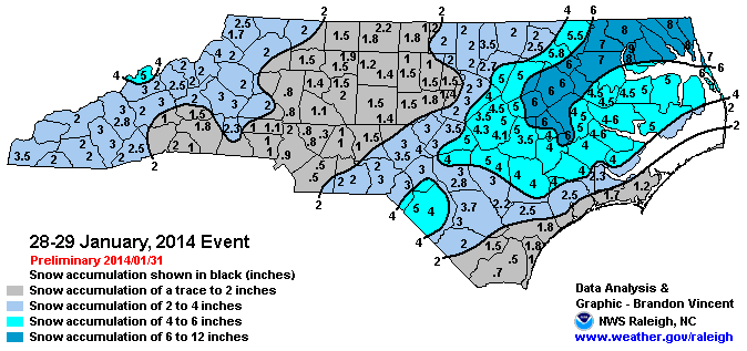
Here's the verification for those curious
january_28-29_2014_nc_snowmap.gif
 
I reminded of Jan. 9-10, 2011. A second wave came up from the south to really beef up totals toward the end.

I don’t see that comparison here really.

This is a classic +TNH overrunning look like Jan 2014 in many ways. Jan 2011 was a nice pattern too but very different from what we have here with a big west-based -NAO.

Jan 2011

IMG_4436.gif


Jan 2014

IMG_4434.gif


Forecast

IMG_4435.png
 
Back
Top