• Hello, please take a minute to check out our awesome content, contributed by the wonderful members of our community. We hope you'll add your own thoughts and opinions by making a free account!

Wintry January 21-23 2025

Looks like GSP nibbled a little bit. Just don't trust the Canadian but if it scores it will have my respect going forward. I will say this she's not backing down.

Hazardous Weather Outlook
National Weather Service Greenville-Spartanburg SC
436 AM EST Fri Jan 17 2025

GAZ010-017-018-026-028-029-NCZ035>037-056-057-068>072-082-502-504-
506-508-510-SCZ008>014-019-101>109-180945-
Rabun-Habersham-Stephens-Franklin-Hart-Elbert-Alexander-Iredell-
Davie-Catawba-Rowan-Cleveland-Lincoln-Gaston-Mecklenburg-Cabarrus-
Union-Greater Caldwell-Greater Burke-Eastern McDowell-
Greater Rutherford-Eastern Polk-Cherokee-York-Anderson-Abbeville-
Laurens-Chester-Greenwood-Oconee Mountains-Pickens Mountains-
Greenville Mountains-Greater Oconee-Greater Pickens-
Central Greenville-Southern Greenville-Northern Spartanburg-
Southern Spartanburg-
436 AM EST Fri Jan 17 2025

This Hazardous Weather Outlook is for northeast Georgia, Piedmont
North Carolina, western North Carolina and Upstate South Carolina.

.DAY ONE...Today and tonight.

Hazardous weather is not expected at this time.

.DAYS TWO THROUGH SEVEN...Saturday through Thursday.

An arctic air mass moves into the area Sunday night and remains in
place through Wednesday. Temperatures will be 15 to 20 degrees below
normal Monday through Wednesday and wind chills may be so low as to
be dangerous for some individuals. The potential for any wintry
precipitation during this time is highly uncertain.

.SPOTTER INFORMATION STATEMENT...
 
8104eecab13f9fe6057bfd76c3c7138e.png

dbb0f740c83404c84350e566917af23b.png

841b2427383586c99e2d44629f14a816.png

1eb9f3155c81dc9de2a47d326222d0f4.png

Some areas outta the NWS Tallahassee forecast area


Sent from my iPhone using Tapatalk
Let’s not put all of these screenshots here in the future. It takes up a lot of room and folks can look them up easily. Thanks.
 
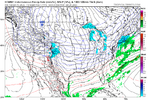
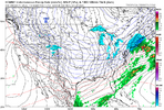
Here was the where the rubber meets the road. Canadian, ukmet, 6z GFS same time stamp: Show you how close they all are and how perfectly timed this has to be.

View attachment 164467
View attachment 164468

View attachment 164469
CMC is the happy blend of both bringing the base of the trough east like the GFS but also having the N/S further south like the UK. It’s ridiculous how close these 3 are. What’s more annoying is this is 100 hours away and you have this much variability at H5
 
CMC is the happy blend of both bringing the base of the trough east like the GFS but also having the N/S further south like the UK. It’s ridiculous how close these 3 are. What’s more annoying is this is 100 hours away and you have this much variability at H5
I’m afraid we are going to have to wait another 48 hours before there’s a better consensus about what the surface is going to look like. I’m encouraged that the energy dropping in the west looks similar on the modeling.
 
So couple of keys we want to watch for:
1. First is getting your initial vorticity to slide in preferably on the pacific coast, but at least near Seattle as it drops enters from Western Canada.
2. You want this to dig into California while also getting influence from the N/S.
3. At this point we need our N/S to be back over the plains. This is where things start turning amongst all the models. Some are picking up the S/W diving down the coast and sliding it east and some are leaving it back and flattening the trough out.
4. If we can get it to kick east you want to keep it positively tilted going east but start getting it to go more neutral over Texas and the Mississippi River. This is where the CMC/UK/GFS are diverging as posted above. The UK is broadening the trough and leaving the base flatter, the GFS is sliding it intact east but the N/S is still too far north, the CMC is a perfect blend between the 2. Biggest key is you want that N/S further south. It’s why the UK is closer to the cmc from a surface depiction.
 
6z euro is better than 0z, but not as good as 18z from yesterday. We are all still in the game. Let’s see what the rest of today brings. View attachment 164466
Yes sir, need that trend to continue through the 12z models. Next 48 hrs of model suites, once data from our S/Ws of interest are ingested, gonna be huge. Not gonna lie I don't care how good the CMC and others look, as long as the Euro has QPF off the coast, I'm nervous lol. So glad to see it ticked back this morning
 
I’m afraid we are going to have to wait another 48 hours before there’s a better consensus about what the surface is going to look like. I’m encouraged that the energy dropping in the west looks similar on the modeling.
Yeah until we get that piece of energy coming out of Canada sampled better we are guessing and getting so much volatility in the models.

1 thing I’m noticing with this storm that is similar to last storm is we get are getting a bad cycle at 0Z and clawing it back the remaining 3 cycles. 0Z 2 nights ago took a big step backwards and we spent all day getting it back to the previous 18Z. Then last night it took a much smaller step backwards again. So far we seem to be reversing that. The good news is if we hold 12z and 18z taking more steps forward we probably sitting in a really good place across the southeast.
 
As I sip my morning coffee I’m looking at this weekends storm on the Euro and seeing how much the precip field has changed/ expanded over New England in just the last 36 to 48 hours. I get the feeling we might be dealing with some of the same biases on the Euro (and other models) that the mid Atlantic and NE have to deal with regularly with coastal systems. Below is this mornings 0z and the 12z from Wednesday. Obviously we’re looking at a different storm but this gives me hope we might see a similar expansion as we get closer to go time.
1737115031220.png
1737115067409.png
 
ce24e7f9031c996f3700f3654f4310a5.gif

Help me out guys, trying to figure out why the GFS is trending favorable. One thing I see is the rising heights over Greenland, trough over the eastern US/Canada is becoming more longated, lower heights over the west, and a flexing WAR


Sent from my iPhone using Tapatalk
 
Yeah until we get that piece of energy coming out of Canada sampled better we are guessing and getting so much volatility in the models.

1 thing I’m noticing with this storm that is similar to last storm is we get are getting a bad cycle at 0Z and clawing it back the remaining 3 cycles. 0Z 2 nights ago took a big step backwards and we spent all day getting it back to the previous 18Z. Then last night it took a much smaller step backwards again. So far we seem to be reversing that. The good news is if we hold 12z and 18z taking more steps forward we probably sitting in a really good place across the southeast.
Fortunately, we're at a place where everything looks good on a broader scale. This disagreement is in the details where a lot can change well into the NAM range. If you recall, the mid-January 2018 storm in Central NC was 1-2" until about 48", and I got 7." Same thing with December 2017.
 
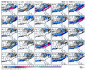
6z eps is solid. Decent model consensus now with the Canadian being the outlier. Averaging everything is starting to make sense.
View attachment 164472
Looking at the 6z EPS members…the 2-3” mean comes from a bunch of 0z Canadian like members. Talk about boom or bust.
 
As I sip my morning coffee I’m looking at this weekends storm on the Euro and seeing how much the precip field has changed/ expanded over New England in just the last 36 to 48 hours. I get the feeling we might be dealing with some of the same biases on the Euro (and other models) that the mid Atlantic and NE have to deal with regularly with coastal systems. Below is this mornings 0z and the 12z from Wednesday. Obviously we’re looking at a different storm but this gives me hope we might see a similar expansion as we get closer to go time.
View attachment 164471
View attachment 164473
Euro was dry for our last event. Even the last run before the precip moved in was drier than the other models and was less than what we actually received at my location.
 
6z eps is solid. Decent model consensus now with the Canadian being the outlier. Averaging everything is starting to make sense.
View attachment 164472
Pretty good jump on the 6z EPS and 6z GEFS. GEPS has remained much more consistent, there's no doubt about that.
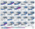
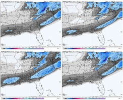
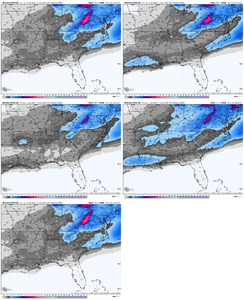
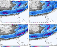
ecmwf-ensemble-avg-se-total_snow_10to1-1737093600-1737612000-1737612000-40.gifgfs-ensemble-all-avg-se-total_snow_10to1-1737093600-1737730800-1737730800-40.gif
cmc-ensemble-all-avg-se-total_snow_10to1-1737072000-1737612000-1737612000-40.gif
 
ce24e7f9031c996f3700f3654f4310a5.gif

Help me out guys, trying to figure out why the GFS is trending favorable. One thing I see is the rising heights over Greenland, trough over the eastern US/Canada is becoming more longated, lower heights over the west, and a flexing WAR


Sent from my iPhone using Tapatalk
It’s digging further southwest with the trough which is increasing heights and amplification out ahead
 
I hope everyone in the SE can score one way or another! Still think this looks to be a primarily coastal event with the big totals then at best some 1-2 inch amounts for inland areas. Seems to be the consensus among models.

But as the saying goes there’s still time! Going to be some fun beach snow photos over the next week!
 
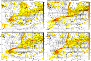
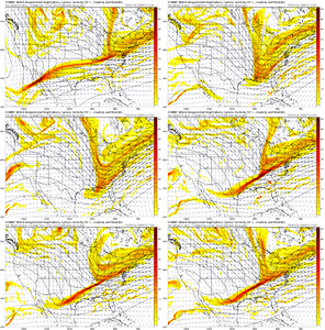
Just giving a few checks on the models this morning and their H5 trends. It's worth noting each one.

CMC - tilting far sooner resulting in the diabolical bomb we keep seeing.

gem_z500_vort_us_fh120_trend.gif

GFS - Wants to trend to holding it back more. It's starting to look more like the CMC in some ways but doesn't pull the phase.
gfs_z500_vort_us_fh114_trend.gif

ICON - You can see the energy growing closer per runs. 6/18Z runs make less frames overall in comparison due to range.

icon_z500_vort_us_fh102_trend.gif
EURO - Seems to have had a hold then jumped to a rather undesirable solution with that flat energy and holding but the Northern stream is all over the place and looks to have more run to run changes than an other model.
ecmwf_z500_vort_us_fh120_trend.gif

I'd think we watch the Euro and if it has a major shift, it's clearly headed in a direction the others are too. If we see it hold, I'd expect to see the CMC fold in the coming days and barely kick up enough snow to make it past Macon.

For those in coastal regions you want to keep seeing what the Euro has. If you're from Birmingham to Charlotte you want to see the neutral tilt and phasing trend into more model runs.
 
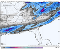
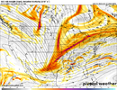
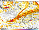
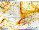
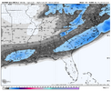
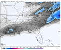
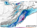
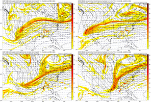
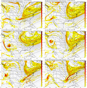
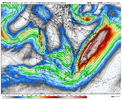
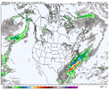
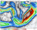
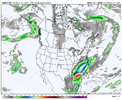
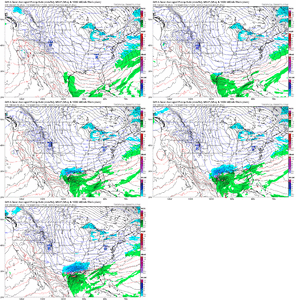
Looking at the 00z CMC and 06z GFS QPF over the southeast, to me it is obvious one of them is handling something wrong. When you have an upper jet oriented like that and are in the right entrance region, combined with strong isentropic upglide due to the dense low-level Arctic air mass, there should be more precip to the west than there is in the 6z GFS. Doesn't matter if it's rain, sleet, snow the GFS is too try if this setup verifies and I am pretty dang confident in that.
gfs-deterministic-namer-z250_speed-7514800.pnggfs-deterministic-namer-precip_6hr_inch-7514800.png
gem-all-namer-z250_speed-7514800.pnggem-all-namer-precip_6hr_inch-7514800.png
 
Looking at the 00z CMC and 06z GFS QPF over the southeast, to me it is obvious one of them is handling something wrong. When you have an upper jet oriented like that and are in the right entrance region, combined with strong isentropic upglide due to the dense low-level Arctic air mass, there should be more precip to the west than there is in the 6z GFS. Doesn't matter if it's rain, sleet, snow the GFS is too try if this setup verifies and I am pretty dang confident in that.
View attachment 164487View attachment 164488
View attachment 164489View attachment 164490
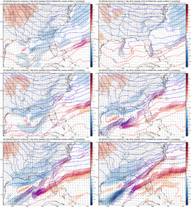
The GFS is trying to work out more FGEN and it only goes towards more each run. gfs_temp_adv_fgen_850_seus_fh114_trend.gif
 
It’s digging further southwest with the trough which is increasing heights and amplification out ahead
I agree, but isn't that because of the push from the WAR? I guess I might be asking which came first the chicken or the egg:p I am not very fond of seeing the ridge nudging its way west this early in the models . Since I live central Alabama, where the WARM NOSE puts out his welcome mat.😅
 
By and large this is a crap shoot on track and precip at this point. However like Metwannabe said earlier, until this is sampled as it comes ashore out west, we don't know which model will be correct. IMO a blend of the EURO and UKMET would be the end result. Unfortunately I would put less weight on the CMC than the EPS just based on history, but it will be interesting for the next 24-48 hours
 
Prob shouldn’t be talking analogs here, but if we actually do happen to pull somewhat of a replay of Jan 2014, we’re not going to really know about the upper end of the precip field until a day before go time.

About to post this very thing. January 2014 was caused by a little ripple on H5 that turned the flow SW. Even if we lose the big dog potential, the chance for 2-5” is very very real here and I think most of us would cope well there.
 
Looking at the 00z CMC and 06z GFS QPF over the southeast, to me it is obvious one of them is handling something wrong. When you have an upper jet oriented like that and are in the right entrance region, combined with strong isentropic upglide due to the dense low-level Arctic air mass, there should be more precip to the west than there is in the 6z GFS. Doesn't matter if it's rain, sleet, snow the GFS is too try if this setup verifies and I am pretty dang confident in that.
View attachment 164487View attachment 164488
View attachment 164489View attachment 164490
It interesting to note that the jet orientation is quite similar on both the UK and EURO as well. The fact is that there should be a much more expansive precip shield to the NW than what we’re seeing right now on both the GFS and EURO. Something interesting to note… I went back and looked at the 1/3-4/2018 coastal storm and found that the Canadian actually did the best job on the precip to the NW. In fact the EURO kept all precip right within about 60 miles of the immediate coastal line right up until about 18 hours before the storm
 
Last edited:
Back
Top