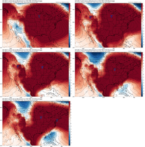
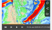
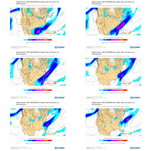
Haha ooh I remember this one extremely well. @deltadog03 and I were adamant that the Euro was wrong about that and even NWS refused to budge that it would come west but it did.It interesting to note that the jet orientation is quite similar on both the UK and EURO as well. The fact is that there should be a much more expansive precip should to the NW than what we’re seeing right now on both the GFS and EURO. Something interesting to note… I went back and looked at the 1/3-4/2018 coastal storm and found that the Canadian actually did the best job on the precip to the NW. In fact the EURO kept all precip right within about 60 miles of the immediate coastal line right up until about 18 hours before the storm
-
Hello, please take a minute to check out our awesome content, contributed by the wonderful members of our community. We hope you'll add your own thoughts and opinions by making a free account!
You are using an out of date browser. It may not display this or other websites correctly.
You should upgrade or use an alternative browser.
You should upgrade or use an alternative browser.
Wintry January 21-23 2025
- Thread starter SD
- Start date
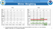
Here's a link to a PowerPoint on the NBM, seems it was updated in May 2024, below is best info I could find within the PP of what models go into it's output. According to NOAA they utilize both NWS and non-NWS modelsNational Blend of models. I’m not sure which models go into to this or how they are weighted, but I imagine the GFS suite gets the most weight at longer lead times. I would think it would tick up in future runs.
View attachment 164483
Last edited:
SnowDoomer21
Member
More North and Snow
Sorry I’m still learning weather models
Sent from my iPhone using Tapatalk
- Joined
- Jan 23, 2021
- Messages
- 4,577
- Reaction score
- 15,106
- Location
- Lebanon Township, Durham County NC
map
250121/1900Z 109 06003KT 31.2F 0:1| 0.0|| 0.00|| 0.00|| 0.000 0:1| 0.0|| 0.00|| 0.00|| 0.00 0| 0| 0
250121/2000Z 110 06004KT 30.8F SNOW 21:1| 0.1|| 0.00|| 0.00|| 0.007 21:1| 0.1|| 0.00|| 0.00|| 0.01 100| 0| 0
250121/2100Z 111 05004KT 30.6F SNOW 15:1| 0.2|| 0.00|| 0.00|| 0.011 17:1| 0.3|| 0.00|| 0.00|| 0.02 100| 0| 0
250121/2200Z 112 04005KT 30.1F SNOW 14:1| 0.1|| 0.00|| 0.00|| 0.006 17:1| 0.4|| 0.00|| 0.00|| 0.02 100| 0| 0
250121/2300Z 113 05004KT 29.4F 0:1| 0.0|| 0.00|| 0.00|| 0.000 17:1| 0.4|| 0.00|| 0.00|| 0.02 0| 0| 0
250122/0000Z 114 04004KT 29.0F 0:1| 0.0|| 0.00|| 0.00|| 0.000 17:1| 0.4|| 0.00|| 0.00|| 0.02 0| 0| 0
----------------------------------------------+----++-----+-------------++--------------++-------------++-----------+---+---
250122/0100Z 115 04006KT 28.1F SNOW 16:1| 0.2|| 0.00|| 0.00|| 0.014 16:1| 0.6|| 0.00|| 0.00|| 0.04 100| 0| 0
250122/0200Z 116 01007KT 27.4F SNOW 17:1| 0.4|| 0.00|| 0.00|| 0.023 16:1| 1.0|| 0.00|| 0.00|| 0.06 100| 0| 0
250122/0300Z 117 01007KT 22.5F SNOW 11:1| 0.8|| 0.00|| 0.00|| 0.069 14:1| 1.8|| 0.00|| 0.00|| 0.13 100| 0| 0
250122/0400Z 118 01006KT 22.5F SNOW 13:1| 0.8|| 0.00|| 0.00|| 0.063 13:1| 2.6|| 0.00|| 0.00|| 0.19 100| 0| 0
250122/0500Z 119 01006KT 22.2F SNOW 14:1| 0.8|| 0.00|| 0.00|| 0.062 13:1| 3.4|| 0.00|| 0.00|| 0.26 100| 0| 0
250122/0600Z 120 01006KT 21.8F SNOW 21:1| 1.0|| 0.00|| 0.00|| 0.049 15:1| 4.5|| 0.00|| 0.00|| 0.30 100| 0| 0
RDU Bufkit.
6z euro is better than 0z, but not as good as 18z from yesterday. We are all still in the game. Let’s see what the rest of today brings. View attachment 164466
That’s a huge shift still, blanks TLH with all-rain after dropping 5-6” of snow at 0z.
Looky at those ratiosmap
250121/1900Z 109 06003KT 31.2F 0:1| 0.0|| 0.00|| 0.00|| 0.000 0:1| 0.0|| 0.00|| 0.00|| 0.00 0| 0| 0
250121/2000Z 110 06004KT 30.8F SNOW 21:1| 0.1|| 0.00|| 0.00|| 0.007 21:1| 0.1|| 0.00|| 0.00|| 0.01 100| 0| 0
250121/2100Z 111 05004KT 30.6F SNOW 15:1| 0.2|| 0.00|| 0.00|| 0.011 17:1| 0.3|| 0.00|| 0.00|| 0.02 100| 0| 0
250121/2200Z 112 04005KT 30.1F SNOW 14:1| 0.1|| 0.00|| 0.00|| 0.006 17:1| 0.4|| 0.00|| 0.00|| 0.02 100| 0| 0
250121/2300Z 113 05004KT 29.4F 0:1| 0.0|| 0.00|| 0.00|| 0.000 17:1| 0.4|| 0.00|| 0.00|| 0.02 0| 0| 0
250122/0000Z 114 04004KT 29.0F 0:1| 0.0|| 0.00|| 0.00|| 0.000 17:1| 0.4|| 0.00|| 0.00|| 0.02 0| 0| 0
----------------------------------------------+----++-----+-------------++--------------++-------------++-----------+---+---
250122/0100Z 115 04006KT 28.1F SNOW 16:1| 0.2|| 0.00|| 0.00|| 0.014 16:1| 0.6|| 0.00|| 0.00|| 0.04 100| 0| 0
250122/0200Z 116 01007KT 27.4F SNOW 17:1| 0.4|| 0.00|| 0.00|| 0.023 16:1| 1.0|| 0.00|| 0.00|| 0.06 100| 0| 0
250122/0300Z 117 01007KT 22.5F SNOW 11:1| 0.8|| 0.00|| 0.00|| 0.069 14:1| 1.8|| 0.00|| 0.00|| 0.13 100| 0| 0
250122/0400Z 118 01006KT 22.5F SNOW 13:1| 0.8|| 0.00|| 0.00|| 0.063 13:1| 2.6|| 0.00|| 0.00|| 0.19 100| 0| 0
250122/0500Z 119 01006KT 22.2F SNOW 14:1| 0.8|| 0.00|| 0.00|| 0.062 13:1| 3.4|| 0.00|| 0.00|| 0.26 100| 0| 0
250122/0600Z 120 01006KT 21.8F SNOW 21:1| 1.0|| 0.00|| 0.00|| 0.049 15:1| 4.5|| 0.00|| 0.00|| 0.30 100| 0| 0
RDU Bufkit.
Forevertothee
Member
CAE discussion
An upper trough is expected to move from the Desert Southwest
across the Gulf coast region Tuesday and initiate low pressure
in the Gulf of Mexico and track east across Florida to possibly
near the SC coast. The remains quite uncertainty how fast the
the trough will move east and possibly phase with the northern
stream digging trough into the Mid Mississippi Valley. The GFS
continues to be faster moving the short wave east from the
Desert Southwest and does not phase with the northern stream
trough. This leads to the moisture suppressed further to the
south. Snow probabilities remain highest in the southern portion
of the area Tuesday/Tuesday night. The Canadian remains the
most aggressive with winter weather potential. The ECMWF/UKMET
are compromises. One concern with the latest 00z 1/17 guidance,
the GFS has trended back inland a bit with the snowfall. Will
obviously continue to monitor this wintry potential.
- Joined
- Jan 23, 2021
- Messages
- 4,577
- Reaction score
- 15,106
- Location
- Lebanon Township, Durham County NC
Even better for youLooky at those ratios
250121/1900Z 109 08004KT 29.9F 0:1| 0.0|| 0.00|| 0.00|| 0.000 0:1| 0.0|| 0.00|| 0.00|| 0.00 0| 0| 0
250121/2000Z 110 05003KT 29.9F 0:1| 0.0|| 0.00|| 0.00|| 0.000 0:1| 0.0|| 0.00|| 0.00|| 0.00 0| 0| 0
250121/2100Z 111 06005KT 29.6F SNOW 22:1| 0.2|| 0.00|| 0.00|| 0.009 22:1| 0.2|| 0.00|| 0.00|| 0.01 100| 0| 0
250121/2200Z 112 05005KT 29.0F SNOW 18:1| 0.3|| 0.00|| 0.00|| 0.014 19:1| 0.5|| 0.00|| 0.00|| 0.02 100| 0| 0
250121/2300Z 113 04006KT 28.3F SNOW 19:1| 0.2|| 0.00|| 0.00|| 0.009 19:1| 0.6|| 0.00|| 0.00|| 0.03 100| 0| 0
250122/0000Z 114 02005KT 28.5F 0:1| 0.0|| 0.00|| 0.00|| 0.000 19:1| 0.6|| 0.00|| 0.00|| 0.03 0| 0| 0
----------------------------------------------+----++-----+-------------++--------------++-------------++-----------+---+---
250122/0100Z 115 02007KT 27.8F SNOW 5:1| 0.1|| 0.00|| 0.00|| 0.009 16:1| 0.7|| 0.00|| 0.00|| 0.04 100| 0| 0
250122/0200Z 116 04009KT 25.4F SNOW 18:1| 0.2|| 0.00|| 0.00|| 0.009 17:1| 0.8|| 0.00|| 0.00|| 0.05 100| 0| 0
250122/0300Z 117 02008KT 24.9F SNOW 16:1| 0.4|| 0.00|| 0.00|| 0.026 16:1| 1.3|| 0.00|| 0.00|| 0.08 100| 0| 0
250122/0400Z 118 02008KT 23.8F SNOW 19:1| 1.3|| 0.00|| 0.00|| 0.069 17:1| 2.5|| 0.00|| 0.00|| 0.15 100| 0| 0
250122/0500Z 119 02008KT 23.6F SNOW 14:1| 0.9|| 0.00|| 0.00|| 0.066 16:1| 3.5|| 0.00|| 0.00|| 0.21 100| 0| 0
250122/0600Z 120 02007KT 23.4F SNOW 16:1| 1.0|| 0.00|| 0.00|| 0.061 16:1| 4.4|| 0.00|| 0.00|| 0.27 100| 0| 0
----------------------------------------------+----++-----+-------------++--------------++-------------++-----------+---+---
250122/0900Z 123 01008KT 21.6F SNOW 26:1| 3.6|| 0.00|| 0.00|| 0.139 20:1| 8.1|| 0.00|| 0.00|| 0.41 100| 0| 0
Cumulative snow ratio of 20:1
iGRXY
Member
I’ve been telling myself and mentioned it a couple times on here but even with hold these current H5 looks, we are still pumping the jet right over the gulf and off the coast over a dense arctic airmass and there should be more precip on the NW side. Although they’re not exactly the same at H5 the CMC has been pretty consistent with other models with its surface low track over central Florida and off the coast but just has a more expansive previo field. Regardless of whether you believe the totals it’s spitting out, they precip shield just looks more realistic considering we are using WAA over a deep Arctic airmass which should result in quite a bit more QPF over a wider areaYeah and it's awful at it. If we can hold this look just wait until we get in NAM range...
CltNative90
Member
I’ve always heard north Florida to Savannah/Charleston is the benchmark for my area and the old fashioned 85 classic ATL to CLT storms. Looks like the GFS is heading that direction.We still confident on a Central Florida transfer?View attachment 164495
I’ve always heard north Florida to Savannah/Charleston is the benchmark for my area and the old fashioned 85 classic ATL to CLT storms. Looks like the GFS is heading that direction.
I once saw a study that showed the mean surface low for 6”+ storms for GSO and RDU and the surface low was surprisingly far offshore. Like not right on the coast but maybe 100 miles offshore, if I remember it right. Kind of surprised me versus what I would’ve thought, especially for GSO.
Downeastnc
Member
We still confident on a Central Florida transfer?View attachment 164495
This is critical all the great southern Miller A's cross central Florida and the turn up well offshore....once it gets east of the Carolinas we need it to bomb away....
NWS RAH put a chance of snow back in the point forecast here. Not sure I’ve ever seen a chance of snow with a low of 13 (!!!) here.
Tuesday Night
A chance of snow after 1am. Mostly cloudy, with a low around 13. Chance of precipitation is 30%.
Tuesday Night
A chance of snow after 1am. Mostly cloudy, with a low around 13. Chance of precipitation is 30%.
Straight powder probably 20:1 possibly more depending on upper levels.NWS RAH put a chance of snow back in the point forecast here. Not sure I’ve ever seen a chance of snow with a low of 13 (!!!) here.
Tuesday Night
A chance of snow after 1am. Mostly cloudy, with a low around 13. Chance of precipitation is 30%.
BHS1975
Member
Makes sense as that warm nose reaches pretty far to the NW sometimes.I once saw a study that showed the mean surface low for 6”+ storms for GSO and RDU and the surface low was surprisingly far offshore. Like not right on the coast but maybe 100 miles offshore, if I remember it right. Kind of surprised me versus what I would’ve thought, especially for GSO.
rburrel2
Member
Overnight model recap for the Upstate:
Major Hits(3+ inches):
00z CMC - 12 inches(trended slightly worse)
00z CMCE - 3.5 inch mean(trended slightly worse)
00z CFS - major storm (held steady)
Light Hits(dusting - 3 inches):
06z GFS - 1 inch(trended much better)
06z EUro - 1/2 inch(trended much better)
00z Ukmet - 1 to 2 inches (held steady)
06z Euro AI - 2-3 inches (trended much better)
06z NAVGEM - 1 to 3 inches (trended better)
18z GFS graphcast - 1 inch (trended worse)
06z GEFS - 1 inch mean (up from .3 inch)
06z EPS - 1.5 inch mean ( up from .4 inch)
Complete whiffs:
06z Icon- complete miss way to the south (held steady)
00z Spire- complete miss way to the south (trended better)
00z Euro Graphcast - whiff to the south (held steady)
We seem to be in line for a light event at minimum looking at this.
Last edited:
Yes. I even remember seeing posts on American WX the day before the storm that there was no way the EURO was that wrong compared to the Canadian and NAM. It finally folded on the 0z run the night before the storm.Haha ooh I remember this one extremely well. @deltadog03 and I were adamant that the Euro was wrong about that and even NWS refused to budge that it would come west but it did.
- Joined
- Jan 23, 2021
- Messages
- 4,577
- Reaction score
- 15,106
- Location
- Lebanon Township, Durham County NC
Some of that Beech goodness right there.Straight powder probably 20:1 possibly more depending on upper levels.
Seeing lots of 20:1 cumulative ratios on bufkit
iGRXY
Member
Would be curious to hear how each model has performed in the past when it comes to these setups of getting overrunning over deep Arctic air masses and its precip shields. I believe the GFS is one of the worst at it if I recall but would love for somebody else to confirm that and the other models
NBAcentel
Member
yeah the latest AIFS looks like a significant improvement for many
rburrel2
Member
We cookin boys... we've got 4 days left for this baby to tick north/wetter.
Tokenfreak
Member
I really hope the coastal areas get a good snow storm out of this as they don't see snow as often as some of you folks. But would be nice if everyone could benefit for sure.
Wow yeah. The darker blue line is 20mm (0.78") and the yellow is 30mm (1.18"). The 20mm is almost back to CLT to RDU!yeah the latest AIFS looks like a significant improvement for many
Update: Looks like the 850 0C line gets as far inland as approx. I-95 before retreating east.
Those are my thoughts about this system too. At this time I would lean towards a costal event like the Cheistmas storm of 1989 which brought blizzard conditions to the North Carolina coast with the cutoff line for measurable snow running roughly along I95. I don't think the coast will see a blizzard again but there could be some places that see more than six inches of snow. Hopefully the track of the low will be closer to the coast or even along the coast when all is said and done and more people will be able to cash in on some snow,I hope everyone in the SE can score one way or another! Still think this looks to be a primarily coastal event with the big totals then at best some 1-2 inch amounts for inland areas. Seems to be the consensus among models.
But as the saying goes there’s still time! Going to be some fun beach snow photos over the next week!
Looking at past southeast winter storms, it appears that the Canadian has done really well in instances where there is a true Arctic airmass in place ahead of a storm and things aren’t as reliant on timing cold air and moisture just right. As has been noted, it nailed the January 1988 storm, and also did very well with January 2011 and the January 3-4, 2018 storm I mentioned earlier.
Round Oak Weather
Member
Whats the timing look like on the AI? I know it was later the last few runs6z AI Euro looks like a significant improvement in precipView attachment 164496
Stormsfury
Member
Actually did fairly well in the northeast from someone I talked to yesterday. Most of the major modeling had more snow whereas the GEM had warm nosing and primarily kept a mix profile and lighter amounts. It nailed that for his area.How did the Canadian model do on the January 10 storm? I don’t remember, relying on it too much,
Chattownsnow
Member
You know when you are hoping on the north trend at 4-5 days out you are sitting pretty lol. Doesn’t happen often. I’m speaking for you all in SC NC and central GA. I’m still on the outside looking in I’m afraidWe cookin boys... we've got 4 days left for this baby to tick north/wetter.
broken025
Member
Wouldn’t 20mm be like 10 inches of snow with higher ratios? Or is some of that lost from the dry air in place.Wow yeah. The darker blue line is 20mm (0.78") and the yellow is 30mm (1.18"). The 20mm is almost back to CLT to RDU!
Update: Looks like the 850 0C line gets as far inland as approx. I-95 before retreating east.
rburrel2
Member
This seems like a scenario where it could snow lightly for like 8-12 hours here and only add up to an inch or two of powder. That sounds like a dream to me, no complaints on that if it plays out that way.
Is that just the storm Tuesday and Wednesday or is that counting precip this weekend too?Wow yeah. The darker blue line is 20mm (0.78") and the yellow is 30mm (1.18"). The 20mm is almost back to CLT to RDU!
Update: Looks like the 850 0C line gets as far inland as approx. I-95 before retreating east.
Have to subtract out maybe 5-10mm to account for rain on Sunday ahead of the system but in general I think 15:1 average may not be a bad place to start with for the CLT to RDU corridor.Wouldn’t 20mm be like 10 inches of snow with higher ratios? Or is some of that lost from the dry air in place.
5-10mm from the prior precipitation. Still a big jump for the actual event.Is that just the storm Tuesday and Wednesday or is that counting precip this weekend too?

SnowNiner
Member
Wow yeah. The darker blue line is 20mm (0.78") and the yellow is 30mm (1.18"). The 20mm is almost back to CLT to RDU!
Update: Looks like the 850 0C line gets as far inland as approx. I-95 before retreating east.
Thank you! My geography without political lines is terrible. Extrapolating clt location based on the outer banks is hard, lol. .78 inches would do work!
Seems like we can’t get any consistent good trends in a while. Hopefully we keep this going at 12z.
This is a tough one because so many have a shot because of the anomalous cold out front. Will be winners and losers unfortunately as long as we can keep the stormI really hope the coastal areas get a good snow storm out of this as they don't see snow as often as some of you folks. But would be nice if everyone could benefit for sure.
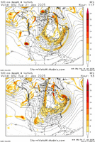
Good discussion in here this AM. Here are the 3 key players as I see it at 500mb, with wave evolution and timing playing big parts:
1) How much lift do we get with the heights along the east coast? More lift, more storm
2) Does the shortwave in the southwest remain intact and kick east or get squashed and weakened?
3) How much and where does the northern TPV piece phase in? Farther to the south and west, more storm
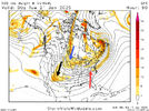
Here is today's 06z GFS run vs yesterday's
- Joined
- Jan 23, 2021
- Messages
- 4,577
- Reaction score
- 15,106
- Location
- Lebanon Township, Durham County NC
Canadian snow ratios IMBY are 16:1. lawd.

