• Hello, please take a minute to check out our awesome content, contributed by the wonderful members of our community. We hope you'll add your own thoughts and opinions by making a free account!

Wintry January 21-23 2025

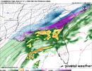
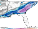
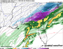
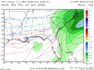
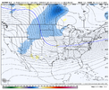
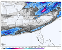
It’s crazy because it looks as though most of the GEFS supports the suppressed coastal to nada scenario the GFS has.

And most of the CMCE (from 12z and I’ll assume the 00z stays the same but time will tell) completely support the CMC solution

Both models and their ensembles seem to be 10 toes deep into what they think will happen. That’s what makes this an especially big time failure for one of these models.

10 years ago we wouldn’t even respect the CMC like that but nowadays it’s made incredible improvements.

So it’s a genuine question .. who’s right and who’s wrong?!

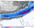
The thing about the CMC though is in the past when it would do something stupid and crazy; it would do it at long range and for one or two runs at max. This is five straight runs with a huge area of 10-12”+. I’ve never seen this before.
 
So in 5 days parts of ENC will either get a warm nosed sleet pellet or 42” of Snowbird Utah powder. How do you plan for that?

Be nice to see the CMC be right for a change, obviously I dont expect 24-30" but it would be nice to end the 3 year snow drought. I do think it would be fitting to end such a drought in grandiose fashion however, which 2-3ft of snow certainly does, I have been patiently waiting since Mar 1980 to get a storm to become the "new" Mar 1980, maybe 45 years is long enough.
 
If I recall, the Canadian has higher verification scores than the GFS, there an image that showed verification.

The fact that the Canadian has been adamant on a solution like this and it's ensembles support it somewhat makes me think that it's not completely out to lunch imo. Is it realistic? No, but shave those totals by 1/3rd-3/4ths but keep the extent of the snow and that's totally on the table.

Of course, the GFS/GEFS can also be right, but there has been more variation, which makes me trust it less.

I wouldn't wanna be a met at any of the NWS offices in the south right now.

The GEFS was just lost. The WHOLE GEFS mean is skewed by one obnoxious member. It's not just the GFS. At day 5 it (GEFS) is losing the storm..... something it has not done yet, until tonight.
 
It's kind of had a consistent footprint over the last few cycles too. I mean, I don't like it for me, but it's been pretty steady. We really need to see the Euro hop back onboard. The GFS is foolish, and will eventually fall in line.
 
It looks like Can an Ukmet
What? The 12z Graphcast cut the wave off and introduced all kinds of ptype problems?

Am I crazy? Did that not happen on the 12z Graphcast, especially up into NC?
 
I'm a Carolina Homer but this is just absurd. I can only hope it happens to the Bayou. Furthermore, and linking some thoughts, I'm in Augusta for the next week and man that weight of snow on the trees in this area. (Standard caveats apply/not gonna happen, but still)View attachment 164430
You and me both. The most snow we've had in parts of southern Louisiana in recent years was the December 2008 snow, which dropped up to 10" in a few spots. But widespread snow over a foot would do a number on the infrastructure and vegetation, I would think.
 
What? The 12z Graphcast cut the wave off and introduced all kinds of ptype problems?

Am I crazy? Did that not happen on the 12z Graphcast, especially up into NC?
I have it confussed with another AI model. Like 3 diff versions being discussed on here between 6-9 pm tonight. I plead 5th. Cant keep up with them. So many. One had same footprint as ukie, can inland alot
 
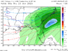
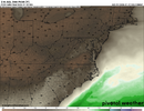
wow this is honestly an amazing image never seen anything quite like it in all my model fantasies. What makes it even more wild is how cold it actually still is despite the low big time cranking so close to the coast

View attachment 164419

This is the kind of madness you usually see on the hr 300+ GFS. To see it at D5 is pretty insane…I’m honestly not sure I’ve ever seen a solution for the SE quite this extreme so close to a potential event.
 
What? The 12z Graphcast cut the wave off and introduced all kinds of ptype problems?

Am I crazy? Did that not happen on the 12z Graphcast, especially up into NC?
Yes, the 12z GFS Graphcast broke off the southern piece and had some delay but still is quite cold here, just not quite as cold as others

265D3F40-54D8-435D-8BE7-3E3B5046458C.png
410EEF33-D935-4EFA-BB89-828B28131600.png
 
This is the kind of madness you usually see on the hr 300+ GFS. To see it at D5 is pretty insane…I’m honestly not sure I’ve ever seen a solution for the SE quite this extreme so close to a potential event.
I did, the NAM on the Jan 3rd, 2018 winter storm. NAM spit out a run of 27" across the Low country counties...
 
A blend of all the models @0z tonight should have a significant winter storm for the Deep South.
 
Back
Top