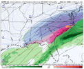
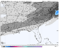
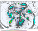
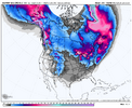
Euro says thank you may I have another
-
Hello, please take a minute to check out our awesome content, contributed by the wonderful members of our community. We hope you'll add your own thoughts and opinions by making a free account!
You are using an out of date browser. It may not display this or other websites correctly.
You should upgrade or use an alternative browser.
You should upgrade or use an alternative browser.
Wintry January 21-23 2025
- Thread starter SD
- Start date
That’s only day 8 back to the west. EPS has shown plenty of support
Cary_Snow95
Member
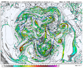
The high pressure over the top during that whole storm is a sight to behold. 1042 anchored up top
D
Deleted member 609
Guest
I got 29.9 less inches than what was shown here.Just as an aside these are the same runs we were printing in December 2017 on the Euro. Somebody’s gonna get it. And a lot of it. I’d still favor west but you just never know do youView attachment 162966
Pretty sure I go nothing out of that prediction in Dec 2017. Now Dec 2018 was a bit differentJust as an aside these are the same runs we were printing in December 2017 on the Euro. Somebody’s gonna get it. And a lot of it. I’d still favor west but you just never know do youView attachment 162966
Drizzle Snizzle
Member
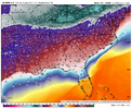
Low 20s in SE GA and Southern SC. Kinda weird to have a mix at such a low temp.Heavy snow in the low teens. I wouldn't even know what to do with myself.
View attachment 162971
View attachment 162968
You'd be hard pressed to draw up a better map than that. A nearly perfect placement and magnitude of all the prominent features. I wish for just one time, we could see one of these on the plots 24 hours out.Heavy snow in the low teens. I wouldn't even know what to do with myself.
View attachment 162971
View attachment 162968
NCWeatherhound
Member
RDUHeatIsland
Member
Heavy snow in the low teens. I wouldn't even know what to do with myself.
View attachment 162971
View attachment 162968

I bet you’d reconsider moving to Boston lololHeavy snow in the low teens. I wouldn't even know what to do with myself.
View attachment 162971
View attachment 162968
When will the rug pull happen?
We are a long way out this is just for entertainment lol.On the other forum someone said there’s not much ensemble support.
SnowwxAtl
Member
Wrong Thread.. positive vibes onlyWhen will the rug pull happen?
howboutthemdawgs
Member
Drizzle Snizzle
Member
Nobody is out of the game. It’s over a week away.south of Nashville seems to be out of the game on this one
View attachment 162981
SnowwxAtl
Member
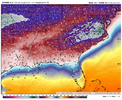
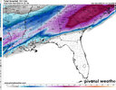
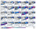
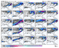
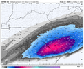
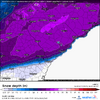
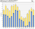
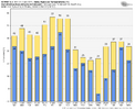
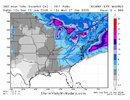
It's on low medium heatEPS is slowly cooking. Nothing quite like that hall of fame run, but there’s some smoke View attachment 162976View attachment 162977View attachment 162978
John1122
Member
The heartbreak is catastrophic when it shows that and then fails at such close range. A few years ago the Euro put a 30 inch bullseye over my area 24 hours out and I ended up getting 2 inches. I couldn't look at a model for a month after that one.You'd be hard pressed to draw up a better map than that. A nearly perfect placement and magnitude of all the prominent features. I wish for just one time, we could see one of these on the plots 24 hours out.
My bad. Forgot which link I had open.Wrong Thread.. positive vibes only
1988 all over again go look back at that storm!Heavy snow in the low teens. I wouldn't even know what to do with myself.
View attachment 162971
View attachment 162968
It was EPIC!
SnowwxAtl
Member
That happened in Feb 2014 for ATL. I remember those clown maps.The heartbreak is catastrophic when it shows that and then fails at such close range. A few years ago the Euro put a 30 inch bullseye over my area 24 hours out and I ended up getting 2 inches. I couldn't look at a model for a month after that one.
John1122
Member
Keep in mind, someone will miss, southeast or western areas. I do always look with a skeptical eye when any model shows historical winter events deep into Florida. They've tried it a couple of times this year already and it's not even been close really. That said, even though I "only get" half a foot from that run, it'd be incredible to see snow lovers in those unusual areas get such a monster.south of Nashville seems to be out of the game on this one
View attachment 162981
SnowwxAtl
Member
No worries...just don't want you to be moderated or banned in this thread...interesting times ahead!My bad. Forgot which link I had open.

Don’t let the models pull the wool over your eyes again! It might get cold but we will see temp moderated anytime a low moves through! Rain or ice!
- Joined
- Jan 23, 2021
- Messages
- 4,602
- Reaction score
- 15,197
- Location
- Lebanon Township, Durham County NC
It's good to see a weenie run like that, even at such long range. Lot of you have been very good at sharing the potential of this pattern. Runs like this give some validation to those thoughts. Great to see we have a chance of something.
Snowman63
Member
No, not really. Oklahoma, most of Arkansas and Tennessee all received 8"-12". This storm is not showing that. I would be surprised if we ever see another Jan 7, 1988.1988 all over again go look back at that storm!
It was EPIC!

EPS is slowly cooking. Nothing quite like that hall of fame run, but there’s some smoke View attachment 162976View attachment 162977View attachment 162978
Dang, that is an incredible signal for the Deep South.
Showmeyourtds
Member
He’s got a SC location…Can you blame him?Wrong Thread.. positive vibes only
Chattownsnow
Member
Looks like it was about to do it again after that lol
Oh the rug's going to go back and forth for at least a week. Be prepared for all kinds of rug comingWhen will the rug pull happen?


