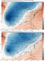
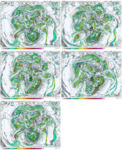
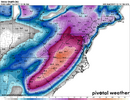
Man, if blocking comes back, ain't nobody going to be sleeping around here.Ooh my. I am loving this.
View attachment 162951
-
Hello, please take a minute to check out our awesome content, contributed by the wonderful members of our community. We hope you'll add your own thoughts and opinions by making a free account!
You are using an out of date browser. It may not display this or other websites correctly.
You should upgrade or use an alternative browser.
You should upgrade or use an alternative browser.
Wintry January 21-23 2025
- Thread starter SD
- Start date
WolfpackHomer91
Member
I guess the one exception would be a rain changing to snow type set up where the cold air is coming in during the storm. Other than that really I would say that all winter storms have at least some period of overrunning at some point. With the February 2004 storm everyone remembers the upper low passing by that dumped so much snow on CLT metro in just a few hours, but even that storm saw a huge overrunning event earlier in the day that had already put down 8-12” in a lot of areas that would get hit hard by the upper low that night.
That’s what happen in 2004 and 2014. My totals were like 8-10” with Both and ULL swung through and I got lucky each time and made it to 13”
Sent from my iPhone using Tapatalk
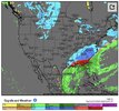
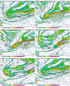
My default position is not to worry too much about the Canadian. I feel better when the Euro and GFS are looking good and the Canadian is meh than the other way around.We need that Atlantic ridge further from us. This was a big step here this afternoon but not enough as is. Plenty of time View attachment 162954
Cary_Snow95
Member
Pretty much in every recent scenario the CMC loves to drastically change and go to consensus, sometimes within 90 hours. Fact is, it’s just not a good model. If you are ever counting on it when it’s showing a favorable look I’d have the same view
Bigedd09
Member
I know the Canadian didn't show what we wanted but the low shifted from Upstate to south Georgia in one run and the snow foot print was much further south east compared to 0z. A much better run for the SE
Patterns repeat once established.I've been noticing that too. The trough is just wanting to set up east this winter. What a nice contrast to winters of late!
See the last 2-5 years regarding troughs in the West,
See the same things 60's-80's.
Looks like we r establishing a wonderful pattern at the right time of year for a change of the past half decade or so!
- Joined
- Jan 23, 2021
- Messages
- 4,602
- Reaction score
- 15,197
- Location
- Lebanon Township, Durham County NC
1988 loading on the euro
- Joined
- Jan 23, 2021
- Messages
- 4,602
- Reaction score
- 15,197
- Location
- Lebanon Township, Durham County NC
That’s one of the most epic winter storms I’ve ever seen
- Joined
- Jan 23, 2021
- Messages
- 4,602
- Reaction score
- 15,197
- Location
- Lebanon Township, Durham County NC
Put that euro run in the hall of fame, goodness
Pops
Member
Expand it please
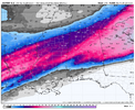
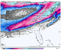
HOLY FREAKING CRAP THAT WAS A ALL-TIMER EURO RUN.
Stormlover
Member
That would make everyone here very happy. And the EURO was dead on with last one. Let's see if it will keep it around for a couple of runs.
i haven't done a ton of digging, taken last day or so off of model watching but the incoming pattern does seem to be a reload, with a great angle for the cold coming in and potentially better synoptics to work with so it doesn't shock me to get a class a weenie run
- Joined
- Jan 23, 2021
- Messages
- 4,602
- Reaction score
- 15,197
- Location
- Lebanon Township, Durham County NC
Temps go from 18 at the beginning to 9 in the last frame.
Also it is a bit later in the run but only really 24 hours. That’s some consistency.
Also it is a bit later in the run but only really 24 hours. That’s some consistency.
Is this a banana high set up we might have going? Didn't really see a new England cold pump centered up there.i haven't done a ton of digging, taken last day or so off of model watching but the incoming pattern does seem to be a reload, with a great angle for the cold coming in and potentially better synoptics to work with so it doesn't shock me to get a class a weenie run
I'll take half that, and it's not like it's the GFS out that farThat would make everyone here very happy. And the EURO was dead on with last one. Let's see if it will keep it around for a couple of runs.
- Joined
- Jan 23, 2021
- Messages
- 4,602
- Reaction score
- 15,197
- Location
- Lebanon Township, Durham County NC
Everything about the last event we worried about isn’t present in this event.
The only thing I’m concerned about is the positive heights over the Atlantic and the potential that things trend west and cut.Everything about the last event we worried about isn’t present in this event.
But I do like the blocking trends
LukeBarrette
im north of 90% of people on here so yeah
Meteorology Student
Member
2024 Supporter
2017-2023 Supporter
Can someone post the whole storms lifecycle from Weatherbell?
Yet lolEverything about the last event we worried about isn’t present in this event.
Drizzle Snizzle
Member
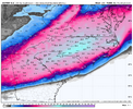
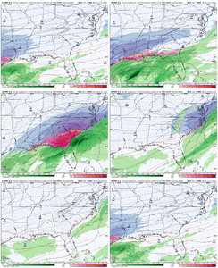
Major ice storm for Panama City Beach ?I didnt know the euro could print this much snow. I’m never going to sleep again. Gear up fellas.View attachment 162963
D
Deleted member 609
Guest
I’ll pass. Don’t think my flight to Punta Cana can take off in those conditions.I didnt know the euro could print this much snow. I’m never going to sleep again. Gear up fellas.
Little Rock fringed. Come to Jimmy
View attachment 162963
baroowoofr
Member
Yeah I got in good on both where I lived in southern Cabarrus County. Got 9.6” during the day from overrunning and another 10.5” that evening. I’ll never forget the amount of lightning I saw that eveningThat’s what happen in 2004 and 2014. My totals were like 8-10” with Both and ULL swung through and I got lucky each time and made it to 13”
Sent from my iPhone using Tapatalk
If this were to happen there would be a lot of cracked and broken stuffI didnt know the euro could print this much snow. I’m never going to sleep again. Gear up fellas.
Little Rock fringed. Come to Jimmy
View attachment 162963
coldspringsfarm
Member
1973 all over again.

