NBAcentel
Member
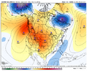
Reminder that the National Championship game is in Atlanta on 1/20Euro is a hit and splits the gfs/cmc at H5 View attachment 162891View attachment 162892View attachment 162893View attachment 162894
It’s great to till be in the game for another outlet of weeks. Do you see the possibility of strong high pressures lining up favorably to our northeast to filter down the cold more than we’ve seen? It seems like the polar vortex piece as been blocking these highs from coming across.The snow mean on this GEFS run is going to be good, but not eye-popping. But my goodness... you can hang this one in the louvre looking at the southern wave train in to cold 850 temps... wall to wall threats from hr 200 through the end of the run. Also showing a ridiculous amount of ice storms.
With regards to our day 9 threat... the trends have been to build in the cold a little better and orient the high pressure a little more favorably over the last 36 hrs. To the point where most models are showing a hit or supression now. What we want to look for is a good cold press and shifting east of the cold/high pressure,(that's what we've seen happen)... but also more separation between initial front and the follow up wave... (that's what the 06z GFS is doing; the euro has a little less separation, but still works out; the euro AI has very little separation so it's not as robust with the over running in to colder air.It’s great to till be in the game for another outlet of weeks. Do you see the possibility of strong high pressures lining up favorably to our northeast to filter down the cold more than we’ve seen? It seems like the polar vortex piece as been blocking these highs from coming across.
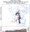
Now that's what I like to see. As everyone's already talking about, it's very likely we're going to see a massive overrunning event down the road, just have to figure out where it's heading. Massive TMB going to be draped somewhere nearby.The brutally cold air mass that enters the CONUS next week originates over Siberia 10 days earlier.
Starting out around -30C to -40C
https://www.ogimet.com/cgi-bin/ogimet_nav?lang=en
https://www.ready.noaa.gov/hypub-bin/trajtype.pl
View attachment 162918
View attachment 162919
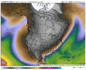
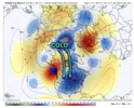
You can't draw it up much better than thatRidge of high pressure near Alaska in the medium range drags this brutally cold Siberian Air mass across the North Pole & drives it into the CONUS.
Yeah, a lot of things still have to go right for us to get a winter storm here, but I'd absolutely take my chances w/ this look.
The longwave trough is also in a more classic positioning for an overrunning style event in the southern US, w/ WSW flow mid-level flow aloft.
View attachment 162922
If this depiction is right (yeah I know, too far out) the low would likely track just east of the light blue line 50-100 miles off the coast which would be hits especially NC/SC/GA and VA. Of course that depends on the timing, after the cold press, or before and the strength of a low. Caveat being it is a ways out but deserves at least some precursory attentionNow that's what I like to see. As everyone's already talking about, it's very likely we're going to see a massive overrunning event down the road, just have to figure out where it's heading. Massive TMB going to be draped somewhere nearby.
View attachment 162921
If it stalls on the coast it's goin b a good time for a lot of folksWhen was the last time we had a true Siberian Express come over the top and hit us for a week?
Broadly speaking, it's a great look. Plentiful supply of cold, dry air to the north and west with healthy surface high pressure for delivery and moisture just to the south and east.If this depiction is right (yeah I know, too far out) the low would likely track just east of the light blue line 50-100 miles off the coast which would be hits especially NC/SC/GA and VA. Of course that depends on the timing, after the cold press, or before and the strength of a low. Caveat being it is a ways out but deserves at least some precursory attention
Im not sure thats a good look. Is the moisture off the coast giving us the middle finger?Broadly speaking, it's a great look. Plentiful supply of cold, dry air to the north and west with healthy surface high pressure for delivery and moisture just to the south and east.
View attachment 162923
You can have either, or bothDoes overrunning mainly cause ice storms Or can the SE see Snow in them?
Ok thanks that's what I was thinking but it just seems like most of our overrunning events are Ice stormsYou can have either, or both
All depends where the artic boundary sets up at . Further south of you means deeper cold air means snowDoes overrunning mainly cause ice storms Or can the SE see Snow in them?
This last event was an overrunning event and many areas saw SN, IP and ZR. Just depends on the setup of warm air above you.Ok thanks that's what I was thinking but it just seems like most of our overrunning events are Ice storms
That’s a thumb trough it’s giving us aIm not sure thats a good look. Is the moisture off the coast giving us the middle finger?
January 1988 was 100% an overrunning event. It’s just a matter of how far south the deep cold air is able to pushDoes overrunning mainly cause ice storms Or can the SE see Snow in them?
January 1988 was 100% an overrunning event. It’s just a matter of how far south the deep cold air is able to push
