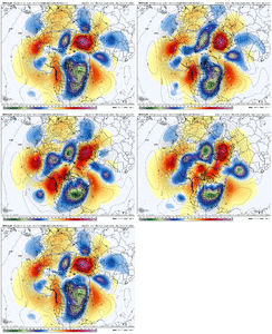
Can someone please clarify overrunning for me? I keep hearing that thrown around. How is overrunning different than than a low, cyclogenesis that brings the precip up from the south? Is there no low pressure system? WAA without a storm persay?
I'm used to the standard Miller A/B, but I'm not sure what to look for in an "overrunning" system. Thanks.
-
Hello, please take a minute to check out our awesome content, contributed by the wonderful members of our community. We hope you'll add your own thoughts and opinions by making a free account!
You are using an out of date browser. It may not display this or other websites correctly.
You should upgrade or use an alternative browser.
You should upgrade or use an alternative browser.
Wintry January 21-23 2025
- Thread starter SD
- Start date
Prestige Worldwide
Member
You bring up a good question that I’ll certainly let someone smarter than me answer completely. I’ve always understood though that overrunning is simply in precip caused warmer/moisture riding over the top of a cold dry air mass.Can someone please clarify overrunning for me? I keep hearing that thrown around. How is overrunning different than than a low, cyclogenesis that brings the precip up from the south? Is there no low pressure system? WAA without a storm persay?
I'm used to the standard Miller A/B, but I'm not sure what to look for in an "overrunning" system. Thanks.
Prestige Worldwide
Member
Jan88
Member
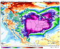
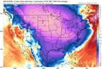
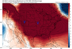
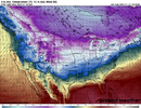
That's cold as it gets if that verifies
SnowNiner
Member
Thanks. Sounds like it’s still a storm, low pressure, it just is overrunning a large cold dome already in place?
But that to me sounds like all winter storms??
Jan88
Member
Below zero at night in the southeast might happen especially if there is snow on the ground
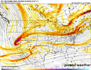
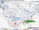
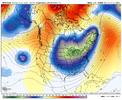
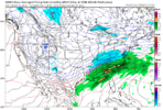
Ignore that lil lakes low sliding east. Just dissecting the GFS, we’ve got sprawling high pressure to the west, north and east. If this general MSLP look can hold then we’d at least have the cold air feed figured out and someone will be getting snow again. The way that gulf low just rides the void between “too cold to snow” and “just right” was perfect here. That’s how you do it. @Myfrotho704_ snow on snow on snow?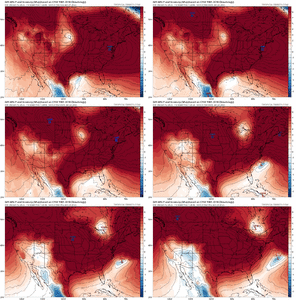

DAWG4LIFE
Member
Are the models showing the low developing in the gulf or, developing in the Atlantic just off the coast of Georgia and what would the difference be as far as snow in the south east? Thanks guys still learning …I appreciate all the knowledge that is in here though.
iGRXY
Member
You get a mix. But it’s all about how far south the cold airmass is. In this instance if we held all else true to what the models are showing. The mix line probably is on the I20 corridorDoes overrunning mainly cause ice storms Or can the SE see Snow in them?
iGRXY
Member
You get a weak surface low that rides frontal boundaries and using WAA aloft as the precip driver.Can someone please clarify overrunning for me? I keep hearing that thrown around. How is overrunning different than than a low, cyclogenesis that brings the precip up from the south? Is there no low pressure system? WAA without a storm persay?
I'm used to the standard Miller A/B, but I'm not sure what to look for in an "overrunning" system. Thanks.
rburrel2
Member
Also isentropic upglide can generate a lot of/enhance qpf in overrunning events even when the wave is relatively weak, if conditions are right.
View attachment 162920
How is that high pressure for you, RC?
Now where have I seen that before?
Tarheelwx
Member
I believe overrunning almost always has traditional transition from rain to freezing rain to sleet to snow. Oftentimes, those zones stay reasonably static. This is all contingent of cold high pressure. You can also have overrunning with nothing but rain.
TW
TW
ITUSETOSNOW
Member
So this is off-the-chart cold?
iGRXY
Member
This is true. It’s generally all about how far south the cold press is that determines your p types.I believe overrunning almost always has traditional transition from rain to freezing rain to sleet to snow. Oftentimes, those zones stay reasonably static. This is all contingent of cold high pressure. You can also have overrunning with nothing but rain.
TW
I guess the one exception would be a rain changing to snow type set up where the cold air is coming in during the storm. Other than that really I would say that all winter storms have at least some period of overrunning at some point. With the February 2004 storm everyone remembers the upper low passing by that dumped so much snow on CLT metro in just a few hours, but even that storm saw a huge overrunning event earlier in the day that had already put down 8-12” in a lot of areas that would get hit hard by the upper low that night.Thanks. Sounds like it’s still a storm, low pressure, it just is overrunning a large cold dome already in place?
But that to me sounds like all winter storms??
rburrel2
Member
Icon looks more than a little interesting at hr 156…
We’ve got to push that boundary through first. It can’t drag its legs. If anything drags it’s legs it needs to be that secondary wave
The ICON is slowly building HP over the Apps. Note the NE winds in the SE at the end of the run and the 1026 isobar pushed out into the Atlantic. Not a strong push, but more of a bleed.We’ve got to push that boundary through first. It can’t drag its legs. If anything drags it’s legs it needs to be that secondary wave
rburrel2
Member
That run of the icon was about to generate a massive winter storm in the next few panels
You bring up a good question that I’ll certainly let someone smarter than me answer completely. I’ve always understood though that overrunning is simply in precip caused warmer/moisture riding over the top of a cold dry air mass.
Folks understand, artic cold air is dense an heavy. Last storm it was shallow in the layers of the atmosphere. So the futher south the boundary sets up next week the deeper the freezing air will be throughout the column, hopefully averting Warm noses as moisture gets slung up over top of us.
D
Deleted member 609
Guest
its literally the Southeast against the world in this pattern.
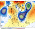
Looks like if we can slow this thing down we might be able to achieve that. Consolidate it back towards our Aleutian lowThe 12z GFS was very close to a big overrunning storm. We just needed a little bit more digging.View attachment 162946View attachment 162945
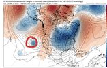
I've been noticing that too. The trough is just wanting to set up east this winter. What a nice contrast to winters of late!
And it wants to snow this winter. Something will come for someone in the south/east day 8-15.I've been noticing that too. The trough is just wanting to set up east this winter. What a nice contrast to winters of late!
-AO popping off now?Ooh my. I am loving this.
View attachment 162951
LukeBarrette
im north of 90% of people on here so yeah
Meteorology Student
Member
2024 Supporter
2017-2023 Supporter
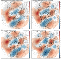
Yep. Looks good west. Dec 2017 type footprint in playView attachment 162952
Canadian is in play.
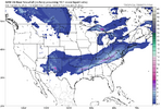
SnowwxAtl
Member
It's seems like the CMC is the outlier for the SE
Man unfortunately I wouldn’t say that. But it could become one if we can trend the trough to better placement.It's seems like the CMC is the outlier for the SE

