packfan98
Moderator
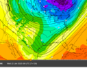
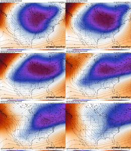
Can you show the mid-atlantic view please? It looks like a couple of members turn the corner and are amped up.
Can you show the mid-atlantic view please? It looks like a couple of members turn the corner and are amped up.
I think I largely agree with this. I don't think it's the key either. It may assist in what you're describing but it doesn't seem to be the main ingredient. I've got another theory that the baroclinic zone is sharper on the CMC thus inducing more intense overrunning early, which results in latent heat processes that result in a stronger surface low down the line.Hot take:
The little cut off low in the pacific has nothing to do with the evolution of our storm. The Icon/CMC are more juiced simply b/c they're digging further west and tilting better with the main trough. They're catching that tiny cut off as product of digging further West, but it is not pivotal/critical with respect to the moisture injection in to the system.
If you look at relative humidity maps, it's a nothing burger, and the CMC/ICON is already cranking before anything related to that tiny cut off even reaches the developed storm.
just my two cents.
I also noticed a couple days ago looking at individual ensemble members that the small cut off low being absorbed or not had no predictive value on "big dog or not" solutions.
Just my opinion but think the problem is when that pacific cutoff low is west it pumps heights a hair and causes our western ridge to bubble inward and we lose our digging mechanism. Pulling that cutoff into the main trough or at least kissing it eliminates that problem and gives us a chance for a big boom like the CMC is showing. Can we still eek something out without that happening? MaybeHot take:
The little cut off low in the pacific has nothing to do with the evolution of our storm. The Icon/CMC are more juiced simply b/c they're digging further west and tilting better with the main trough. They're catching that tiny cut off as product of digging further West, but it is not pivotal/critical with respect to the moisture injection in to the system.
If you look at relative humidity maps, it's a nothing burger, and the CMC/ICON is already cranking before anything related to that tiny cut off even reaches the developed storm.
just my two cents.
I also noticed a couple days ago looking at individual ensemble members that the small cut off low being absorbed or not had no predictive value on "big dog or not" solutions.
I feel like there should be concern that the CMC’s sharper baroclinic zone is overdone due to its tendency to be way cold, right?I think I largely agree with this. I don't think it's the key either. It may assist in what you're describing but it doesn't seem to be the main ingredient. I've got another theory that the baroclinic zone is sharper on the CMC thus inducing more intense overrunning early, which results in latent heat processes that result in a stronger surface low down the line.
Usually yes. With this air mass? It may have a chance.I feel like there should be concern that the CMC’s sharper baroclinic zone is overdone due to its tendency to be way cold, right?
More than a tick.. that was a massive jump North and west.AI looks like it ticked a little NW...but didn't really look at the 0z/6z runs all that close
View attachment 164232
And tbh we don’t need it to be usual crazy cmc cold.Usually yes. With this air mass? It may have a chance.
im near Huntsville. This doesn’t feel too good for those of us up here. Well probably only see a dusting at best. That high is too freaking dry and we seemed to get robbed of moisture in these setups. Enjoy your storm Deep South.The weenie in my honestly doesn’t know whether to be excited be being in a good zone for a north trend or bummed that south of me will likely get snow while I’m bone dry. I don’t want to get hit and sacrifice the Deep South though. It’s usually feast or famine with snow in these parts
Even if the airmass doesn’t moderate, you can still see a significant NW trend even within the final 36 hours. February 2010 and January 2014 are both good examplesA NW trend is absolutely possible, if not likely. The arctic airmass is going to moderate, it always does. Also, if the northern stream picks up the Baja SW, or even half of it, its going to amp the system. I'm telling you now, be prepared for some big shifts over the next 48 hours.
I thought it was a realistic potential outcome. Fantasy maps support this notion.Guys this nonsense has got to stop.
Can someone give me the link to the Euro AI again? Thanks!

This is hopium based and centered to those on the northwest cutoff... but the Euro AI has higher verification scores than other stuff... but that's related to predicting height fields. I haven't seen any info where it's suppose to be better at predicting precipitation.
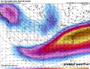
This 5h map on the Euro AI looks like money to me, and maybe as good or better than the icon/cmc?!? I would think the moisture plume would be bigger than what it's currently advertising.
View attachment 164236
Is it possible the moisture plume on the AI is lower despite a better H5 depiction because the alternative would be so anomalous? I believe the AI model is better at the height fields because it senses what is most likely to happen based on past events but purposely shies away from depicting scenarios outside a certain deviation score. I could be wrong so mostly thinking out loud here.This is hopium based and centered to those on the northwest cutoff... but the Euro AI has higher verification scores than other stuff... but that's related to predicting height fields. I haven't seen any info where it's suppose to be better at predicting precipitation.
This 5h map on the Euro AI looks like money to me, and maybe as good or better than the icon/cmc?!? I would think the moisture plume would be bigger than what it's currently advertising.
View attachment 164236
My next door neighbor who is a retired naval meteorologist said the same thing. I just talked to him about it an hour or so ago and he said that this absolutely the type of set up that the CMC could have the correct handle on cold. He reminded me that it nailed the January 1988 storm better than any other models at the time and that this is a similar look with how the airmass is pushing in.Usually yes. With this air mass? It may have a chance.
Yea, I dunno.Is it possible the moisture plume on the AI is lower despite a better H5 depiction because the alternative would be so anomalous? I believe the AI model is better at the height fields because it senses what is most likely to happen based on past events but purposely shies away from depicting scenarios outside a certain deviation score. I could be wrong so mostly thinking out loud here.
Can someone give me the link to the Euro AI again? Thanks!

Yea. and i'm wondering if we get the typical stronger WAA trend in the short range... that is really going to go to town with precip generation b/c you're not only getting the WAA lift, but it's being also lifted over a very tight temperature gradient that's laid out West to East, so enhanced by isentropic lifting,(and I think that's something most models underdo).My next door neighbor who is a retired naval meteorologist said the same thing. I just talked to him about it an hour or so ago and he said that this absolutely the type of set up that the CMC could have the correct handle on cold. He reminded me that it nailed the January 1988 storm better than any other models at the time and that this is a similar look with how the airmass is pushing in.


If you get enough latent heat release in the developing low it can lead to an instant occlusion.I think I largely agree with this. I don't think it's the key either. It may assist in what you're describing but it doesn't seem to be the main ingredient. I've got another theory that the baroclinic zone is sharper on the CMC thus inducing more intense overrunning early, which results in latent heat processes that result in a stronger surface low down the line.
No, that's not exactly how these models work. I can explain later when I have more timeIs it possible the moisture plume on the AI is lower despite a better H5 depiction because the alternative would be so anomalous? I believe the AI model is better at the height fields because it senses what is most likely to happen based on past events but purposely shies away from depicting scenarios outside a certain deviation score. I could be wrong so mostly thinking out loud here.
