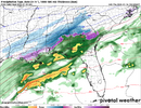
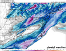
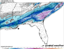
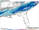
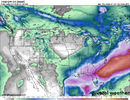
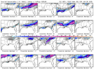
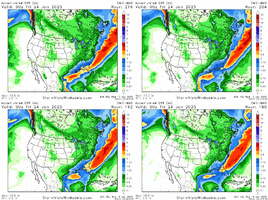
Hard to glean much from free GEFS H5 plots but looks like it did something similar to op and missed phase but is maybe just a hair better with digging the trough around Mon afternoon.
-
Hello, please take a minute to check out our awesome content, contributed by the wonderful members of our community. We hope you'll add your own thoughts and opinions by making a free account!
You are using an out of date browser. It may not display this or other websites correctly.
You should upgrade or use an alternative browser.
You should upgrade or use an alternative browser.
Wintry January 21-23 2025
- Thread starter SD
- Start date
Operational or ensemble? Which run?Didn't the GFS score decent on the last system?
buckinbronco
Member
Probably won't be as good at CMC/ICON, but at least we know the UKMET is not in the GFS camp.
Stormsfury
Member
The GEM deepened the Sunday/Monday system to 994mb off the Mass Coast.UKMET looks to have a lot less juice at around 111 hours out on pivotal vs the CMC
absolutely an absurd model difference at hour 120 from all these models.
Someone is truly going to win a coup here but no one’s budging? Something has to give but I think the biggest players are that Baja low and the storm out ahead that’s continuing to show a more strong solution for the NE
iGRXY
Member
UKMET looks to have a lot less juice at around 111 hours out on pivotal vs the CMC
absolutely an absurd model difference at hour 120 from all these models.
Someone is truly going to win a coup here but no one’s budging? Something has to give but I think the biggest players are that Baja low and the storm out ahead that’s continuing to show a more strong solution for the NE
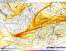
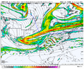
Ehh these look very similar to me
iGRXY
Member
CMC is a biblical run, I wouldn't use that as the bench mark here. Just keep the storm signal out of the southern gulf and at least along and south of I20 right now
Another interesting thing about that Canadian run is the length of the cold air. It has me going below freezing around midnight Sunday night and stay below freezing right through the end of the run… obviously aided by the snowpack it puts down. It has a coldest high of 18 on Wednesday followed by a low of -4 on Thursday morning
Winter Storm Demigod here we come!
NBAcentel
Member
UKMET looks fine at H5
Tokenfreak
Member
Winter Storm Demigod here we come!
Is that a graphic from the weather channel? Looks like something they would make.
Yep TWC.Is that a graphic from the weather channel? Looks like something they would make.
iGRXY
Member
Exactly. As long as it kept digging the western vort we need to be happyUKMET looks fine at H5
Actually UKMET is gonna end up warmer for us along i-20 east of the apps.
Possibly a delayed but not denied on the 12z UK, hard to tell, it is taking it's time bringing the energy east, I'm not sure if some will be left behind like we saw on EC runs over the past few days. At 132hrs.
- Joined
- Jan 23, 2021
- Messages
- 4,602
- Reaction score
- 15,197
- Location
- Lebanon Township, Durham County NC
Think we're gonna hold serve looking at RH maps at 132 but we'll see.UKMET looks fine at H5
Tokenfreak
Member
Figures! While I like it as I'm in the purple part I feel its very misleading especially at this point in time since we still don't have all the models on board or know exactly whats going to happen yet.Yep TWC.
packfan98
Moderator
Yes. Pretty similar to the Canadian. Let's see if we can get a better consensus over the next 48 hours.UKMET looks fine at H5
Identical to its 0Z . Almost copy an paste. What another hit!
buckinbronco
Member
buckinbronco
Member
5h energy was way diff vs 00z
yeah anybody to the NW shouldn't worry about too much almost always ends up more on the NW quadrant and the most important thing signal and model generally agrees with others!!!
NBAcentel
Member
Interesting. Gefs looks worse qpf wise but at H5 looked better
Well its was 4 mb weaker in gulf. Like to see it deepening in GOM like at 0ZIdentical to its 0Z . Almost copy an paste. What another hit!
- Joined
- Jan 5, 2017
- Messages
- 3,773
- Reaction score
- 5,983
Ukie is an ACCU special! Nice hit for the low country. We now have three models against one. Where will the Euro fall?
In this case that would not be a bad thing. More cold air is usually a signal for more suppression.Actually UKMET is gonna end up warmer for us along i-20 east of the apps.
yeah for ncIn this case that would not be a bad thing. More cold air is usually a signal for more suppression.
RollTide18
Member
Yeah UK definitely looked a tick warmer, went from rain to snow across south Alabama vs all snow
buckinbronco
Member
NBAcentel
Member
iGRXY
Member
Absolutely love the UK right now. Day 6 with big totals about 150-200 miles to my south? Yes please
lusting4Adusting
Member
Somebody smarter than me ( so basically everyone here), I'm curious how the Ukie ends up high and dry back west with such a similar look at H5 to the CMC. What's happening with the Canuck to get it to kick start this party a bit earlier, and expand the qpf field northwest?
- Joined
- Jan 5, 2017
- Messages
- 3,773
- Reaction score
- 5,983
It is likely you will have more precipitation on the northwest side, even if the low track stays the same. It will show up later.Somebody smarter than me ( so basically everyone here), I'm curious how the Ukie ends up high and dry back west with such a similar look at H5 to the CMC. What's happening with the Canuck to get it to kick start this party a bit earlier, and expand the qpf field northwest?
D
Deleted member 609
Guest
Chattownsnow
Member
Would that include the precip from the storms preceding it?
Last night it deepened from 1016 to 1012mb in the gulf on hour 138 frame. Today it stayed at 1016 so we didn't get the north slug of moisture as much. That's what we want to happen in central gulf a quick deepening and a lot of us will be Golden.Absolutely love the UK right now. Day 6 with big totals about 150-200 miles to my south? Yes please
- Joined
- Jan 5, 2017
- Messages
- 3,773
- Reaction score
- 5,983
That includes the rain from Saturday. I have about .40" over my location after you deduct Saturday's precip. That would still be about 4 to 5" of snow, depending on ratios.

