• Hello, please take a minute to check out our awesome content, contributed by the wonderful members of our community. We hope you'll add your own thoughts and opinions by making a free account!

Wintry January 21-23 2025

Kinda feel like I am sitting pretty here, am also nervous that its gonna screw me yet again....lots of big dogs on the ensembles for the eastern half of NC just have to reel this one in....the EPS/Ukie ensemble agreement trumps the GFS any day, and even the GFS ens have plenty of big dogs. Still we have 5 very very long days for all manner of model mischief to upend this system.
 
Here is the problem with next week:

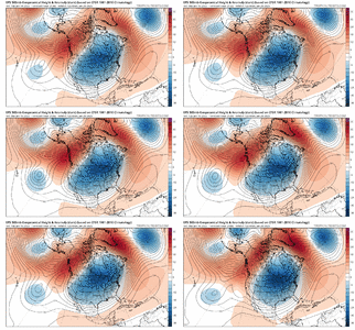
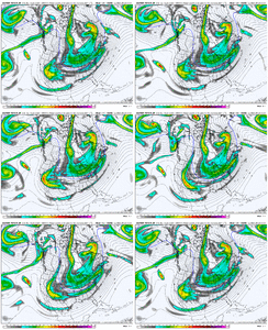
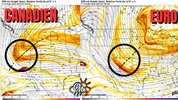
Overnight models are ALL OVER THE PLACE. The left solution is what the ICON/CMC/UKMET show. They push our trough much further west, and gives our storm time to spin up and produce a southern winter storm.

The solution on the right is closer to the EURO/GFS. This consolidates our trough to the east. This means our trough struggles to hit a favorable orientation for a southern winter storm.

The bad news is the EURO was on the left, and switched to the right.

The good news is the ensembles still look as good as they did yesterday.1737032898972.jpeg
 
Even if you get a flatter more suppressed look I still feel okay here east of the Apps. You’d likely still get some kind of NW trend here. But again for a model and its ensembles to collapse like that in basically 1 run should also tell you maybe it doesn’t have the best handle on the situation here. Especially when you’re still 5-6 days out. There’s still plenty of time to see things trend one way or the other. I get it’s a different setup but a week ago we went from amped to flat solutions, and this isn’t hyperbole , every 24 hours until under 48 hours out. That’s a credibility problem regardless of whether it’s the euro, or gfs, or EPS, or whatever, IMO.
 
Here is the problem with next week:

Overnight models are ALL OVER THE PLACE. The left solution is what the ICON/CMC/UKMET show. They push our trough much further west, and gives our storm time to spin up and produce a southern winter storm.

The solution on the right is closer to the EURO/GFS. This consolidates our trough to the east. This means our trough struggles to hit a favorable orientation for a southern winter storm.

The bad news is the EURO was on the left, and switched to the right.

The good news is the ensembles still look as good as they did yesterday.View attachment 164061
Great take. I would prefer we get back to that L shape overrunning. Like fro said it probably has something to do with that system in the pacific screwing with our heights up the coast. Idk what else it could be.
 
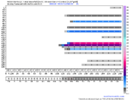
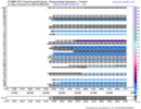
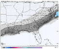
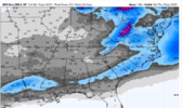
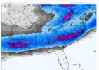
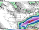
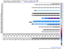
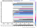
Things look fine to me. Below is the 06z GEFS and EPS for Birmingham and Montgomery. All options are still very much on the table and not to mention the UKMET and CMC ensembles are loaded. I understand some overnight trends were not great but we have a long ways to go. Just like ARCC said, will not take much to get something to cause significant effects with the cold weather. Take a deep breath and let’s see what happens today.
IMG_7135.pngIMG_7133.pngIMG_7132.pngIMG_7134.png
 
Even if you get a flatter more suppressed look I still feel okay here east of the Apps. You’d likely still get some kind of NW trend here. But again for a model and its ensembles to collapse like that in basically 1 run should also tell you maybe it doesn’t have the best handle on the situation here. Especially when you’re still 5-6 days out. There’s still plenty of time to see things trend one way or the other. I get it’s a different setup but a week ago we went from amped to flat solutions, and this isn’t hyperbole , every 24 hours until under 48 hours out. That’s a credibility problem regardless of whether it’s the euro, or gfs, or EPS, or whatever, IMO.
Yeah you don't see this in the EPS often after so much consistency for many runs.

f8edabee-a2cd-42c9-ad3d-fde265d5a051.gif
 
528c66817d7eee0588ddd41600a2df08.jpg

Posted by NWS Charleston office


Sent from my iPhone using Tapatalk
That is a little bit north and west of what I thought it would be. I20 looks pretty good?
 
All the angst about having to have good trends today or we're cooked seems a little overblown to me. We always see waffling around. I mean, if we start to see a catastrophic -PNA/raging SE ridge, sure. But we're not.

There are a multitude of reasons why a model may drift away from a big hit and then come back to the table later. We see bouncing around like this all the time. Suppressed, amped, suppressed, amped, flat, late, early, etc.

If this were 2 days before the event, then yeah, we absolutely need good trends today. Otherwise, not really. We've got a long way to go here, folks. And the entire area is still in the game.

Don't do that...don't poo poo our grief! Let us wallow in our tears...let it envelope us.
 
All the angst about having to have good trends today or we're cooked seems a little overblown to me. We always see waffling around. I mean, if we start to see a catastrophic -PNA/raging SE ridge, sure. But we're not.

There are a multitude of reasons why a model may drift away from a big hit and then come back to the table later. We see bouncing around like this all the time. Suppressed, amped, suppressed, amped, flat, late, early, etc.

If this were 2 days before the event, then yeah, we absolutely need good trends today. Otherwise, not really. We've got a long way to go here, folks. And the entire area is still in the game.
Ensembles hand off to ops around D4 for finer details. Ops hand off to hi-res guidance inside of 48 hours. Ensembles still show lots of potential.

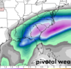
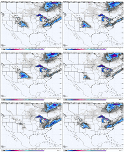
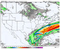
00z UKMET is probably about the farthest west solution that looks realistic as far as spatial extent right now IMO (although I could see the northern edge definitely expanding haha).
ukmo-all-conus-precip_24hr_inch-7590400.png
 
Last edited:
a6ff5220f771684748a32de2162f0979.gif

Nice little trend in QPF especially the last 2 cycles on the GEFS. Much heavier QPF lurks not too far offshore


Sent from my iPhone using Tapatalk
subtle change here is that the axis of heaviest precip gained a northerly component, it's more SW-NE. In line with other models depicting more northern stream component and less influence from southwest shortwave

wouldn't be surprised if that trend continues today- which for a lot of us would be mano a mano, it would favor a miller a and precip type corridors would be cleaner and frankly the ceiling on this even goes *up* a little bit if you can line up that shortwave right. however, if northern stream truly wants to dig more, heightened risk of more amplified solutions and stronger south east ridge come into play

tough to discern completely but to me it appears we're at an inflection point in the guidance and we should know a winner by the 00zs tonight
There is certainly a window to get an amped Miller A. It’s a fine line to walk but amp it just right and as you said for NC it’s probably best case. All the p-type concerns also go out the window in that scenario.
 
All the angst about having to have good trends today or we're cooked seems a little overblown to me. We always see waffling around. I mean, if we start to see a catastrophic -PNA/raging SE ridge, sure. But we're not.

There are a multitude of reasons why a model may drift away from a big hit and then come back to the table later. We see bouncing around like this all the time. Suppressed, amped, suppressed, amped, flat, late, early, etc.

If this were 2 days before the event, then yeah, we absolutely need good trends today. Otherwise, not really. We've got a long way to go here, folks. And the entire area is still in the game.
Yeh agree, I definitely don't think today is a make or break day. I think Saturday might be though but idk, people probably have different opinions on that.
 
There is certainly a window to get an amped Miller A. It’s a fine line to walk but amp it just right and as you said for NC it’s probably best case. All the p-type concerns also go out the window in that scenario.
Heh, maybe not *all* but it certainly lowers the chances of Brian Kemp having to call in the national guard because the columbus/macon/augusta corridor is under an inch and a half of ice. which is what our previously favored overrunning solution ran the risk of
 
subtle change here is that the axis of heaviest precip gained a northerly component, it's more SW-NE. In line with other models depicting more northern stream component and less influence from southwest shortwave

wouldn't be surprised if that trend continues today- which for a lot of us would be mano a mano, it would favor a miller a and precip type corridors would be cleaner and frankly the ceiling on this even goes *up* a little bit if you can line up that shortwave right. however, if northern stream truly wants to dig more, heightened risk of more amplified solutions and stronger south east ridge come into play

tough to discern completely but to me it appears we're at an inflection point in the guidance and we should know a winner by the 00zs tonight
I would be nervous if I was further west but those of us here east of the Apps still have big potential here whether you get more digging out west for overrunning or more N/S digging with a true Miller A.
 
I would be nervous if I was further west but those of us here east of the Apps still have big potential here whether you get more digging out west for overrunning or more N/S digging with a true Miller A.
yeah if i were to name a big loser in the runs yesterday its the i-20 corridor west of augusta
 
Tbh I think we’re going to have to find a way to get that baja cutoff moved east. The further it drifts west the worse our ridge gets over the SW. it starts to bubble our ridge and we lose our vertical digging mechanism and basically we run out of room to make anything happen to the east. It’s not even the cold suppressed look I’m worried about. We need interaction between these two pieces
 
If you live in the Carolinas, it's time to root for that infamous northwest trend that often occurs in the models before a system arrives. Right now things looked too far south and suppressed for many of us but there is still time for adjustments. As of now, KRDU has a 30% chance of snow on Tuesday and hopefully that percentage will go up as time goes by.
 
I wouldn’t think we would have to see major wholesale positive changes until the 0z suite tomorrow night. I fully expect a few more bad looking model runs until then. Hopefully, we can keep getting some positive signs along the way before making a big comeback. Then again, we might completely lose the threat and this place will be miserable. In any case, whatever the models say doesn’t affect the weather that’s going to happen. Enjoy the ride and hobby y’all!
 
So are we trending up or down in Virginia? The Euro still looks no good for us.
For the Sunday system it’s trending up, for the other system down, actually at this point take a lot of VA out of the equation at this moment.
 
Amazing looking at the 500mb vort on pivotal for Monday and comparing all the 0z Big Ops. The Can and Ukmet , if you look at the west coast ridging are sharper with their lines and this is why we get more digging with energy in sw. The GFS and euro west coast ridging lines are like McDonald arches, to rounded and not as sharp. I cant see out in the pac far enough on Ukmet, but all seem to have the vort off the baja about same location. That subtle diff is the reason for the 2 separate camps. No clue what causes the west coast ridging angle to be not as sharp on gfs and euro.
 
Back
Top