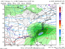
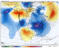
2/12/10.The fun part about this type of storm is you really only need to be worried about amplification/strength and location of the low pressure system as long as it's not delayed by shenanigans to our West.
The air mass that is likely to be in place is cold enough at the surface and throughout the entire atmospheric column with those model's depictions (maybe a little sleet mixing in further South of I-20 and ZR on the coastal plain).
The caveat to this is, this is only true if the models are correct in their very cold temperature depictions. Along with cold temperatures, you'll have dry air in place which will lead to more cooling as precipitation evaporates (at first) in the dry air mass. That may make up for them being overdone on the cold.
In all of my years seeing storms around I-20, I can say that the biggest ones in my lifetime, have started in the daytime. To get a nice I-20 snow, we need more than "just being right on the line" and needing night time to keep us snow.
-
Hello, please take a minute to check out our awesome content, contributed by the wonderful members of our community. We hope you'll add your own thoughts and opinions by making a free account!
You are using an out of date browser. It may not display this or other websites correctly.
You should upgrade or use an alternative browser.
You should upgrade or use an alternative browser.
Wintry January 21-23 2025
- Thread starter SD
- Start date
Cbmatt2408
Member
We even have the weather channel forecasting 5-10” on the daily forecast here in LaGrange. I have never seen a snow forecast like that here. It seems like the cold could be in place enough to allow for it to make it down this far. Just can’t have too much NW shift over the next 6 days.The fun part about this type of storm is you really only need to be worried about amplification/strength and location of the low pressure system as long as it's not delayed by shenanigans to our West.
The air mass that is likely to be in place is cold enough at the surface and throughout the entire atmospheric column with those model's depictions (maybe a little sleet mixing in further South of I-20 and ZR on the coastal plain).
The caveat to this is, this is only true if the models are correct in their very cold temperature depictions. Along with cold temperatures, you'll have dry air in place which will lead to more cooling as precipitation evaporates (at first) in the dry air mass. That may make up for them being overdone on the cold.
In all of my years seeing storms around I-20, I can say that the biggest ones in my lifetime, have started in the daytime. To get a nice I-20 snow, we need more than "just being right on the line" and needing night time to keep us snow.
ChattaVOL
Member
Chattanooga gonna be too far north for this one?? 
Sent from my iPhone using Tapatalk

Sent from my iPhone using Tapatalk
NBAcentel
Member
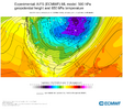
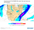
New AIFS looks slightly more suppressive then last run and colder aloft
Round Oak Weather
Member
I don’t mind being right on the snow/ sleet line those can make the best storms. Freezing rain in my area can wreck havoc as most of northern middle GA is pine trees and 2014 is on all of our minds. I’d liked the 12z model runs but that 18z Euro would make a lot of people uneasy.The fun part about this type of storm is you really only need to be worried about amplification/strength and location of the low pressure system as long as it's not delayed by shenanigans to our West.
The air mass that is likely to be in place is cold enough at the surface and throughout the entire atmospheric column with those model's depictions (maybe a little sleet mixing in further South of I-20 and ZR on the coastal plain).
The caveat to this is, this is only true if the models are correct in their very cold temperature depictions. Along with cold temperatures, you'll have dry air in place which will lead to more cooling as precipitation evaporates (at first) in the dry air mass. That may make up for them being overdone on the cold.
In all of my years seeing storms around I-20, I can say that the biggest ones in my lifetime, have started in the daytime. To get a nice I-20 snow, we need more than "just being right on the line" and needing night time to keep us snow.
I know we have to have everything perfect to get snow.
packfan98
Moderator
Anyone have the 18z MOGREPS?
NBAcentel
Member
- Joined
- Jan 23, 2021
- Messages
- 4,602
- Reaction score
- 15,197
- Location
- Lebanon Township, Durham County NC
Graphcast GFS looks like it may be a massive hit
SnowNiner
Member
That looks real suppressed, not liking that one for nc. It seems to be bouncing around more than the last storm.
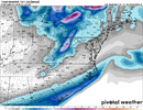
That's probably 6-12 inches from northwest to southeast.
Last edited:
iGRXY
Member
It's not dry in southeastern sections. Looks like the 850 0C line stays just northwest of ILM.View attachment 163961
Doubt it. It's really dry
GeorgiaGirl
Member
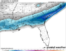
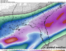
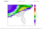
Yeah, the Euro AI was a bit more suppressed than what I was thinking based on the pivotal weather maps. Good for those deep in the SE who haven't had much snow, including myself.
Curious what the snow map is for it.
Curious what the snow map is for it.
Stormlover
Member
Yeah, noticed thatModels spitting out so much snow it broke Bouncy's Blender. Paging @bouncycorn.
I'm in the same boat. I feel good, but too soon to know. Northwest trend!Chattanooga gonna be too far north for this one??
Sent from my iPhone using Tapatalk
Loganville Winter
Member
Does the AI model have a NW Trend?Yeah, noticed that
I'm in the same boat. I feel good, but too soon to know. Northwest trend!
- Joined
- Jan 23, 2021
- Messages
- 4,602
- Reaction score
- 15,197
- Location
- Lebanon Township, Durham County NC
18z EPS mean high is 22 for Tuesday around me. Wow.
JLM
Member
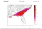
Yes, could use a good Gulf Coast snow for once. Its been since 2018 since anything meaningful, havent had anything but a little freezing rain since then. The AIFS based on soundings dumps a lot of ice in the FL Panhandle thru the entire event, doesnt seem like much snow with that run, but snow is hard to come by here anyways.Yeah, the Euro AI was a bit more suppressed than what I was thinking based on the pivotal weather maps. Good for those deep in the SE who haven't had much snow, including myself.
Curious what the snow map is for it.
NBAcentel
Member
- Joined
- Jan 23, 2021
- Messages
- 4,602
- Reaction score
- 15,197
- Location
- Lebanon Township, Durham County NC
I feel like this is straight out of the weenie handbook but I feel compelled to say it:
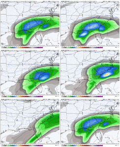
Remember those ENS model snow maps are 10:1. You might nearly double that.
Remember those ENS model snow maps are 10:1. You might nearly double that.
Yeah for sure...if it was going to do anything I want a tick SE at day 6 then a tick NW.I don’t get the fret about the AI. Looks good to me. Shifting around as any deterministic model would View attachment 163964
SnowNiner
Member
Wow, it went from a 2-3 inch mean across the Carolina’s to suppressed in one run?
Hate to see aifs and ukmet go suppressed. Ouch
iGRXY
Member
Not really. Again, we are 6-7 days out. Suppressed should be cheered for at this lead.Wow, it went from a 2-3 inch mean across the Carolina’s to suppressed in one run?
Hate to see aifs and ukmet go suppressed. Ouch
Blue_Ridge_Escarpment
Member
Yeah especially with how consistent the AIFS was run after run with the last storm.Wow, it went from a 2-3 inch mean across the Carolina’s to suppressed in one run?
Hate to see aifs and ukmet go suppressed. Ouch
That was the first Euro AI that looked like all snow here. Very good.
I don’t get the fret about the AI. Looks good to me. Shifting around as any deterministic model would View attachment 163964
That fact that it was so much colder is huge.
Pops
Member
This is the craziest thing I’ve ever seen possibly 6 days away and we don’t know what is going to happen
Chattownsnow
Member
I’m guessing you haven’t been following models longThis is the craziest thing I’ve ever seen possibly 6 days away and we don’t know what is going to happen
I’d say the middle ground of the EPS and its trends are the best piece of forecast data we have right now. Some hits more north, some more south, some weak, some big
An hour ago the eps and op were too far north then the AI was too far SE now the mudgrips are too far SE. Too many models running too many times and too many people living these events in 1 hour vacuums
Keep in mind though, it really didn’t completely lock in until 5 days out. Before that, it was bouncing around like it is nowYeah especially with how consistent the AIFS was run after run with the last storm.
I can't wait until tomorrow when we can start extrapolating the 84-hour NAM and RGEM. Not an hour will go by with some new runs!An hour ago the eps and op were too far north then the AI was too far SE now the mudgrips are too far SE. Too many models running too many times and too many people living these events in 1 hour vacuums
rburrel2
Member
Just doing a recap for the upstate of SC as of this evening. I've bolded the runs that I think are the most important right now:
Major hits:
12z CMC-snow to ice significant accumulations
18z Euro-all snow, significant accumulations
12z GFS Graphcast-all snow, significant accumulations
12z JMA-all snow, significant accumulations
18z EPS- 2 inch mean at hr144(biblical hit incoming)
12z CMCE- 3.5-4.0 mean, jackpot zone
Light hits:
18z Euro AI-fringed to South, light snow accumulations
12z Ukmet-fringed to South, light snow accumulations (18z probably worse going off 18zMOGREPS)
18z GEFS- 1.5 inch Snow mean
12z Euro Graphcast-fringed to the South, light snow accumulations
Complete whiffs:
18z GFS- no storm at all
12z ICON- Missed completely to the south
12z Spire- Missed completely to the south
Not gonna lie, this could be straight useful if at the end of each day we had an area-specific model summary.Just doing a recap for the upstate of SC as of this evening. I've bolded the runs that I think are the most important right now:
Major hits:
12z CMC-snow to ice significant accumulations
18z Euro-all snow, significant accumulations
12z GFS Graphcast-all snow, significant accumulations
12z JMA-all snow, significant accumulations
18z EPS- 2 inch mean at hr144(biblical hit incoming)
12z CMCE- 3.5-4.0 mean, jackpot zone
Light hits:
18z Euro AI-fringed to South, light snow accumulations
12z Ukmet-fringed to South, light snow accumulations (18z probably worse going off 18zMOGREPS)
18z GEFS- 1.5 inch Snow mean
12z Euro Graphcast-fringed to the South, light snow accumulations
Complete whiffs:
18z GFS- no storm at all
12z ICON- Missed completely to the south
12z Spire- Missed completely to the south
Pilotwx
Member
Cold air is out running moisture
Pops
Member
Yeah I have but this is all over the placeI’m guessing you haven’t been following models long

