• Hello, please take a minute to check out our awesome content, contributed by the wonderful members of our community. We hope you'll add your own thoughts and opinions by making a free account!

Wintry January 21-23 2025

For folks NW they want big big…for us degenerates east of 85 we want this.
Well yeah, I'm definitely in the I-85 degenerate group with you unfortunately. But the way it split the wave and went positive tilt with the top part is what stood out. And you can see how it looks pretty weak at 850mb - with a baggy low skirting across the N Gulf. Not terrible, but not a biggie either. But of course, it's just one model member of many

floop-ecmwf_full-2025011518.850wh.conus.gif
 
Well yeah, I'm definitely in the I-85 degenerate group with you unfortunately. But the way it split the wave and went positive tilt with the top part is what stood out. And you can see how it looks pretty weak at 850mb - with a baggy low skirting across the N Gulf. Not terrible, but not a biggie either. But of course, it's just one model member of many

View attachment 163945
One thing with a lot of overrunning/isentropic lift is it doesn't necessarily need a strong low to get it done. We've kind of seen some hints at a 1-2 punch on some OP outputs the last couple of days, so obviously that also can't be ruled out..
 
Give me the quicker "lighter" euro storm.
1. It gets here faster so it's already closer to verification
2. Temps aloft will be a lot colder
3. I haven't seen a dry powder snow since February 2010.
4. No sweating transition lines in the last 48hrs before the storm.(what's that like???)
Amen man. The best storms are the ones you’re not checking correlation coefficient radar maps every 10 minutes
 
I don't know grit. Part of me thinks we don't have to bring the whole thing out - we really just need to keep the overrunning going and tilt the upper level jet. 18z EPS continuing to increase also makes me think we may not need to bring the whole thing out (although I'd love to see the H5 for the individual members to know). The ideal solution, the UKMET, seems to not be that far off from the 18z Euro despite the Euro not bringing it all the way out.
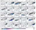
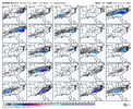
View attachment 163941View attachment 163942

Wow that was a huge jump. It's been ticking each run, but now I bet 3/4 of the members were going to go for the big dog.
In full agreement here. I like the UKMet 500mb look better there. And again, if the whole wave comes out, you have warmer risks. And great to see continued improvement on the EPS. Euro Op is just one of the options here, but it was a weaker option
 
In full agreement here. I like the UKMet 500mb look better there. And again, if the whole wave comes out, you have warmer risks. And great to see continued improvement on the EPS. Euro Op is just one of the options here, but it was a weaker option
It's probably going to come out b/c that's what the Euro AI has been advertising. And we probably have mixing issues. Just my two cents.
 
Well yeah, I'm definitely in the I-85 degenerate group with you unfortunately. But the way it split the wave and went positive tilt with the top part is what stood out. And you can see how it looks pretty weak at 850mb - with a baggy low skirting across the N Gulf. Not terrible, but not a biggie either. But of course, it's just one model member of many

View attachment 163945
Raleigh hasn’t had a snow event over 6-7” in 23 years…anytime events go big big we rain. Give me .3-.4 of precip in cold temps.
 
I think most of us will be happy with either scenario. I'll take 4-6 inches of dry powder, or 6-8 inches of snow capped with sleet as well. Just don't want any other scenarios coming in to play.
4-8” of dry fairy dust would be Jan 11 made over here which was my favorite storm to date. Bar none
 
One thing with a lot of overrunning/isentropic lift is it doesn't necessarily need a strong low to get it done. We've kind of seen some hints at a 1-2 punch on some OP outputs the last couple of days, so obviously that also can't be ruled out..
I'm with you on the overrunning not needing a strong sfc low, I just didn't like how the Euro split the wave complex and went solely with the northern most piece dropping down - that limits the overrunning flow / overrunning potential. But for your area, that's less of an issue - you'd have more moisture there and colder temps potentially
 
Well, before the 0z Greek model is released:

The Forecast Discussion by GSP is disappointing, even for a guy living in GA. That office used to have some of the best winter weather discussions in the country or at the least, in the region. You would read a paltry discussion by FFC (unless written by Nelson) but you always had GSP to count on for detailed breakdowns of modeling including ensembles. Perhaps too soon? Maybe but to rely heavily on a 12z Ops run of the Euro for that office? Just seems disappointing and rather lazy. Just my .02.
They said "near 0% chance of snow" before the last event, if I recall correctly.
 
Cross posting this to the more Southern members:

I'd hate to be a newbie here who is just wondering what's going to happen in their back yard.

This board has become one state dominant, as have all the rest of boards, and what looks good that way messes up the I-20 corridor.

If you live around I-20, east of the Midsouth, you want the weaker solutions and you don't want that thing they're talking about "coming out" completely and slowing the system down. You want it to come in fast when it's cold enough and weaker.

The 18z GEFS and the 18z Euro/EPS is showing the idea of what you want. The further North the heavy precipitation shield, the worse off you will be with mid-level temperatures.
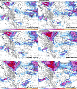
 
I have mixed feels on the Euro run. It's splitting the northern stream and squashing the wave in the SW still, but digging more with the top part of the wave (the colder part). That's not the path to a big storm, but on the flip, it's a cold storm and gets more folks involved in wintry precip to the south. The path to a bigger storm is for all that piece in the desert SW to come on out as one and then have the wave sharpen over the lower MS valley (but warmer risks aloft).

View attachment 163934).

Didn't something similar happen with the last storm? The NS never fully phased with the SW energy and took only a piece of it? Maybe that happens again here. It seems like some of this storm is very similar to the last, except colder.
 

Bring it (on the ensembles, not the ops yet). I'm ready to go big here. I want a 1.5 qpf inch mean at least, swing for the fences. If we can't hit it out of the park with this much cold we forever suck. I'll risk the sleet and ZR, I'm used to it, lol.
 
Bring it (on the ensembles, not the ops yet). I'm ready to go big here. I want a 1.5 qpf inch mean at least, swing for the fences. If we can't hit it out of the park with this much cold we forever suck. I'll risk the sleet and ZR, I'm used to it, lol.
I would take the sleet any day, but not the ZR. That is nothing but trouble.
 
My question for those that know a lot more. With the Euro depiction coming in around 18z Tuesday and heading into the night time hours would that increase the duration of snow for us along I-20?

The fun part about this type of storm is you really only need to be worried about amplification/strength and location of the low pressure system as long as it's not delayed by shenanigans to our West.

The air mass that is likely to be in place is cold enough at the surface and throughout the entire atmospheric column with those model's depictions (maybe a little sleet mixing in further South of I-20 and ZR on the coastal plain).

The caveat to this is, this is only true if the models are correct in their very cold temperature depictions. Along with cold temperatures, you'll have dry air in place which will lead to more cooling as precipitation evaporates (at first) in the dry air mass. That may make up for them being overdone on the cold.

In all of my years seeing storms around I-20, I can say that the biggest ones in my lifetime, have started in the daytime. To get a nice I-20 snow, we need more than "just being right on the line" and needing night time to keep us snow.
 
Back
Top