NBAcentel
Member
Looks like the 18z euro is putting some of us mid south peeps back in the game
No one is or ever was out of the game, my friend.Looks like the 18z euro is putting some of us mid south peeps back in the game
Thanks for clarifying that for me I’m just full of emotions right now lolNo one is or ever was out of the game, my friend.
This is the kind of things we want to see. That's a lot of moisture and a lot of cold air with a heavy press of it too.This was about to be a biggin for SC/NC/GA. Big slug of moisture moving north in response to the northern stream energy View attachment 163932
Can you post 500 whole way through?This was about to be a biggin for SC/NC/GA. Big slug of moisture moving north in response to the northern stream energy View attachment 163932
Love how that 540 line is way down at I-20 in GA and Alabama!If that northern energy digs more like 18z euro this could be an historic storm for some the airmass in place is insane.
Sent from my iPhone using Tapatalk
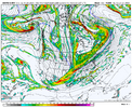
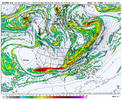
Appears to be a low developing near Daytona Beach. That would a big dog level look for many areas in the SE, including eastern GA/Central SC.Euro starts snowing Tuesday afternoon in the 20s with room to drop in the teens with dews way lower. Awesome View attachment 163929View attachment 163930View attachment 163931
This was about to be a biggin for SC/NC/GA. Big slug of moisture moving north in response to the northern stream energy View attachment 163932
We most likely will be once the imminent northwest trend begins.Looks like the 18z euro is putting some of us mid south peeps back in the game
Is that the "overrunning" potion of the storm? The streaky precip from the WAA? It doesn't look like the precip from a standard gulf low.
I'm late here, but I found this part of the discussion by KCAE interesting, especially given that GSP apparently doesn't mention ensembles...
While the cold outbreak is high confidence, what follows is
less confident, but quite interesting. All major pieces of
guidance, including the majority of GEFS and ECE members show
some sort of coastal low developing along the southeastward
extent of the primary cold dome. Climatologically, this type of
setup is favorable for wintry precip in the Carolinas and
eastern GA, but it raises a series of possible outcomes as well,
which are shown well in guidance now. The EC and Canadian
(along with their ensembles) show a classic southern slider
overrunning event; ECE probs of greater than 1.0" of snow over
much of the area continues to exceed 40% for multiple runs in a
row now. Ditto for the Canadian. However, these mean probs are a
bit biased towards the high end members of the ensembles. These
high end members raise their own interesting point by
themselves however. Now on the other end for the possible
Tuesday- Thursday system, the GEFS over the last few runs
presents the classic suppressed solution with the surface high
dragged too far south and forcing any synoptic forcing well
south. So, at this point, based on the extent of the airmass,
typical trends in ensembles in the 6-10 day window, and the
current depictions, confidence is increasing in some wintry
precip in the Carolinas and eastern GA; however, as with all
possible wintry precip systems around here it will take time to
figure this out.
They don't have anything in the forecast, but they're honking in this discussion, and I can say local mets are as well.
 ).
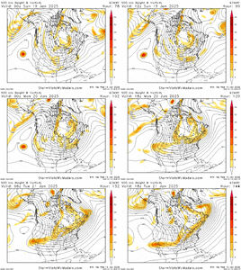
).I think most of us will be happy with either scenario. I'll take 4-6 inches of dry powder, or 6-8 inches of snow capped with sleet as well. Just don't want any other scenarios coming in to play.I have mixed feels on the Euro run. It's splitting the northern stream and squashing the wave in the SW still, but digging more with the top part of the wave (the colder part). That's not the path to a big storm, but on the flip, it's a cold storm and gets more folks involved in wintry precip to the south. The path to a bigger storm is for all that piece in the desert SW to come on out as one and then have the wave sharpen over the lower MS valley (but warmer risks aloft).
View attachment 163934).
For folks NW they want big big…for us degenerates east of 85 we want this.I have mixed feels on the Euro run. It's splitting the northern stream and squashing the wave in the SW still, but digging more with the top part of the wave (the colder part). That's not the path to a big storm, but on the flip, it's a cold storm and gets more folks involved in wintry precip to the south. The path to a bigger storm is for all that piece in the desert SW to come on out as one and then have the wave sharpen over the lower MS valley (but warmer risks aloft).
View attachment 163934).
Definitely. One or two more frames. This run was coming in on Tuesday so we are cold. The ratios could be crazy on the NW side of the storm.Good lord. That 18z EPS was gonna go for 4-8 inch snow means across the upstate and most of NC if it went out past 144hrs think.
I don't know grit. Part of me thinks we don't have to bring the whole thing out - we really just need to keep the overrunning going and tilt the upper level jet. 18z EPS continuing to increase also makes me think we may not need to bring the whole thing out (although I'd love to see the H5 for the individual members to know). The ideal solution, the UKMET, seems to not be that far off from the 18z Euro despite the Euro not bringing it all the way out.I have mixed feels on the Euro run. It's splitting the northern stream and squashing the wave in the SW still, but digging more with the top part of the wave (the colder part). That's not the path to a big storm, but on the flip, it's a cold storm and gets more folks involved in wintry precip to the south. The path to a bigger storm is for all that piece in the desert SW to come on out as one and then have the wave sharpen over the lower MS valley (but warmer risks aloft).
View attachment 163934).


Wow that was a huge jump. It's been ticking each run, but now I bet 3/4 of the members were going to go for the big dog.Pretty large shift NW on the 18z EPS with QPF. Sweating bullets already. This eps run was about to be big thoughView attachment 163937View attachment 163938
Seems to me we are on the upswing. More members with the same idea. It doesn’t look like the surface low is trending NW….yet..Time to get nervous View attachment 163943
