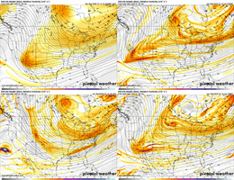
Majority like the maps...please keep posting!What's the difference between posting ZR outputs vs posting model outputs in general? If AIFS verified, there'd be a massive ice storm. And it's not as far fetched as GDPS, which has a significant cold bias.
So share ZR maps.. or share QPF maps.. or share MSLP maps.. either way, the model is predicting an ice storm.
-
Hello, please take a minute to check out our awesome content, contributed by the wonderful members of our community. We hope you'll add your own thoughts and opinions by making a free account!
You are using an out of date browser. It may not display this or other websites correctly.
You should upgrade or use an alternative browser.
You should upgrade or use an alternative browser.
Wintry January 21-23 2025
- Thread starter SD
- Start date
WxBlue
Meteorologist
Ensemble signal is definitely a lot louder for this event. Clown maps aren't completely out of reach here, IMO.
I agree with you...if people don't want to see snow/ice maps then I would take the next week or so off of this even thread at the very least.100%. Many thought the maps were ridiculous when they were pumping out 1-2 inches of freezing rain before the Mid Feb 2014 storm… and then it happened
I’m agreeing with you not disagreeingI get it...if you don't want to see snow/ice maps then I would take the next week or so off.
I am agreeing with you agreeing with me....and I re-worded my post. It didn't sound right.I’m agreeing with you not disagreeing
Big fan of the 12z op euro, sheared wave, jet enhancement, weak waa, under modeled qpf, nom nom woof woof
Stormsfury
Member
Honestly, I cannot recall such a loud and almost metalcore storm signal at this lead time in my life. I ain't exactly a spring chicken at 52Ensemble signal is definitely a lot louder for this event. Clown maps aren't completely out of reach here, IMO.
Cblake
Member
As long as we’re all in agreement…
- Joined
- Jan 23, 2021
- Messages
- 4,602
- Reaction score
- 15,197
- Location
- Lebanon Township, Durham County NC
@bouncycorn you don’t happen to have IP do you
D
Deleted member 609
Guest
Feb 2014. Felt like that thing was non stop clown maps for 2 weeks straight.Honestly, I cannot recall such a loud and almost metalcore storm signal at this lead time in my life. I ain't exactly a spring chicken at 52
There's such an easy path to a regional T-6 event here that it doesn't even seem real.
Yeah there’s a big difference between an in-situ CAD with no continuous supply of CAA like we had in the last storm (where ice accrual still managed to overperform IMO) and this one with a textbook-positioned 1035+ mb high. High-end ice is on the table depending on the track and amount of WAA.How do we know it won't verify? We have a highly anomalous cold air being dumped very far south into the conus.
Brad Travis mentioned there was a chance on Tuesday and Friday next week of something frozen falling for north Alabama.
WxBlue
Meteorologist
Last time for me personally was probably the January 2016 storm when I was in Asheville. I don't recall anything like this since my return to NC in 2019.Honestly, I cannot recall such a loud and almost metalcore storm signal at this lead time in my life. I ain't exactly a spring chicken at 52
SnowNotHappen
Member
Last edited by a moderator:
Snowlover34
Member
Hey guys is this more of a deep south event with the trends being more suppressed that leaves us folks out in the Tennessee valley? Or should I just move on from this system?
RollTide18
Member
Honestly, I cannot recall such a loud and almost metalcore storm signal at this lead time in my life. I ain't exactly a spring chicken at 52
January 28, 2014 comes to mind for me
RollTide18
Member
Hey guys is this more of a deep south event with the trends being more suppressed that leaves us folks out in the Tennessee valley? Or should I just move on from this system?
I don’t think anyone’s out of it at this point
SnowNotHappen
Member
RobertRath
Member
Can someone explain why N AL seems to be in an unfavorable position for this storm? It seems like many models either have it mainly suppressed south of us or for whatever reason the precipitation sort of dries up coming out of MS then redevelops further east.
rburrel2
Member
The thing is the Euro AI nailed the frozen qpf footprint with the last storm starting at around 168hrs out. It's definitely worth looking at now for this storm, imo. I expect the footprint it shows over the next day or two to be close to the ultimate footprint that verifies for the storm.
Also... man the surface temps being modeled are ridiculous cold. Assuming we get a storm, this will be the coldest CAD storm at the surface since 2014, and could be a good bit colder than that one, imo. There was another exceptionally cold CAD storm here in the winter of 2004/2005, but I'm only going off my memory for that one. I know here in Clemson I bottomed out around 23 degree's and we got a few inches of sleet with just a little snow on the front end.
I looked it up: January 29th, 2005.
Drizzle Snizzle
Member
I remember Late January 2005 there was a strong CAD that produced Ice and Sleet all the way to Alabama.The thing is the Euro AI nailed the frozen qpf footprint with the last storm starting at around 168hrs out. It's definitely worth looking at now for this storm, imo. I expect the footprint it shows over the next day or two to be close to the ultimate footprint that verifies for the storm.
Also... man the surface temps being modeled are ridiculous cold. Assuming we get a storm, this will be the coldest CAD storm at the surface since 2014, and could be a good bit colder than that one, imo. There was another exceptionally cold CAD storm here in the winter of 2004/2005, but I'm only going off my memory for that one. I know here in Clemson I bottomed out around 23 degree's and we got a few inches of sleet with just a little snow on the front end.
SnowNotHappen
Member
I remember back in 73 when the wind starting blowing out the south and it dumped here. Doesn't get much better than that.
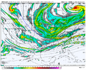
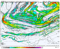
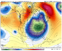
View attachment 163889View attachment 163890While we are digging further west, the TPV is also more stretched west to east.
The fact that we are not losing our cold air feed is absolutely mind blowing.
The answer to your question is the same for every storm - the upper level wave evolution will largely dictate where the low pressure and associated precipitation forms and tracks / and cold air availability. There’s a path to a big hit in the mid-south just as there is the Deep SouthCan someone explain why N AL seems to be in an unfavorable position for this storm? It seems like many models either have it mainly suppressed south of us or for whatever reason the precipitation sort of dries up coming out of MS then redevelops further east.
NBAcentel
Member
packfan98
Moderator
Probably not. It also doesn’t make sense to take a blend right now, because of how the energy is being handled. Heck, the GEFS can’t even agree.
Cary_Snow95
Member
- Joined
- Jan 5, 2017
- Messages
- 3,772
- Reaction score
- 5,979
18Z GFS is cold and dry on Tuesday/Wednesday.
Cary_Snow95
Member
We are worrying about too much digging on the ICON and Euro... meanwhile the GFS doesn't dig literally at all
GFS sticking to its guns. No big jump there to hang that energy back even more so maybe this is the pivot point of it coming to other guidance. No matter the storm, there’s always one out there to spoil it and make you sweat bullets
I said this earlier, but models wanted to let that baja wave hang back during the last storm too. Especially the euro early on. That never happened.
Cary_Snow95
Member
I would expect the GEFS mean to decrease significantly.. simply because it closely follows the OP. So no one panic lol
rburrel2
Member
What's crazy is as awful as the GFS is with the first wave... it's still just gonna pop us with the next wave dropping down. It's like we can't lose.
Six Mile Wx
Member
If our modeled event starts as early as next Tuesday morning at 7:00am then we should start seeing it tonight on the 18z 144hr Euro run.
Last edited:
LukeBarrette
im north of 90% of people on here so yeah
Meteorology Student
Member
2024 Supporter
2017-2023 Supporter
It’s more like the GFS didn’t even feature the energy this runGFS sticking to its guns. No big jump there to hang that energy back even more so maybe this is the pivot point of it coming to other guidance. No matter the storm, there’s always one out there to spoil it and make you sweat bullets
jetstream30
Member
I hope this is not one of the few times the GFS is correct. I suspect not.

