• Hello, please take a minute to check out our awesome content, contributed by the wonderful members of our community. We hope you'll add your own thoughts and opinions by making a free account!

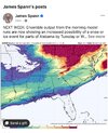
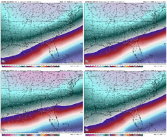
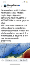
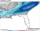
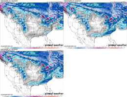
Wintry January 21-23 2025

Only time I can recall locking on to something so quick was Jan 21-22 2022, we got monster runs esp from the euro then it trended flatter but still there was consistent hits, then we almost lost it at day 3-4, then the short range brought it back
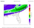
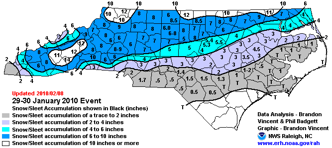
january_29-30_2010_nc_snowmap.gif


This one stands out in my mind as one of the most consistent on all NWP that I can remember. Most guidance had this consistently for almost a week if I remember correctly. They are rare, but they do happen.
 
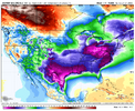
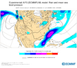
Yes and the strength of the high pressure has been quite consistent on all models. With both the GFS and EURO now showing 1050mb+. Also the strength of those HP also leads me to believe that the amount of ZR is over done in areas that are in the teens to low 20s. A stronger will typically lead to a deeper dome of cold air
If the high pressure is as strong as modeled, I will not worry about any ptype issues. However, I am having a tough time believing it will be that strong.
 
So for people that know better terminology than me, what should I look for in terms of positive signs with the models for the along/south of US 80 areas?
 
I don't see how we get freezing rain with temps in the teens. No way....
Northern Alabama/southeast Tenn. had an ice storm in 1985 when it was pouring rain and in the upper teens. I know because I was in it. It's one of the most beautiful and surreal moments of my life. Pouring rain with no puddles -- just an insta-freeze. Needless to say, power was out for more than 2 weeks.

 
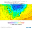
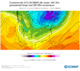
Even the EPS mean has a ~1045 high though. It's extremely impressive on a mean at this range.
View attachment 163441
Yeah agreed. I was just saying to someone that we have virtually full model support, across the board, for a highly anomalous cold air intrusion. If that indeed does come to pass, amplification risk would go down.

I just hate to pull out the "this time it's different" card. Because it hardly ever is. But maybe we're on a different track this year. We certainly seem to be.
 
If the HP verified anywhere close to strength and shape, there will not be P-type concerns with a non-amped SLP moving ENE 80 miles south of Baton Rouge, LA....that's a guarantee. Soften the HP dramatically, then you have a chance of amping some, and generating more of a mixed bag....but that's just not what any model is showing at this point. This is absolutely incredible agreement to be in the 8 day range.

Also....It will surprise me in the least to see this speed up 24 hours or so. It also wouldnt surprise me to see a smaller event pop up as the HP slides down ahead of our main energy.
 
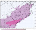
I've said it before already, but like ILMRoss said, I am definitely more worried about the Ice situation here. When you get overrunning over a legit cold CAD you're asking for trouble across a large swath of places. If I had to just make a day 8 guess (I know, that's dumb), but you're probably looking at more snow in traditional CAD areas of NC/SC, IF and that's a big IF, you get these 1040+ modeled HP. CAD is typically a low level and surface level thing, but these super CADs tend to be able to hold NE winds better in the mid-levels vs a standard CAD cold air feed. Right now I'd say places around 10-20 miles south of 85 and North and west would be snow with everyone below that mixing. I think the I20 and I95 corridor is where you get into some serious trouble with ZR. Again, that's just today. I'd say there's a better chance more people are icing vs snow and that includes even my area. It's such a tight rope to balance here. But where you do get ZR especially, you're going to get some serious accretions when you're dropping 1.5" of liquid on avg in low to mid 20's at the surface. People love to shave a big percentage off of these totals, but even a third of that is half an inch of Ice. and There's a solid chance that at least half would freeze. Even with heavier rates.
 
Yeah agreed. I was just saying to someone that we have virtually full model support, across the board, for a highly anomalous cold air intrusion. If that indeed does come to pass, amplification risk would go down.

I just hate to pull out the "this time it's different" card. Because it hardly ever is. But maybe we're on a different track this year. We certainly seem to be.

Yeah, things look great and I'm looking around wondering how the rug could be pulled.

1. Highs are not as strong as modeled. I think this is likely, like you mentioned. Not as cold but cold enough?
2. TPV in SE Canada pulls out faster than modeled, WAR flexes west, storm cuts inland, rain/ice CAD.
3. TPV stays strong but it's suppressed and a coastal clipper. EPS currently hints at this with several members.
4. Trend to a baja low, it spins and laughs at us in the SW until our cold is gone, then ejects and rains on everybody.

Everything trended really nice really fast; but I feel it's too early and some thread is going to pull on us. Weenie paranoia phase.
 
If the high pressure is as strong as modeled, I will not worry about any ptype issues. However, I am having a tough time believing it will be that strong.
I doubt we 1050mb+, but I certainly think that 1040-1042 is very possible here. Even smoothed ensemble means have it in the 1045-1050mb range.
 
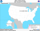
Anyone know if we get a new CPC winter precip outlook today? Thought it was supposed to be 3pm drop
 
For those of us in Georgia, Feb 2014 was sleet/ZR under the wedge followed up by a ULL sprinkling a few inches on top after some time in the dry slot. If I recall, there were some convective issues along the panhandle the limited snow totals under the wedge where the air was thick enough to support mostly snow. https://www.weather.gov/ffc/20140212_winterstorm
 
Latest Charleston, SC already bringing up next week.

LONG TERM /FRIDAY NIGHT THROUGH TUESDAY/...
A considerably more active period is expected to commence this
weekend with the passage of a cold front Saturday night into Sunday.
The suite of model solutions depict a healthy frontal band pushing
into the area from the west Saturday morning with precipitation
potential lingering into Sunday morning. Widespread significant
rainfall amounts will be possible, with potential totals of 0.75-
1.50" for the entire weekend. Then behind this front, there is
widespread agreement that an impressive arctic high will spill a
bitterly cold airmass across much of the CONUS with high
probabilities for well below normal temperatures.

Attention then turns to the very end of the forecast period where
there is increasing confidence in a widespread precipitation event
in association with a coastal low track, potentially beginning as
early as Tuesday. This event would be unfolding in the presence of
the arctic airmass noted above, yielding the potential for winter
weather. Model guidance, both of the deterministic and ensemble
variety, suggests a threat of winter weather for the forecast area
and the region as a whole. It must be stressed that considerable
uncertainty remains, especially regarding such important items as
possible precipitation types, possible precipitation amounts, and
specific impacted areas.
 
GSP doesn’t get into much specifics in its discussion other than mentioning the Arctic airmass coming in with waves of low pressure approaching. They did put in a chance of snow showers in my point forecast Monday night and Tuesday
 
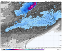
AI is my fear for losing this threat...the deep upper low in southern Canada lifts out to quickly.

View attachment 163466
Crazy how right now this is one of the more poor solutions and it’s still a winter storm for SC/NC/GA, just rather ice. But yeah this is my concern as well with no big block up top
 
AI is my fear for losing this threat...the deep upper low in southern Canada lifts out to quickly.

View attachment 163466
It's literally the only version of any model showing this....don't let it get to you. It was latched on to the last system and never wavered....and it was pretty bad wrong....maybe the worst honestly.
 
Back
Top