-
Hello, please take a minute to check out our awesome content, contributed by the wonderful members of our community. We hope you'll add your own thoughts and opinions by making a free account!
You are using an out of date browser. It may not display this or other websites correctly.
You should upgrade or use an alternative browser.
You should upgrade or use an alternative browser.
Wintry January 21-23 2025
- Thread starter SD
- Start date
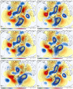
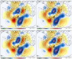
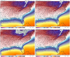
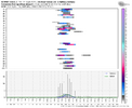
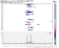
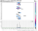
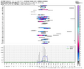
now we’ve got most members starting to look like that one operational run from the other dayEPS Panels. I see a member with 20 inches in Savannah lol
View attachment 163408View attachment 163407
at this point i would just sit back for a few days and have fun with the ops but only pay attention to trends on the ensembles until we get in the 5 day window
rburrel2
Member
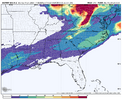
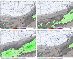
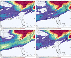
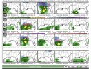
Not that anyone cares but the 12z JMA is also a major winter storm.
View attachment 163414View attachment 163415
We always care when a model shows snow!
G
ener always comes north and west and all storms generally come earlier than projected. Have seen this in over 39 years of snow and ice managementWhat did we learn from the past weekend storm? (and many others)
Temps will be higher than modeled
Precip will come north (how much is the question)
NAM will nail the temp profiles early and there will be WAA
Precip will likely come in sooner and finally
Runs will change dramatically every time from now to onset
Not trying to spoil anyone's dreams but it will break some hearts in the end
WolfpackHomer91
Member
Feb 2014 .... Atleast for NC, Started showing HUGE phased Baja Bombs on Friday afternoon, and never stopped until that next Weds at go time Weds overnight into Thursday. Ive literally never seen some of the at the time I thought was garbage from models. But they just kept coming....run....after....run...after run lolI think so, yeah.
I can remember I was ringing the alarm for my parents from Rome, GA and we're getting close to where I'm going to sound the alarm again. Need a bit more time though.
I just really hope that this isn't as bad looking. Really would like for it to be more sleet.
NBAcentel
Member
ForsythSnow
Moderator
If the ENS across the board are screaming major storm I think we are going to be in for some epic runs of they hold. Get some good rest the next couple nights because it's all gone soon.
These are great trends overall but I definitely think we should pay attention to the 709 and 850 layers. They're absolutely critical here.
These are great trends overall but I definitely think we should pay attention to the 709 and 850 layers. They're absolutely critical here.
NBAcentel
Member
Yeah folks get good rest. ill be up posting away at night for yall to wake up to hahaIf the ENS across the board are screaming major storm I think we are going to be in for some epic runs of they hold. Get some good rest the next couple nights because it's all gone soon.
These are great trends overall but I definitely think we should pay attention to the 709 and 850 layers. They're absolutely critical here.
Yes and the strength of the high pressure has been quite consistent on all models. With both the GFS and EURO now showing 1050mb+. Also the strength of those HP also leads me to believe that the amount of ZR is over done in areas that are in the teens to low 20s. A stronger will typically lead to a deeper dome of cold airBig difference. Last storm, we were left with in-situ wedging. This one is modeled to have a very cold renewing source of extremely cold, dry air ala 1040mb+ sprawling high pressure freshly supplying a constant feed
albertwilsonjr
Member
Yeah folks get good rest. ill be up posting away at night for yall to wake up to haha
Legend
Sent from my iPhone using Tapatalk
atlweatherman
Member
can you post for ATL?
whatalife
Moderator
- Joined
- Jan 2, 2017
- Messages
- 1,566
- Reaction score
- 4,279
Ill be up at 0430 ready to read themYes and the strength of the high pressure has been quite consistent on all models. With both the GFS and EURO now showing 1050mb+. Also the strength of those HP also leads me to believe that the amount of ZR is over done in areas that are in the teens to low 20s. A stronger will typically lead to a deeper dome of cold air
Yes and the strength of the high pressure has been quite consistent on all models. With both the GFS and EURO now showing 1050mb+. Also the strength of those HP also leads me to believe that the amount of ZR is over done in areas that are in the teens to low 20s. A stronger will typically lead to a deeper dome of cold air
Yeah unless we just get an insane phaser, if the highs stay the same, this one will just trend colder.
Stormsfury
Member
That's my hope here. Single digit dewpoints ahead of the moisture and still seeing a slightly stronger cold press with a high of that strength could literally dome and stall the warm air press or at least greatly slow it down. During the Dec 2002 icestorm...the isentropic lift line practically parked over SC. South of that. Just sporadic light rain/ZR or drizzle with temps constantly dropping during any precip/evaporative processes.Yes and the strength of the high pressure has been quite consistent on all models. With both the GFS and EURO now showing 1050mb+. Also the strength of those HP also leads me to believe that the amount of ZR is over done in areas that are in the teens to low 20s. A stronger will typically lead to a deeper dome of cold air
ITUSETOSNOW
Member
Do KPDK.can you post for ATL?
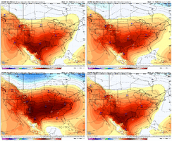
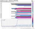
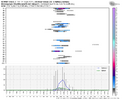
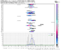
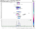
I was wondering about this. Thanks for posting. Not sure the last time I’ve seen almost every available piece of modeling this excitedJust glossing back over the previous storm thread and we weren’t really cooking yet at this range but we were getting some hits here and there. This was the GEFS at similar range View attachment 163435
Snowflowxxl
Member
Quit asking for totals/maps please
Stormsfury
Member
I think Columbia WFO reads these boards and social media a lot ..
LONG TERM /FRIDAY THROUGH TUESDAY/...
Key Message(s):
- Moderating temperatures into this weekend with widespread showers
Saturday with unsettled weather beyond.
Guidance keeps temperatures closer to normal into Sunday ahead
of an approaching cold front. This front may not push through
until the daytime hours Sunday, so highs may occur early in the
afternoon, with temperatures dropping by late afternoon. Much
colder air will push into the region for Monday, with an arctic
airmass possible for Tuesday.
As for precip, good amount of moisture increase Friday night
through Saturday ahead of the weekend cold front. Widespread
rain showers expected Saturday, with rain chances continuing
into Sunday. Some dry weather may occur by Monday into the day
on Tuesday.
***Note: As for just beyond the current forecast period, yes we
continue to monitor the potential strength of the arctic
airmass, along with any winter precip potential just beyond our
current forecast period. There remains a lot of model differences,
and a LOT of uncertainty even with the blends that far out.
However, we will continue to watch the model trends over the
next several days along with the rest of you.***
NBAcentel
Member
Only time I can recall locking on to something so quick was Jan 21-22 2022, we got monster runs esp from the euro then it trended flatter but still there was consistent hits, then we almost lost it at day 3-4, then the short range brought it backI was wondering about this. Thanks for posting. Not sure the last time I’ve seen almost every available piece of modeling this excited
Also goes to show how much models and ensembles can change over the course of 200 hours. We have yet to see the final product but odds for a winter storm for people who aren’t used to seeing it are going up for sure.Just glossing back over the previous storm thread and we weren’t really cooking yet at this range but we were getting some hits here and there. This was the GEFS at similar range View attachment 163435
Pretty remarkable short range come back. It looked more than dead in the water at that 3-4 day range. RGEM was king back then.Only time I can recall locking on to something so quick was Jan 21-22 2022, we got monster runs esp from the euro then it trended flatter but still there was consistent hits, then we almost lost it at day 3-4, then the short range brought it back
That’s important to remember. We’re still in the range where often the EURO is around 3 or 4 degrees too warm in CAD.Yeah unless we just get an insane phaser, if the highs stay the same, this one will just trend colder.
January 24 and 28, 2014 had back to back winter storms for the Baton Rouge area, which is almost unheard of down here. My house got a dusting of snow from the 24th storm and saw some sleet and freezing rain accumulations. Then came the big one the following Tuesday. Temperatures stayed in the mid 20s all day with a steady sleet. I had to work at McDonald's that day, since I had only just graduated college. I wonder if this period of time will see something similar to those events, but hopefully with more snow instead of ice and sleet here. I live just north of Baton Rouge now, so hopefully would be far enough inland that some snow might mix in.The storm in late January that year caused a lot more problems if I remember correctly.
My worry is skewed toward early amplification. I love the big, sprawling HP, although we know a 1050+ high 6 days out is like a 1035 high in real life. We'll see.
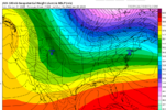
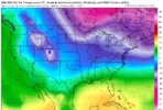
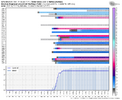
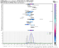
Meanwhile, I'm just astonished by the minus mid-20s at 850mb on the GEPS mean. That's an ensemble mean 6 days out! Even Mexico is purple lol!
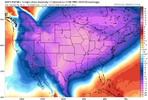
Meanwhile, I'm just astonished by the minus mid-20s at 850mb on the GEPS mean. That's an ensemble mean 6 days out! Even Mexico is purple lol!

We also didn’t have every model on board then so it’s hard to draw any sort of parallel. This is highly abnormal agreement. At worst, we get to use this as another learning experience. At best, we all get smoked.Also goes to show how much models and ensembles can change over the course of 200 hours. We have yet to see the final product but odds for a winter storm for people who aren’t used to seeing it are going up for sure.
Yes. These are really just for illustrative purposes at this range. The main idea is that many ensemble members have hits and the means aren't getting skewed by a few rogue members.Quit asking for totals/maps please
Psalm 148:8
Member
- Joined
- Dec 25, 2016
- Messages
- 344
- Reaction score
- 789
Surprised FFC is honking the possibility horn.. BMX usually honks first.
Definitely getting good benchmarks for later in the winter as we still have a good 2 months of winter possibilities to goWe also didn’t have every model on board then so it’s hard to draw any sort of parallel. This is highly abnormal agreement. At worst, we get to use this as another learning experience. At best, we all get smoked.
I honestly don’t remember seeing this much agreement across the board since the February 2014. I remember with that one, Brad P was talking about it on his blog 10 days out showing pretty much every model latching onOnly time I can recall locking on to something so quick was Jan 21-22 2022, we got monster runs esp from the euro then it trended flatter but still there was consistent hits, then we almost lost it at day 3-4, then the short range brought it back
Even the EPS mean has a ~1045 high though. It's extremely impressive on a mean at this range.My worry is skewed toward early amplification. I love the big, sprawling HP, although we know a 1050+ high 6 days out is like a 1035 high in real life. We'll see.
Meanwhile, I'm just astonished by the minus mid-20s at 850mb on the GEPS mean. That's an ensemble mean 6 days out! Even Mexico is purple lol!
View attachment 163439
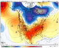
hate to say it but if the "silhouette" of the storm we have so far verified then yeah it would be a multimodal p-type catastrophe
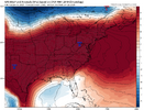
an issue with overrunning to me has always been the diffuse areas of low pressure. it's never as organized as your ULL or sharper shortwave. i think that this makes the thermal profile disorganized to say the least.
another issue is, and we saw this last week, is that often overrunning events are positively tilted slugs. the base of the trough can help raise heights downstream, warming the mid levels
with you have a god-tier HP, way different story than the in situ cad last week. tough to scour out. if our current storm form verified the forecast would be a devastating ice storm. the likely bust would be the models underdoing the cold in the low levels, meaning a lot of places bust as sleet, but other places south of that were supposed to remain rain becoming icy. probably getting ahead of my skies here, but just sketching out the general outline of this storm if this verifies
I still have the screenshot. This was the first model I saw, unless I missed some posted earlier. This was the Euro at 156 for the Jan 22 storm. Other models got on board quicklyOnly time I can recall locking on to something so quick was Jan 21-22 2022, we got monster runs esp from the euro then it trended flatter but still there was consistent hits, then we almost lost it at day 3-4, then the short range brought it back
