Stormsfury
Member
GEM is delayed but not denied this cycle.
View attachment 163350
From those looks yes but could easily come north with future runs imoSo is this a situation where this storm is more of a deep south hit more than the areas in the mid south?
No one can know. Just speculation based on models runs and players on the fieldSo is this a situation where this storm is more of a deep south hit more than the areas in the mid south?
I’m in Senoia and I think we’re the sleet capital of Georgia. It can be snowing on the other side of Coweta County and sleeting here. It always seems to work out that way I guess I’m a little bit too far south.It shows a funky warm nose at 800mb over me, which would be heavy snow and sleet, probably more sneet like last time! LOL
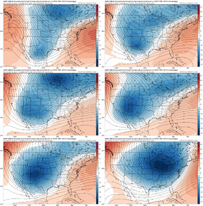
Yep. Probably going to be a total cave here from the GEPS with an OP jump like thatGEFS dialed in with the WAR. Great zone opening up for a storm track View attachment 163288
GEPS not there yet but improving every run View attachment 163289

The other thing I like here is that if we can keep the big and wide conus trough, we won’t be dealing with 5-6 different pieces that have to miraculously come together to make it work. The modeling should be better equipped to handle a solution where the features are longwave in nature and not chopped up with a bunch a small featuresI think the big takeaway right now is the ensembles are leading the way showing a favorable pattern for overrunning an Arctic air mass. What is beginning to become quite encouraging is that despite quite variable H5 evolutions, the ops and individual ensemble members are starting to pump out winter storm solutions quite frequently.
GEFS H5 trend is a trend of salivation View attachment 163354
Exactly,That GFS run honestly gave me February 2014 vibes. Even had a small wave down a quick inch or two for some areas 18-24 hours before the main storm arrives. Great cold airmass in place and getting reinforced with a 1055mb high
Yeah with overrunning I think the north precip field as modeled now would inch up north a littleBrad Travis is taking the GFS I guess View attachment 163360
Might be less than 10. Could start as early as next Tues night.1. We're not 10 days out
2. The setup isn't all that complicated
3. Broad model and ensemble support for very cold air in the area and high pressure over top
4. Ops AND ensembles showing a system
5. You better get some rest while you can
Yes the mess in Atlanta happened two weeks before that incredible week in February 2014. In facts models first started to pick up on the potential of that storm just a couple of days after the late January storm endedExactly,
Am I wrong in my memory that snowmegeddon happened a couple of weeks or so prior to the storm your talking about here?
It seemed it was an appetizer for the main course for many!
Similarly to what we had this past weekend!
I mentioned this on Twitter to Mitch before the last storm based upon what the long range modeling was showing after that storm.
It reminded me so much of the evolution of 2014 with what this was showing last week.
P17 looks climo to me
The way the trends going so far i may have to snow chase south considering being in far northern Alabama. But the deep south is long over due for a good snowstormYeah with overrunning I think the north precip field as modeled now would inch up north a little
It looks awfulP17 looks climo to me
Long ways to goThe way the trends going so far i may have to snow chase south considering being in far northern Alabama
The thing I like about those is that there either showing a significant winter storm for all of CLT metro or they are missing to the south. Nothing cutting west of the Apps
I've promised myself not to pick on you so much. I think the karma is cutting back on my sleet totals, lol. If I'm real good, I think I can reel in a really good period of sleet in about a week, with beaucoup snow on top. So this is me wishing you the best snow of your life!!Yeah, no doubt. I will be happy for folks south of here to cash in but it hurts to be north of the best snows when you live far enough south already! Mind numbing when that happens. @dsaur likes to remind me of one of those events!
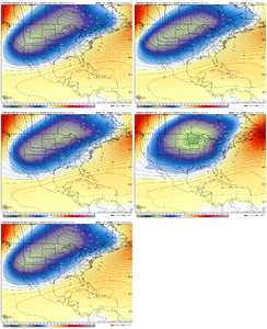
Consistency is all we need right now View attachment 163363
I know this is being lame but looks like that includes all mixed precip if I had to guess

To you as well, Tony who if anyone on the board just gets dumped on with sleet, I hope it is you my friend. Onward to the EURO and let's see what Dr. No has to offer at 12z.I've promised myself not to pick on you so much. I think the karma is cutting back on my sleet totals, lol. If I'm real good, I think I can reel in a really good period of sleet in about a week, with beaucoup snow on top. So this is me wishing you the best snow of your life!!
