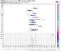
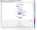
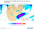
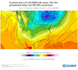
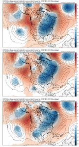
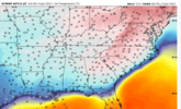
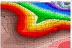
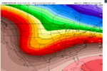
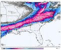
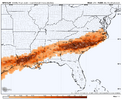
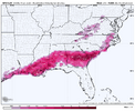
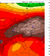
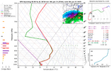
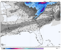
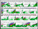
That is quite the signal between the EPS/GEFS/GFS and like I said earlier, I do think this setup 1) could be something ensembles sniff out sooner rather than later and 2) may support eastern parts of the board more with those being closest to the right entrance region of the upper jet and strong baroclinicity. Looong way to go and obviously things can and will change, but quite the signal at this range.Dude was just about to say this. I mean it's almost a carbon copy. Several big dogs View attachment 163237View attachment 163238
-
Hello, please take a minute to check out our awesome content, contributed by the wonderful members of our community. We hope you'll add your own thoughts and opinions by making a free account!
You are using an out of date browser. It may not display this or other websites correctly.
You should upgrade or use an alternative browser.
You should upgrade or use an alternative browser.
Wintry January 21-23 2025
- Thread starter SD
- Start date
That the craziest pac-ridge I think I’ve ever seen modeled and in a great location!Yes, some trending in recent Euro runs of widening / fattening (are those words?) of the cold plunge along with more ridging into Greenland
View attachment 163235
NBAcentel
Member
Another shot at this producing a rare footprint. Let’s hopefully not mess it up againThat is quite the signal between the EPS/GEFS/GFS and like I said earlier, I do think this setup 1) could be something ensembles sniff out sooner rather than later and 2) may support eastern parts of the board more with those being closest to the right entrance region of the upper jet and strong baroclinicity. Looong way to go and obviously things can and will change, but quite the signal at this range.
NBAcentel
Member
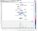
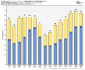
Yeah this is impressive, that mean high though on the 21st is one of the coldest I’ve seen in a while for the EPS at D7-8Quite the signal in eastern NC on the EPS that run especially considering the control / op was dry.
View attachment 163240
View attachment 163239
NBAcentel
Member
Oh my goodness the AIFS 
albertwilsonjr
Member
Oh my goodness the AIFS

Good or bad
Sent from my iPhone using Tapatalk
NBAcentel
Member
NBAcentel
Member
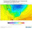
Yup. Lights out on itEh got excited when I saw its output QPF wise with that big CAD high pressure. View attachment 163243
But then saw the low levels… probably a big IP/ZR event. At least the AI has something after blanking this period for a while View attachment 163244
CNCsnwfan1210
Member

4 run trend next Wed afternoon temps…has most of NC below freezing on the 00z . It probably will moderate some , but certainly a cold airmass on the table and prime time to get wintry weather.
Sent from my iPhone using Tapatalk
CNCsnwfan1210
Member
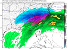
Snow and ice breaking out over central TX hr 168 on the 06z GFS, let’s see where it goes
Sent from my iPhone using Tapatalk
Sent from my iPhone using Tapatalk
CNCsnwfan1210
Member

Wow, nice winter storm for the southern US with a cold high to the north
Sent from my iPhone using Tapatalk
CNCsnwfan1210
Member

Cold air damming signature with that high over NY, a lot of snow and ice for many on this board
Sent from my iPhone using Tapatalk
CNCsnwfan1210
Member

Heavy snow and ice for the Carolinas with the low east of Charleston SC heading NE, big winter storm!
Sent from my iPhone using Tapatalk
We need the SER to be knocked down at this range, definitely not beef up like that.Dangerous game..
View attachment 163246
Yep. 100% agree. But one run.. everyone knows the deal.We need the SER to be knocked down at this range, definitely not beef up like that.
CNCsnwfan1210
Member

Low still heading NE, still not done in the Carolinas, snow well into VA hr 210
Sent from my iPhone using Tapatalk
CNCsnwfan1210
Member
IMO, this storm signal is there during the middle of the arctic outbreak (around Wed) cold air is there, it doesn’t hurt to have some SER but not too much, it’s a fine line, but get the cold air firmly entrenched as the models suggest, and I think we’ll be in a good position for wintry wx.
Sent from my iPhone using Tapatalk
Sent from my iPhone using Tapatalk
Jan88
Member
Storm forming Monday night in Texas so 6 days out .good signalIMO, this storm signal is there during the middle of the arctic outbreak (around Wed) cold air is there, it doesn’t hurt to have some SER but not too much, it’s a fine line, but get the cold air firmly entrenched as the models suggest, and I think we’ll be in a good position for wintry wx.
Sent from my iPhone using Tapatalk
Right, and what’s interesting is I think the temperatures will be the thing to watch because consensus shows temperatures in low to mid 20s. Instead of low to mid 30s we usually see in models in Midlands.Yep. 100% agree. But one run.. everyone knows the deal.
rburrel2
Member
Jan88
Member
Good cold air source.much different from the last stormRight, and what’s interesting is I think the temperatures will be the thing to watch because consensus shows temperatures in low to mid 20s. Instead of low to mid 30s we usually see in models in Midlands.
rburrel2
Member
packfan98
Moderator
Jan88
Member
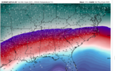
Classic look!Catastrophic sleet in the teens & low 20s in South Carolina.
View attachment 163247
Well like we always say, temperatures will ALWAYS be an issue around here. Whether that’s in the upper levels or the surface. I use to be in the camp of just give me a Winter Storm, but after being reminded of how depressing freezing rain & sleet is, I am really wanting some snow somehow.
im sitting good just south of birmingham al
packfan98
Moderator
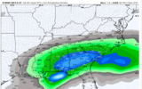
I’m not sure if I’ve ever seen over 5 inches of sleet predicted on a model run. Wow!
rburrel2
Member
I got 3" of pure sleet from the Feb 2014 storm. I hate sleet such a waste.I’m not sure if I’ve ever seen over 5 inches of sleet predicted on a model run. Wow!
Cad Wedge NC
Member
Odds of a storm are pretty good. Now, just nailing down the track and depth of cold air is what we have left. That Euro AI gives me pause. This could very well be an over-running event that produces sleet and freezing rain for most. Keep an eye on the cold air. Let's see how it trends over the coming days. That will tell us all we need to know.
It’s mind boggling to me that we have an artic front coming in, that actually should be well in place by this storm (right?) and we are still dealing with temps.Odds of a storm are pretty good. Now, just nailing down the track and depth of cold air is what we have left. That Euro AI gives me pause. This could very well be an over-running event that produces sleet and freezing rain for most. Keep an eye on the cold air. Let's see how it trends over the coming days. That will tell us all we need to know.
Jan88
Member
That's an amazing look!Yea the wedge being depicted on the GFS is old testament stuff.
View attachment 163259
Jan88
Member
It's our latitude I'm afraid also gonna b an issueWell like we always say, temperatures will ALWAYS be an issue around here. Whether that’s in the upper levels or the surface. I use to be in the camp of just give me a Winter Storm, but after being reminded of how depressing freezing rain & sleet is, I am really wanting some snow somehow.
Cad Wedge NC
Member
rburrel2
Member
packfan98
Moderator
Yeah, big GEFS run with tons of Big Dog potential and a fresh cold air mass. Good times!ONLY through Tues morning.
View attachment 163261

