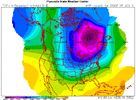
wow
Member
Day 7 GFS Ensembles .. the lobe is leaning back more. If we're going for the Big Kahuna, we need room for it to bloom and this is a good sign. Need that lobe to stretch out NE to SW.


P23 looks familiar…
View attachment 163199
Normal high is 28
2014 snowmageddon in Birmingham is a prime example. Same for Atlanta during that storm. Definitely was not forecast until the very last second. Everything was supposed to be "suppressed "Worrying about suppression 8-10 days away is ludicrous. 1. The Airmass will moderate some the closer we get to verification. It always does. This past week should've been a stiff reminder that having the cold airmass will always be the number 1 ingredient. Worry about the moisture later. Especially when it comes to overrunning because it almost always trends more NW in the final 24-48 hours.
I remember for that storm that Brad P was convinced it would miss CLT to the south until litterally the day before.2014 snowmageddon in Birmingham is a prime example. Same for Atlanta during that storm. Definitely was not forecast until the very last second. Everything was supposed to be "suppressed "
The only reason he probably changed it the day before is because he saw what was happening in Birmingham and AtlantaI remember for that storm that Brad P was convinced it would miss CLT to the south until litterally the day before.
Hard to imagine something not developing from this into the south/east a couple days later
View attachment 163200

Oh boy, Baja low... and another California Santa Ana wind event...This looks similar View attachment 163206
Yeah we are really following the mid 2010s route subseasonally. It’s awful for CaliOh boy, Baja low... and another California Santa Ana wind event...
He was really dependent on their in-house model which at the time always seemed to run very dry.The only reason he probably changed it the day before is because he saw what was happening in Birmingham and Atlanta
It wasn’t forecast by local ATL mets but it sure was on here. I had my wife pull our son out of his elementary school at noon that day. She thought I had lost my mind. Three hours later I was Father of the Year.2014 snowmageddon in Birmingham is a prime example. Same for Atlanta during that storm. Definitely was not forecast until the very last second. Everything was supposed to be "suppressed "
I was forecast to go into work at 1pm that day and I called my boss to tell them i'm not coming in. They didn't understand why lol.It wasn’t forecast by local ATL mets but it sure was on here. I had my wife pull our son out of his elementary school at noon that day. She thought I had lost my mind. Three hours later I was Father of the Year.
I hate that we always get these random S/Ws that appear upstream of our storms around day 7/8 out of nowhere. Every time it’s a guarantee View attachment 163213
And it gave the mother load of snowstorms to the SE sheeshI hate that we always get these random S/Ws that appear upstream of our storms around day 7/8 out of nowhere. Every time it’s a guarantee View attachment 163213
Good thing it’s the CMC which has been absolutely pathetic performance wise recently and with our last storm at H5, that’s that far NW. but certainly still a possibility to be NW given it’s driven by the WAR/SERWe support Canada as a 51st state for this run. View attachment 163212
Damn I called it lolHuge hit for the eastern regionsView attachment 163216
I can smell the NW trend now. Let’s eat.Savannah,Charleston , Columbia getting buried
