-
Hello, please take a minute to check out our awesome content, contributed by the wonderful members of our community. We hope you'll add your own thoughts and opinions by making a free account!
You are using an out of date browser. It may not display this or other websites correctly.
You should upgrade or use an alternative browser.
You should upgrade or use an alternative browser.
Wintry January 21-23 2025
- Thread starter SD
- Start date
Cary_Snow95
Member
Models have definitely started to key on this energy. We’ve seen 5 or 6 runs with significant eastern storms
packfan98
Moderator
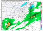
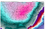
Yeah, ends up with sleet/freezing rain.Canadian has it. Caught in between with a weird look. Let’s go ahead and split the difference and lock it in View attachment 163146


Cary_Snow95
Member
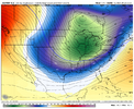
The Canadian & Icon are currently locked into the energy dropping further West. The GFS & Euro are further East.Canadian has it. Caught in between with a weird look. Let’s go ahead and split the difference and lock it in View attachment 163146
GeorgiaGirl
Member
Canadian has it. Caught in between with a weird look. Let’s go ahead and split the difference and lock it in View attachment 163146
Yep, in a perfect world, you want to hold this GFS look for a couple days, then trend it north some.
I'd definitely be more concerned about more ridging, but I don't think the long term CMC handled the last system well (RGEM sure did though).
belowfreezing
Member
I'm glad the storm signal is still there. Should be interested to see if the coastal bombs continue showing up.
Agreed. WAR rearing it’s ugly head would be my biggest concern. Next on the list would be a late bloomer.Yep, in a perfect world, you want to hold this GFS look for a couple days, then trend it north some.
I'd definitely be more concerned about more ridging, but I don't think the long term CMC handled the last system well (RGEM sure did though).
- Joined
- Jan 5, 2017
- Messages
- 3,774
- Reaction score
- 5,985
Euro was best on the last system, followed by the GFS and then the UKMET. Canadian and ICON had odd solutions and threw in some wildly divergent patterns at times. FV3 did well for GA at the end.Yep, in a perfect world, you want to hold this GFS look for a couple days, then trend it north some.
I'd definitely be more concerned about more ridging, but I don't think the long term CMC handled the last system well (RGEM sure did though).
D
Deleted member 609
Guest
Looks great. Just need to do that for the next 35 model runs.
Cary_Snow95
Member
wow
Member
Good to see a similarity to yesterday's 12z Euro run.
Tokenfreak
Member
This looks like the perfect set up. Hopefully nothing changes and it stays that way or even gets better the next 35 model runs lolLooks great. Just need to do that for the next 35 model runs.
Cary_Snow95
Member
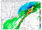
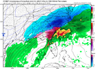
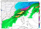
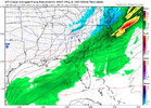
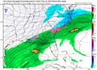
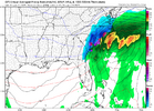
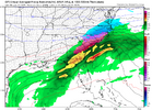
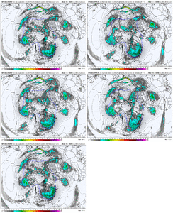
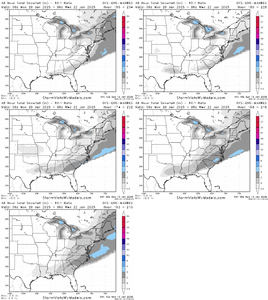
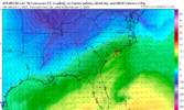
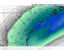
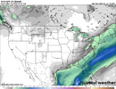
Continued:Here’s what I’ve found for runs that have shown this major overrunning around 01/22
Euro 12z 01/11
View attachment 163151
Euro 00z 01/12
View attachment 163149
Euro 12z 1/12
View attachment 163150
GFS 12z 01/10
View attachment 163152
GFS 18z 01/10
View attachment 163153
GFS 0z 01/11
View attachment 163155
GFS 06z 01/11
View attachment 163156
GFS 12z 01/11
View attachment 163157
GFS 06z 01/12
View attachment 163158
GFS 12z 1/12
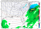
GFS 18z 01/12
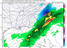
GFS 00z 01/13
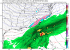
GFS 06z 1/13
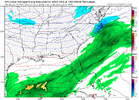
GFS 12z 1/13

This is the biggest storm signal we’ve had this far out in recent memory. This is big time model honking
Yes it would have as depicted for us up here. It was a model run an yes I get you live in central SC. Dont sweat its highly likely not gonna happen. I'll take bothNow THAT is cooking! sorry for the one liner. But the ICON scenario wouldn't work.
I am not sweating it. Just showing what would work & wouldn't work IMO for the majority on here. Even up towards your neck of the woods, it wouldn't be one of the better set ups. I am mainly saying it because what the ICON & CMC are showing are fail modes in this pattern for many on here.Yes it would have as depicted for us up here. It was a model run an yes I get you live in central SC. Dont sweat its highly likely not gonna happen. I'll take both
Ukmet was a miss on early Mon, like Icon.
But, like the Icon at 5H looks like it could have more coming mid week perhaps.
But, like the Icon at 5H looks like it could have more coming mid week perhaps.
GEFS looks to have two threats. Day 8-9 and then one just after.
- Joined
- Jan 23, 2021
- Messages
- 4,602
- Reaction score
- 15,197
- Location
- Lebanon Township, Durham County NC
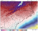
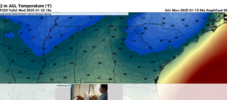
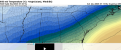
Afternoon highs below freezing down to the Florida panhandle
I just can't see these temps verifying for 1pm ET next Tues afternoon. Maybe if it is overcast with snowing
No talk of the euro 12z monster snow print.
Cold and dry. The big risk for the 18-23rd period.
Cold and dry. The big risk for the 18-23rd period.
Sounds like you're making a forecast if not at least a 'call'No talk of the euro 12z monster snow print.
Cold and dry. The big risk for the 18-23rd period.
aka the first two required ingredients in any winter storm. Great place to start.No talk of the euro 12z monster snow print.
Cold and dry. The big risk for the 18-23rd period.
Its too easy to dash the "wishcasting" of southern snow weenies and it borders on trolling even if backed by facts. I always consider people's location to understand their particular bias and a southern snow usually doesn't benefit a guy wanting snow in Southern Illinois.Sounds like you're making a forecast if not at least a 'call'
SnowNiner
Member
No talk of the euro 12z monster snow print.
Cold and dry. The big risk for the 18-23rd period.
Yeah, to me both the EPS and the GEFS are pretty suppressed at the moment. That's a possibility. I wouldn't be surprised to see the SE ridge and WAR flex more but we'll see.
Agreed, for a threat after the 23rd when the cold relaxesaka the first two required ingredients in any winter storm. Great place to start.
John1122
Member
I don't know that it will be the same or not, but looking back when the just passed cold shot was coming into view the Euro/GFS was nothing but suppression/OTS for a while. It was a cold desert. That obviously didn't come to pass. It was quite a bit warmer than modeled, and way wetter in the end.
rburrel2
Member
Well said. I say this as someone who’s lived in the Carolinas my whole life and have followed too many winter storms to worry about suppression a week or more out. Can suppression happen? Of course it can, but at this point you gotta play the odds and just know that it’s not what typically happensI don't know that it will be the same or not, but looking back when the just passed cold shot was coming into view the Euro/GFS was nothing but suppression/OTS for a while. It was a cold desert. That obviously didn't come to pass. It was quite a bit warmer than modeled, and way wetter in the end.
beanskip
Member
Yeah, there is no better computer model parlay than Euro with a big hit and GFS with the low over Cuba.That was the GFS in 2010..the EURO was pretty lock step with a Central Gulf to Central Florida trajectory... Kind of made it a lot easier for me back then to call that event when even it was over a week out with no workable analogs on such a highly anomalous -AO/-NAO pattern.
rburrel2
Member
Pops
Member
One thing bout it icon and Canadian look almost identical..maybe wrong but identical
The Icon and Ukmet, look like they could have produced a good hit middle next week. They don't go out far enough. We will find out at 0z tonight, 12z tomorrowOne thing bout it icon and Canadian look almost identical..maybe wrong but identical

