-
Hello, please take a minute to check out our awesome content, contributed by the wonderful members of our community. We hope you'll add your own thoughts and opinions by making a free account!
You are using an out of date browser. It may not display this or other websites correctly.
You should upgrade or use an alternative browser.
You should upgrade or use an alternative browser.
Wintry January 21-23 2025
- Thread starter SD
- Start date
I'm not worried about suppression for the 18-23rd period. The overarching look has a broad longwave trough over Canada with energy entering the Pacific Northwest down the Montana, Idaho stovepipe. That's great at this range, even if we lost the crazy Euro operational run. We can root for more digging later and iron out phasing issues.My thoughts remain the same. This Arctic blast looks stronger than the last. There absolutely is a concern for Arctic air suppressing the storm too far south for many in the SE. Seen it many times before.
Best bet would be to wait for the cold air to relax and get a storm that runs into all the cold air.
But if you want those big fantasy storms spit out by yesterdays euro… you better hope models start trending back NW soon.
However, there are three things I will watch for because we're still at a range where the pattern could trend worse.
1. -NAO that will help suppress the Southeast Ridge (this has been trending better)
2. Eastward movement of western ridge (This ruined our last setup)
3. Westward movement of the western ridge where waves cut (look a few days ago)
The Arctic blast is probably overmodelled, but I don't think the magnitude of the air mass hurts us.
- Joined
- Jan 23, 2021
- Messages
- 4,602
- Reaction score
- 15,197
- Location
- Lebanon Township, Durham County NC
Literally starting to snow in NC by 177. At the very minimum, it's sleeting and transitioning to snow.Too much cooking. It cooked up a stew of rain for NC
SnowNiner
Member
No -NAO can tend to enhance ridges I'd think but that's more of a guess than confirmation. I'm basing that off a lack of northern ridging so it's a valid concern if true. However, if I'm not mistaken, the SER doesn't always trend stronger and tends to be neutral to weaker towards verification if anything. That being said I've seen it swing stronger at times too. Need to monitor how the ensembles handle it.
My fear/suspicion is the western ridge either tucks more, or is more west than shown and the cold centers further west than ideal. That's what it was just a few days ago. The SE ridge flexes a bit because everything is west. We perhaps start trending toward an ice event through CAD. I don't really buy in to the arctic tundra in the carolinas at this point, but I could be wrong. We'll see. Wednesday of next week seems like forever away.
Yeah, if there is a 1034 HP over NY building in then we get a better winter precip. performance than modeled. LP would have to be really amped up to warm us up.Literally starting to snow in NC by 177. At the very minimum, it's sleeting and transitioning to snow.
The European doesn't even get good 850s in here until 180 and 2m Ts until 6 hours later. And we're sweating Ptypes on the ICON?
I think we need to line up on what we're looking at here.
Anything on the front end of the cold blast is going to be rain or mixey (rain to ice/snow) in NC. That's the way this used to work when you had an arctic front moving in, and I'm assuming that hasn't changed.
Let's not worry too much about the 180 ICON Ptype map. It looks like a good pattern shaping up. That seems positive to me.
Hate to keep bringing it up but for our Christmas big dog in 2010 we had the low literally in Cuba for several days on the models. Ever since I’ve been fine with suppression unless we are inside 72hrs
Yeah, agree I don’t necessarily think the 21st is the window…the window is larger.The European doesn't even get good 850s in here until 180 and 2m Ts until 6 hours later. And we're sweating Ptypes on the ICON?
I think we need to line up on what we're looking at here.
Anything on the front end of the cold blast is going to be rain or mixey (rain to ice/snow) in NC. That's the way this used to work when you had an arctic front moving in, and I'm assuming that hasn't changed.
Let's not worry too much about the 180 ICON Ptype map. It looks like a good pattern shaping up. That seems positive to me.
Icon is what happens when that boundary stalls on the wrong side of the mountains. We are caught between suppression and a mid south mauler. A lot to figure out here. Volatile setup
Blue_Ridge_Escarpment
Member
Yes. Could be a two or even three part hit for southeast as ripe as this pattern is.Yeah, agree I don’t necessarily think the 21st is the window…the window is larger.
rburrel2
Member
We need the cold press of the euro/GFS but the shortwave out west like the icon shows... That's how you get the 20 inch Euro run.Icon is what happens when that boundary stalls on the wrong side of the mountains. We are caught between suppression and a mid south mauler. A lot to figure out here. Volatile setup
But verbatim, the icon was going to be a significant ice to snow event all the way down in to Georgia.
SnowNiner
Member
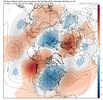
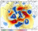
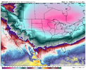
Can see why ICON doing what it’s doing. No way it’s beating the EPS day 7-8 hemispheric pattern.
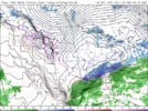
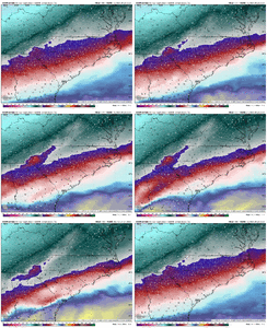
View attachment 163131View attachment 163132
Yeah even the EPS, it just looks like the ridges (atl and pacific) just want to positive tilt and tuck the trough/cold out west. WAR has conditions we've seen for the last 10 years constantly. Will be different than this last storm. I think it'll hurt us for storm track but we back into a CAD storm Miller B. I'll shut up and see what happens.
packfan98
Moderator
Yeah, the first round looks to be cold chasing moisture for those east of the mountains. The next round or two holds more promise. However, it would be great to score while a cold air mass is coming in. High pressure funneling in the cold air is the ticket!The European doesn't even get good 850s in here until 180 and 2m Ts until 6 hours later. And we're sweating Ptypes on the ICON?
I think we need to line up on what we're looking at here.
Anything on the front end of the cold blast is going to be rain or mixey (rain to ice/snow) in NC. That's the way this used to work when you had an arctic front moving in, and I'm assuming that hasn't changed.
Let's not worry too much about the 180 ICON Ptype map. It looks like a good pattern shaping up. That seems positive to me.
Those looks to me much more like an overrunning setup than a Miller B setup. We need the Atlantic ridge to push back some in order to keep the baroclinic zone near/along the coast. The overall trajectories will be from the SW, which will provide an avenue for waves of LP to track NE along the boundary. If the SE ridge slides too far east, you get suppression.Yeah even the EPS, it just looks like the ridges (atl and pacific) just want to positive tilt and tuck the trough/cold out west. WAR has conditions we've seen for the last 10 years constantly. Will be different than this last storm. I think it'll hurt us for storm track but we back into a CAD storm Miller B. I'll shut up and see what happens.
It's a delicate setup, but it could pay huge dividends.
I agree. That’s 1034mb high sitting over snowpack with a fresh supply of Arctic air. The CAD would be much stronger than what the ICON is showing… possibly pushing the below freezing line deep into GA and close to the Carolina coastNa thats frozen and more to come up here with that look.
Thats Act 1, Sun night late into Monday. A BONUS.
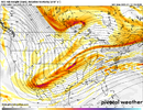
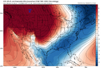
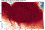
Be more on its heels with this h5 look it has after hr 180
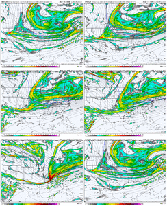
View attachment 163133
I'm far more concerned about losing this NW or to a SW cutoff than I am suppression.
Agreed…That’s a massive Atlantic ridge being modeled.I'm far more concerned about losing this NW or to a SW cutoff than I am suppression.
SnowNiner
Member
Yeh I don't know how anyone East of the Apps can say the ICON is cooking. It's basically showing what we don't need to happen unless we get a second wave behind it after cold settles in.
ForsythSnow
Moderator
Base modeling has changed a lot in 14 years, and to me factoring model trends in over 5 years just isn't as reasonable unless the setup trends over a week are near identical.Hate to keep bringing it up but for our Christmas big dog in 2010 we had the low literally in Cuba for several days on the models. Ever since I’ve been fine with suppression unless we are inside 72hrs
Stormsfury
Member
That was the GFS in 2010..the EURO was pretty lock step with a Central Gulf to Central Florida trajectory... Kind of made it a lot easier for me back then to call that event when even it was over a week out with no workable analogs on such a highly anomalous -AO/-NAO pattern.Hate to keep bringing it up but for our Christmas big dog in 2010 we had the low literally in Cuba for several days on the models. Ever since I’ve been fine with suppression unless we are inside 72hrs
pretty good run here so far. WAR remains offshore. Now we need to clear this first wave and allow this high pressure to build east then pray for the moisture. Strong high pressure building in here. Cold
packfan98
Moderator
Tsappfrog20
Member
Now the gfs is cooking up something let’s go!!
Sent from my iPhone using Tapatalk
Sent from my iPhone using Tapatalk
It’s a great look. That cold is locked in man. Shades of the Euro yesterday
belowfreezing
Member
Wow Gfs looks solid!
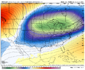
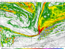
Now THAT is cooking! sorry for the one liner. But the ICON scenario wouldn't work.GFS Cooking...
View attachment 163138
packfan98
Moderator
NBAcentel
Member
packfan98
Moderator
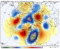
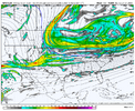
That’s what I was thinking, but taking on more of that overrunning look. Fine line between greatness and nada. But when isn’t it for the good ones?Trough axis is slightly more positive than I would want it, but eastern folks do well.
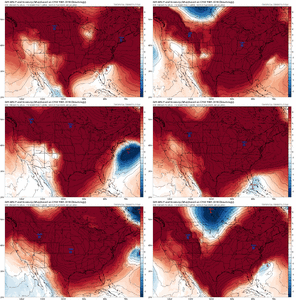
View attachment 163140
not every big coastal is a straight up dec 23 1989 comp but this is as close as you'll see to dec 23 1989 on the goofus
Southern Track
Member
The GEFS suite should be interesting.

