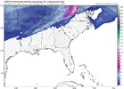
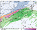
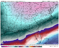
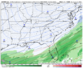
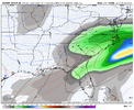
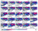
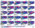
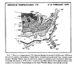
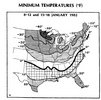
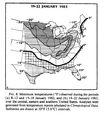
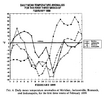
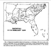
Don't worry it ends on 2/1You know I wouldn’t mind one 70 degree day. But at this rate it’s not gonna happen this January View attachment 163064
-
Hello, please take a minute to check out our awesome content, contributed by the wonderful members of our community. We hope you'll add your own thoughts and opinions by making a free account!
You are using an out of date browser. It may not display this or other websites correctly.
You should upgrade or use an alternative browser.
You should upgrade or use an alternative browser.
Wintry January 21-23 2025
- Thread starter SD
- Start date
Belle Lechat
Member
- Joined
- Aug 29, 2021
- Messages
- 1,529
- Reaction score
- 1,215
One thing to really consider. With the temps this week and next, a euro like storm would completely shut down the entire southeast for at least a week.
We will need to beat the crowds to grab milk and bread yall.
I'll take one for the team*. Why so much laughter? Is it the "Boy you got that right'" type? Because the jug drinking water was bought up well in advance of this last cold weather where I live.
Sincerely,
*Someone from the Gulf who has experienced rare frozen precipitation
Belle Lechat
Member
- Joined
- Aug 29, 2021
- Messages
- 1,529
- Reaction score
- 1,215
Don't worry it ends on 2/1
In Central Texas I assume as default February will be 30 90 30 90.
Forevertothee
Member
GSP
Next weekend period
LONG TERM /WEDNESDAY NIGHT THROUGH SUNDAY/...
As of 2:25 PM EST Sunday: the extended forecast picks up at 00z on
Thursday with the backside of a broad upper trof amplifying again
over the Great Lakes while steep upper ridging lingers over the
western CONUS. Over the next couple of days, the trof axis will
translate off the Atlantic Coast as the upper lvl pattern briefly
flattens over the Southeast. Over the weekend, another round of
very broad upper trofing will amplify over the central CONUS/Great
Lakes and likely cover much of the CONUS. At the sfc, broad high
pressure will be in place over the Southeast as the period begins
and is expected to linger thru the end of the work week. By late
Friday/early Saturday, most of the long-range guidance has another
low developing to our west and quickly bringing a broad area of
deeper moisture to the Carolinas over the weekend as the period
ends. This system will likely bring widespread precip to our CWA,
but the timing of the system is still fairly uncertain.
Sorry for the late response, he posted it on insta. Which he did talk more about the cold but he did show the p-type 12z euro soWhere at?
AJ1013
Member
Worried the SE Ridge will prevent the goodness from getting down to me 
I can't wait until February folds.Don't worry it ends on 2/1
I think February might be interesting at times with a lot of variability in temps. The conventional wisdom says that we should be very mild, however I remember the 1993-94 La Niña came on late like this one has and December and January were both below average with numerous Arctic intrusions and 4 different winter events in the Carolinas outside the mountains. A strong snow pack was put down all across the Midwest and Northeast and that lead to a lot of CAD, but the SER flexing out some warm days in there as well. When the ice/sleet storm that month hit the Carolinas, temperatures in CLT day before were well into the 70s in the mid afternoon and 24 hours later the were in the mid to upper 20s with ZR and heavy sleet.I can't wait until February folds.
Blue_Ridge_Escarpment
Member
00Z ICON looking primed up at the end of its run
Brent
Member
JLL1973
Member
Icon was probably headed for glory after the run was over
WolfpackHomer91
Member

Brad P already Honking in Charlotte. Normally that’s a solid sign, especially in his recent Conservative days. He’s right “Just Pattern favorability” but man, that’s a pretty look for sure
Sent from my iPhone using Tapatalk
Brent
Member
0z GFS big storm out at Frying Pan Shoals
for 9 days out gfs is perfectly fine. common sense says a 1052 mb high will not be over ohio
Brent
Member
John1122
Member
It, unfortunately, makes a lot more sense climatologically than a Cuba cutter bringing a winter storm to Florida.Yeah messy mid-south set up on the Canadian. Although it seemed to do the very worst on the most recent storm by a clear margin. So not sure I’m giving it much weight View attachment 163080
I'm hoping for some middle ground.
But I’d say this is a system on the CMC that runs the Arctic boundary as it is moving SE and bringing the cold air in. Anything of interest SE of the Apps would be a follow-up storm a few days laterIt, unfortunately, makes a lot more sense climatologically than a Cuba cutter bringing a winter storm to Florida.
I'm hoping for some middle ground.
accu35
Member

accu35
Member
Can’t expect a weenie run on every modelFigures
accu35
Member
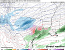
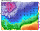
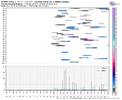
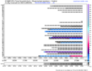
I’m perfectly fine with this at this rangeCold and dry on the 0z Euro. There was some energy flying around but the cold press is too deep and nothing really has a chance to dig. We will see about the EPS
View attachment 163084
View attachment 163085
Once the Euro figures out it can’t bring 0c 850’s 350miles into the Gulf of Mexico the storm will probably be back for someoneCold and dry on the 0z Euro. There was some energy flying around but the cold press is too deep and nothing really has a chance to dig. We will see about the EPS
View attachment 163084
View attachment 163085
packfan98
Moderator
It looked prime for areas to the West. It was following more of a CMC route. You could see the ridge flexing over the Southeast.00Z ICON looking primed up at the end of its run
Six Mile Wx
Member
This potential from the Euro AI looks more realistic. On Thursday Jan. 23 as the cold air press relaxes we get another Baja low phasing with energy in the northern stream and surface low pressure develops in the gulf crossing southern Georgia and into the Atlantic. Looks weak though
Not to disregard the potential on the 20th-21th but it’s in suppression city right now. Let’s bring it back!
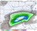
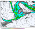
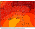
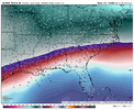
Not to disregard the potential on the 20th-21th but it’s in suppression city right now. Let’s bring it back!


Last edited:
Belle Lechat
Member
- Joined
- Aug 29, 2021
- Messages
- 1,529
- Reaction score
- 1,215
tennessee storm
Member
This strong of a artic frontal boundary pushing down. Going suppress everything down on the gulf and out to sea squash city
Cary_Snow95
Member
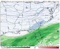
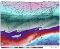
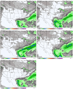
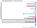
Are we sure this isn’t from the first system 1/19 to 1/21Not a fan (at least for us in the immediate Southeast) of how many members on the EPS showed a Winter storm cutting West. The mean reflected that increased also.
View attachment 163098View attachment 163099
I am not. That’s a good point for sure!Are we sure this isn’t from the first system 1/19 to 1/21
NBAcentel
Member
Yeah the second system of interest, with the more suppressed wave was more muted QPF wise this EPS run with more suppression for the day 8-9 deal. 06z GEFS however shows a lot of interesting solutionsAre we sure this isn’t from the first system 1/19 to 1/21
CNCsnwfan1210
Member
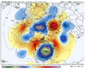
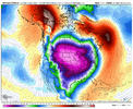
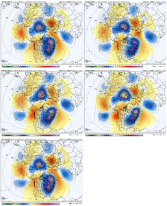
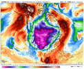
Geez, look at the AK ridge trending more polweward. And what a signal for an event for the 20th, give or take.
View attachment 163105View attachment 163106
Maybe a -NAO block trying to develop as well?
Sent from my iPhone using Tapatalk
- Joined
- Jan 23, 2021
- Messages
- 4,602
- Reaction score
- 15,197
- Location
- Lebanon Township, Durham County NC
NBAcentel
Member

