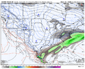
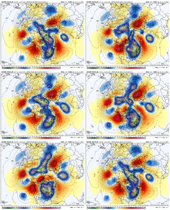
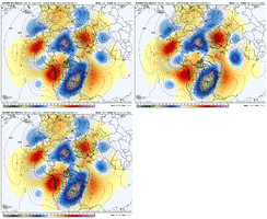
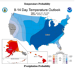
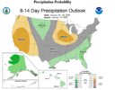
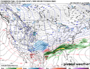
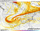
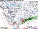
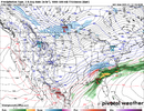
It's a good look. We don't want to see that western ridge roll over too much. Hopefully, that will not be the case.Geez, look at the AK ridge trending more polweward. And what a signal for an event for the 20th, give or take.
View attachment 163105View attachment 163106
-
Hello, please take a minute to check out our awesome content, contributed by the wonderful members of our community. We hope you'll add your own thoughts and opinions by making a free account!
You are using an out of date browser. It may not display this or other websites correctly.
You should upgrade or use an alternative browser.
You should upgrade or use an alternative browser.
Wintry January 21-23 2025
- Thread starter SD
- Start date
Why? You worried about suppression?It's a good look. We don't want to see that western ridge roll over too much. Hopefully, that will not be the case.
- Joined
- Jan 5, 2017
- Messages
- 3,774
- Reaction score
- 5,985
A lot of icy solutions showing up on the GEFS. I'm really fine if the baroclinic zone is to my NW on this one if that is the primary precipitation type.
rburrel2
Member
It seems like suppression is the main concern this morning. Most of the better guidance is cold and dry after day 6 storm.
Good news is there’s still some support on ensembles for a wave after that, and then you’ve got the icon, cmc, gfs graphcsst that are all still developing a big storm later on. Cmc and gfs graphcsst are actually too weak with the cold press and result in rain or ice.
Hopefully we can meet in the middle here. I’m skeptical that the cold press sends -10 850s to the gulf coast like the euro shows, especially with no Greenland blocking.
NCWeatherhound
Member
Yeah, I’m not in the least bit worried about suppression. This winter it’s wanting to snow and I expect something next week for the SE/MA/NE. I think Atlanta to Huntsville has more snow than Boston.It seems like suppression is the main concern this morning. Most of the better guidance is cold and dry after day 6 storm.
Good news is there’s still some support on ensembles for a wave after that, and then you’ve got the icon, cmc, gfs graphcsst that are all still developing a big storm later on. Cmc and gfs graphcsst are actually too weak with the cold press and result in rain or ice.
Hopefully we can meet in the middle here. I’m skeptical that the cold press sends -10 850s to the gulf coast like the euro shows, especially with no Greenland blocking.
SnowNiner
Member
Why? You worried about suppression?
I wouldn't want the ridge to tuck all the energy in the SW like it did with the last one.
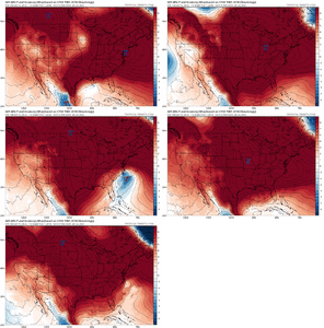
Generally, it seems too early to know what's going to happen next week. Cold will be centered in the middle of the conus, I think that's the consensus. But will it be cold enough in the carolinas, does the SE ridge flex? Will it be too cold in the carolinas, cold and dry trough too far east? Ridge placement out west, tilted, too far east? Honestly I'm not sure what to expect next week just from temps much less a storm. Ensembles look all over the place, but it's nice to see a few hits scattered about. Get to day 7 and see what ensembles show, but I agree the MLK storm probably is not for us.
Everything squashed
rburrel2
Member
Yea, and we saw a period with our last storm where ensembles lost it all together to suppression, and it wound up being too wet/amped/ and warm for 90% of us. Prob best to keep the look we have on ensembles for another couple days. I’m mainly concerned because the euro ai has been bone dry with nothing in the day 9/10 window. I’m very skeptical we can score anything on day 7/8 like what it’s showing now.Yeah, I’m not in the least bit worried about suppression. This winter it’s wanting to snow and I expect something next week for the SE/MA/NE. I think Atlanta to Huntsville has more snow than Boston.
Snowflowxxl
Member
Suppression is not a concern. The concern is temps. We know they will increase closer to verification.
Cary_Snow95
Member
That or we end up with a cutoff in Baja againWhy? You worried about suppression?
NBAcentel
Member
MichaelJ
Member
It is possible we get a storm later but right now, seems unlikely at best. Either the cold push will be too strong and force it off the coast by 2-300 miles S/E or the cold gets here after cutter goes by. People in TN and Ala have a little better shot but nothing I would put money on, but we are are talking about something over 10 days away (around the 25th) so we are just guessing at this point
- Joined
- Jan 23, 2021
- Messages
- 4,602
- Reaction score
- 15,197
- Location
- Lebanon Township, Durham County NC
0z AIFS actually had a sizeable storm for C and E NC
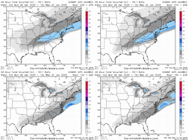
still a very strong signal for the coast with consistency. 4+ inch shading near columbus georgia is ludicrous
as we've seen, cold pushes can and do moderate closer to verification, don't mind a southward trend right now
Cary_Snow95
Member
Yeah everything still looks good overnight. I think some people were expecting the euro to continue showing 2 feet.. which just isn’t going to happen. Same general pattern is there
SnowNiner
Member
Suppression is not a concern. The concern is temps. We know they will increase closer to verification.
Especially since we have a SE ridge and WAR coming up, I'd agree this is likely to be the bigger issue to show itself in the next 4-5 days on modeling.
Yep. They're way over done, let's not forget we thought the last storm could have potentially been suppressed/i10 corridor type of snow way out.
The setup is different, but these air masses verify a good bit warmer.
The footprint is once again, a good bit north of I20, at least for snow
The setup is different, but these air masses verify a good bit warmer.
The footprint is once again, a good bit north of I20, at least for snow
- Joined
- Jan 23, 2021
- Messages
- 4,602
- Reaction score
- 15,197
- Location
- Lebanon Township, Durham County NC
That bit of ridging is the only thing keeping this from being a Lake Okeechobee threat
rburrel2
Member
JMB
Member
So you say “seems unlikely at best” to start your paragraph then finish it off with “we are just guessing at this point” hahahaha great analysis!It is possible we get a storm later but right now, seems unlikely at best. Either the cold push will be too strong and force it off the coast by 2-300 miles S/E or the cold gets here after cutter goes by. People in TN and Ala have a little better shot but nothing I would put money on, but we are are talking about something over 10 days away (around the 25th) so we are just guessing at this point
My thoughts remain the same. This Arctic blast looks stronger than the last. There absolutely is a concern for Arctic air suppressing the storm too far south for many in the SE. Seen it many times before.
Best bet would be to wait for the cold air to relax and get a storm that runs into all the cold air.
But if you want those big fantasy storms spit out by yesterdays euro… you better hope models start trending back NW soon.
Best bet would be to wait for the cold air to relax and get a storm that runs into all the cold air.
But if you want those big fantasy storms spit out by yesterdays euro… you better hope models start trending back NW soon.
Snowflowxxl
Member
Soon? This thing is over 200 hours out. We just saw with the previous storm that models were significantly overstating the cold press.My thoughts remain the same. This Arctic blast looks stronger than the last. There absolutely is a concern for Arctic air suppressing the storm too far south for many in the SE. Seen it many times before.
Best bet would be to wait for the cold air to relax and get a storm that runs into all the cold air.
But if you want those big fantasy storms spit out by yesterdays euro… you better hope models start trending back NW soon.
Soon? This thing is over 200 hours out. We just saw with the previous storm that models were significantly overstating the cold press.
Yeah, at one point the low was over the central GOM and precip didn’t even reach the coast.
At the very worst, at least we won’t see a cold rain with suppression.
For any threat around 18-23 yes soon.Soon? This thing is over 200 hours out. We just saw with the previous storm that models were significantly overstating the cold press.
I favor a threat more from the 23rd-27th when the cold relaxes some and storms can run into it.
ForsythSnow
Moderator
I'm wondering if like the prior blast and as some have mentioned, it trends weaker to some extent. Based on placement I'd think a couple adjustments could lead back to those runs unless we really see a strong deeper south PV shift.My thoughts remain the same. This Arctic blast looks stronger than the last. There absolutely is a concern for Arctic air suppressing the storm too far south for many in the SE. Seen it many times before.
Best bet would be to wait for the cold air to relax and get a storm that runs into all the cold air.
But if you want those big fantasy storms spit out by yesterdays euro… you better hope models start trending back NW soon.
Mahomeless
Member
I absolutely love this look. If everyone will remember the airmass modification, and resulting storm track shift, that occurred on the models with our last system at this timeframe. It was showing record breaking cold that eventually modified with no real cold push. While we are much closer in time with this system, I fully expect some modification of the airmass to occur on the models. That said, I expect there to be a pretty strong high pressure centered somewhere over the plains, stretching east and southeast into the Ohio Valley and into the Southeast. Everyone is in play here, so should be another 300 pager!
If the ridge rolls forward, you tend to see energy want to tuck back into the SW. No likey.Why? You worried about suppression?
Possible.. but we did just throw down a bunch of snow and ice cover across the US. That will certainly bend towards the colder category. But alas this is why we watch and wait.I'm wondering if like the prior blast and as some have mentioned, it trends weaker to some extent. Based on placement I'd think a couple adjustments could lead back to those runs unless we really see a strong deeper south PV shift.
Well, we know the EURO loves that look and will be the first one on top of that dreaded cutoff energy hanging back in the southwest. 12z may tell the tale.If the ridge rolls forward, you tend to see energy want to tuck back into the SW. No likey.
ForsythSnow
Moderator
No -NAO can tend to enhance ridges I'd think but that's more of a guess than confirmation. I'm basing that off a lack of northern ridging so it's a valid concern if true. However, if I'm not mistaken, the SER doesn't always trend stronger and tends to be neutral to weaker towards verification if anything. That being said I've seen it swing stronger at times too. Need to monitor how the ensembles handle it.If the ridge rolls forward, you tend to see energy want to tuck back into the SW. No likey.
Should come into better focus at 120 hr or so. Right now I would say the blast won't be as severe as modeled. Southeast Ridge hopefully will not be too strong to where it pushes any low too far inland and also the arctic airmass not too strong for suppression. It is a fine line.
MichaelJ
Member
Well at over 250 hours out, that is why I put in the caveat about all of us guessing but the odds do not favor it AT THIS TIME. There, is that better?So you say “seems unlikely at best” to start your paragraph then finish it off with “we are just guessing at this point” hahahaha great analysis!
- Joined
- Jan 5, 2017
- Messages
- 3,774
- Reaction score
- 5,985
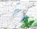
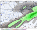
that looks good for TX, AR, N. MS, TN and VA.
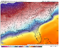
Nice 1034 over the top. Way to start the cycle off today

