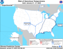
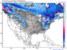
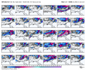
Looks cold and dry. For southern Illinois
-
Hello, please take a minute to check out our awesome content, contributed by the wonderful members of our community. We hope you'll add your own thoughts and opinions by making a free account!
You are using an out of date browser. It may not display this or other websites correctly.
You should upgrade or use an alternative browser.
You should upgrade or use an alternative browser.
Wintry January 21-23 2025
- Thread starter SD
- Start date
ITUSETOSNOW
Member
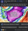
Just curious, why do you think this? The dreaded sun angle is still low.I just can't see these temps verifying for 1pm ET next Tues afternoon. Maybe if it is overcast with snowing
Cad Wedge NC
Member
Wow, you don't see that every day.... looks like it's legit this time.
And that’s why I fear this time it may actually lead to suppression city.Wow, you don't see that every day.... looks like it's legit this time.
Twister
Member
Maybe it will moderate and RainAnd that’s why I fear this time it may actually lead to suppression city.
I'm not indicating it will not be cold, but those afternoon highs looked extreme given we've seen these arctic outbreaks moderate as we get closer. It's going be darn cold for sure though looks likeJust curious, why do you think this? The dreaded sun angle is still low.
Last edited:
Think we need to just stay patient here and get the cold boundary to the Gulf and SE coast and see what we can do from there. Early week favors the mid-south. Better chance mid-late week SE of the Apps.
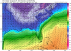
Better for the cold to be stretched out west to east as much as possible and look like a bean bag instead of like a jelly bean. Hard to complain when the conus has the coldest anomalies across the entire Northern Hemisphere.
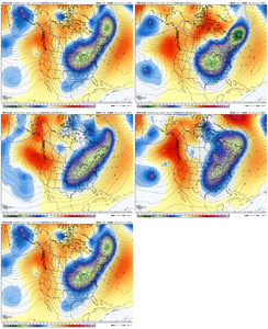
20 run trend loops on the GEFS here:


Better for the cold to be stretched out west to east as much as possible and look like a bean bag instead of like a jelly bean. Hard to complain when the conus has the coldest anomalies across the entire Northern Hemisphere.
20 run trend loops on the GEFS here:


iGRXY
Member
Worrying about suppression 8-10 days away is ludicrous. 1. The Airmass will moderate some the closer we get to verification. It always does. This past week should've been a stiff reminder that having the cold airmass will always be the number 1 ingredient. Worry about the moisture later. Especially when it comes to overrunning because it almost always trends more NW in the final 24-48 hours.
tennessee storm
Member
That’s one true cold air mass modeled coming down. True Siberia air , just going squash systems to Cuba .Worrying about suppression 8-10 days away is ludicrous. 1. The Airmass will moderate some the closer we get to verification. It always does. This past week should've been a stiff reminder that having the cold airmass will always be the number 1 ingredient. Worry about the moisture later. Especially when it comes to overrunning because it almost always trends more NW in the final 24-48 hours.
It will initially. Let's see if that kind of press will last 5-7 daysThat’s one true cold air mass modeled coming down. True Siberia air , just going squash systems to Cuba .
There are going to be different wants and needs based on your location. Yeah, Tennessee and NW of there would be very much worried about suppression, they need more of an inland runner. Many of those outside (south and east) of the mountains want the storm just off the coast, which at this lead would probably be suppression on the models.
Cary_Snow95
Member
The vort maps from the euro yesterday and today are not drastically different. Especially this far out at day 9
packfan98
Moderator
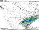
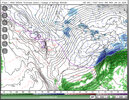
GFS run has a darn good look overall for those SE of the Apps with some snow for @Stormsfury and the coastal crew
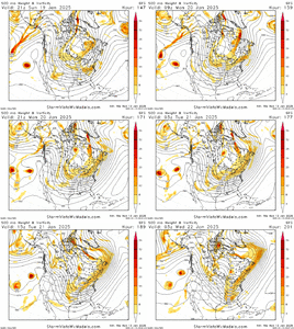
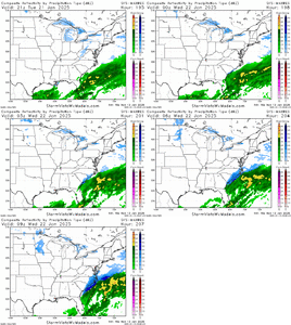


If the long wave pattern can setup basically as depicted by the Euro and GFS, all it is going to take is one of those shortwaves to sharpen up. I do think eastern portions of this board are favored in this setup as currently depicted.GFS run has a darn good look overall for those SE of the Apps with some snow for @Stormsfury and the coastal crew
View attachment 163190
View attachment 163191
Very much so. Just depends if something can break into TVP.GFS run has a darn good look overall for those SE of the Apps with some snow for @Stormsfury and the coastal crew
View attachment 163190
View attachment 163191
SWVA hopefully gets in on the action. We need a big snow storm. Used to get them all the time now it's just these mixed events or light snow events.
Stormsfury
Member
That is about as close to a Dec 1989 type setup as it can get on this cycle. (Although, honestly, the 12z cycle from today was more generous to more including this region).GFS run has a darn good look overall for those SE of the Apps with some snow for @Stormsfury and the coastal crew
View attachment 163190
View attachment 163191
The thing I like too is the split upper jets. We're probably not going to get 500mb waviness in the southern stream, but as the Pac Jet extends out to Hawaii, the end result is split upper jets, with the northern branch going into AK, and the southern branch becoming active in the eastern Pacific (shown here on the GFS run, but this is not just a GFS thing). And as you say, all you need is for a wave to sharpen a bit and the upper jet across the south is going to flex a bit north putting the SE in the right entrance region of the jet for enhanced upward motionIf the long wave pattern can setup basically as depicted by the Euro and GFS, all it is going to take is one of those shortwaves to sharpen up. I do think eastern portions of this board are favored in this setup as currently depicted.


Hoover vacuum type UL jet setting up shop over the North Atlantic in the Gulf of Maine up through the Bay of Fundy. Going to be interesting to see if we can get a dual jet structure over the SE or MA as we get closer to verification.
Exactly. This is why we’re seeing explosive precipitation development with a relatively weak surface low (the right entrance region being positioned over the southeast with rising motion from an offshore low near a strong area of baroclincity).The thing I like too is the split upper jets. We're probably not going to get 500mb waviness in the southern stream, but as the Pac Jet extends out to Hawaii, the end result is split upper jets, with the northern branch going into AK, and the southern branch becoming active in the eastern Pacific (shown here on the GFS run, but this is not just a GFS thing). And as you say, all you need is for a wave to sharpen a bit and the upper jet across the south is going to flex a bit north putting the SE in the right entrance region of the jet for enhanced upward motion


rburrel2
Member
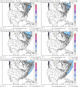
Well the 18z GEFS really turned things around for the day 9 threat, I'd say close to half of the members are hits of some kind. I'm starting to have hope again.
iGRXY
Member
No offense but so has every single Arctic outbreak that has ever been modeled. Doesn’t mean they didn’t moderateThat’s one true cold air mass modeled coming down. True Siberia air , just going squash systems to Cuba .
Forevertothee
Member
Care to post?Well the 18z GEFS really turned things around for the day 9 threat, I'd say close to half of the members are hits of some kind. I'm starting to have hope again.
SnowNiner
Member
That's certainly better than the last few runs for sure, thanks! Based on that, and the last several op runs, I think the GFS is focusing on a late blooming coastal right now. Probably coastal and maybe Raleigh areas is my guess. Maybe they actually do get a 2000 redux?
Shaggy
Member
Amd where some of us need it to stay. Overall.pattern seems ripe for some more shenanigans18z GFS is right where most of us should want it at this point.
View attachment 163189
Seems like we may take 2 shots at something in this period the first is 20/21 the 2nd is 24/25
Stormsfury
Member
Crazy consistent storm signal ... especially from the GEFS..
CNCsnwfan1210
Member

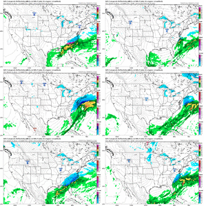
I guess the main takeaway from the CMC ens is that majority of the members (including the deterministic and control) have a gulf coast wave, to amp or not to amp TBD. This would be at the beginning stages of the Arctic outbreak, so take it FWIW.
Sent from my iPhone using Tapatalk
Avalanche
Member
Ok. We need something to trail that then.
I guess the main takeaway from the CMC ens is that majority of the members (including the deterministic and control) have a gulf coast wave, to amp or not to amp TBD. This would be at the beginning stages of the Arctic outbreak, so take it FWIW.
Sent from my iPhone using Tapatalk
packfan98
Moderator

