it's feeling like 1989
-
Hello, please take a minute to check out our awesome content, contributed by the wonderful members of our community. We hope you'll add your own thoughts and opinions by making a free account!
You are using an out of date browser. It may not display this or other websites correctly.
You should upgrade or use an alternative browser.
You should upgrade or use an alternative browser.
Wintry January 21-23 2025
- Thread starter SD
- Start date
Stormsfury
Member
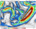
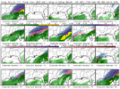
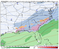
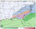
I thought the 12z run earlier today was about as close to Dec 1989. This run is like a mix of 1989 with a 1973 track (only further south)it's feeling like 1989
Raleighwxauthority
Member
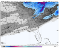
Hey ya'll! I know we are pretty far out from this system but my first call snowfall map for Raleigh forecasts 12-18 inches to fall. Stay tuned!
-TA
-TA
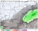
Baton Rouge getting up to 3 inches with a round 2 of snow flurries a couple days later! What's not to love?
I actually think there was a 18z GEFS member with this exact result.
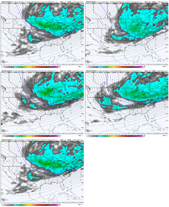
Gfs. Through NC lense. Whole SE gets hit Round 2 @3
ROUND 1 Sun
Round 2 Tues
Round 3 Fri
ROUND 1 Sun
Round 2 Tues
Round 3 Fri
Dear Lord at the ICE storm Augusta up through all of SC on top of a foot of snow. What a fantasy Run.
yeah there's been a few different looks at 500 mb thrown but when i think of 1989 i think of super offshore low, mega high (1050+) crawling through the plains and overrunning right on the coast and this is consistently checking those boxes. kind of interesting btw that theres been a few looks at 500 mb ultimately arriving at the same resultI thought the 12z run earlier today was about as close to Dec 1989. This run is like a mix of 1989 with a 1973 track (only further south)
Over an inch of frzng rain on that foot of snow. Can you imagine. Ugh
2 inches of frzng rain on Mets palace with rd 3. Like some arsonist is running the 0z GFS
2 inches of frzng rain on Mets palace with rd 3. Like some arsonist is running the 0z GFS
Blue_Ridge_Escarpment
Member
Canadian was going to go for it as well for round 3 at the end of its run.
Stormsfury
Member
The crude TT maps warmed up to the mid/upper 30s in the Lowcountry on Friday after starting out as a mix/ice. But damn what an insane runOver an inch of frzng rain on that foot of snow. Can you imagine. Ugh
2 inches of frzng rain on Mets palace with rd 3. Like some arsonist is running the 0z GFS
Actually a rd 4 on Sat for your area up to Morehead. That would be 4 hits from This coming Sun to the following Sat. 6 day span.The crude TT maps warmed up to the mid/upper 30s in the Lowcountry on Friday after starting out as a mix/ice. But damn what an insane run
Stormsfury
Member
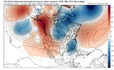
What grabbed my full attention is that the GFS has seemingly locked itself into this solution even with subtle variances in s/w at 500mb. (This run with the Baja Low, and a s/w up an Alberta)... it sharpened the Eastern Trough and is creating a screaming jet at the upper levels inducing strong lift.yeah there's been a few different looks at 500 mb thrown but when i think of 1989 i think of super offshore low, mega high (1050+) crawling through the plains and overrunning right on the coast and this is consistently checking those boxes. kind of interesting btw that theres been a few looks at 500 mb ultimately arriving at the same result
GFS cranking out the good stuff like old times!
That was the 1st time ive seen a baja pop up at h5 like gfs just did. And when it finally started crawling out, the orientation of stalled front, with chunks of ns coming down was a dream.
Interested to see if that SW vort keeps popping up. It was a little beast out there early on. Like 3 contours closed off
Interested to see if that SW vort keeps popping up. It was a little beast out there early on. Like 3 contours closed off
Stormsfury
Member
Shut the front door...Actually a rd 4 on Sat for your area up to Morehead. That would be 4 hits from This coming Sun to the following Sat. 6 day span.
A sneaky trailing s/w along a boundary inducing a little leftover action.
Stormsfury
Member
Yeah. When it first popped up, I was like uh oh.. but the 500mb wavelength didn't support a rollover bogdown. Crazy to see all the random s/w pop up and still didn't really change the outcome if the previous couple runs in the Coastal Plain. Is the GFS trying to lock down this event?That was the 1st time ive seen a baja pop up at h5 like gfs just did. And when it finally started crawling out, the orientation of stalled front, with chunks of ns coming down was a dream.
Interested to see if that SW vort keeps popping up. It was a little beast out there early on. Like 3 contours closed off
Blue_Ridge_Escarpment
Member
Relying on the SER/WAR to be as modeled or weaker sure is risky business.
RollTide18
Member
Looks like a better pattern for us along and south of US 80, at least the cold appears to be there, just got to time up the moisture right
NBAcentel
Member
albertwilsonjr
Member
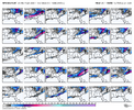
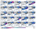
Can someone post the gefs ens when they are ready
Sent from my iPhone using Tapatalk
Sent from my iPhone using Tapatalk
Just at first glance it appears the CMC ejects the Baja wave faster causing an early phase and pumps the WAR. This scenario puts areas west in play. Rainy for the Carolinas. The GFS lets the Baja cutoff hang back which allows a clean push of the Arctic boundary. Baja ejects later. This is what we want. Multiple chances with this scenario
Stormsfury
Member
Those Canadians with their progressive nature...Just at first glance it appears the CMC ejects the Baja wave faster causing an early phase and pumps the WAR. This scenario puts areas west in play. Rainy for the Carolina’s. The GFS lets the Baja cutoff hang back which allows a clean push of the Arctic boundary. Baja ejects later. This is what we want. Multiple chances with this scenario
Almost seemed like to me that the Baja Feature made absolutely no attempt to detach for a short time like the GFS did. In fact the GFS detachment hung back and waited for the next s/w to round the base while the GEM never detached that piece, just slung it east a whole 24 to 36 hours quicker...
NBAcentel
Member
CNCsnwfan1210
Member
GFS op was showing temps in the teens in eastern NC while snowing. The 12z run did that and also the earlier runs of the Euro had that as well.
Sent from my iPhone using Tapatalk
Downeastnc
Member
GFS op was showing temps in the teens in eastern NC while snowing. The 12z run did that and also the earlier runs of the Euro had that as well.
Sent from my iPhone using Tapatalk
Mar 1980 had snow in the teens here....outside of that the closest I can remember was maybe Jan 2018 towards the end I know it was low 20's and snowing at least.
I'd say the GFS / GEFS are the least of our worries right now. Would like to get some other model support to join in.
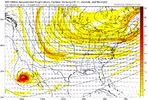
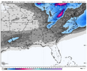
Euro is coming in cold and suppressed thru Tuesday, but on the 500mb trend loop here, I like the way it is "widen-ing" out the cold across the conus. Just need a wave to make its way around the track from Idaho to NMexico into the SE
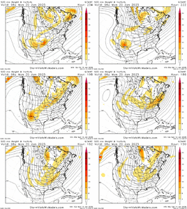
Euro is coming in cold and suppressed thru Tuesday, but on the 500mb trend loop here, I like the way it is "widen-ing" out the cold across the conus. Just need a wave to make its way around the track from Idaho to NMexico into the SE

NBAcentel
Member
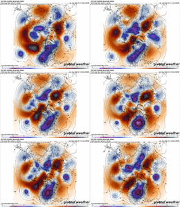
Euro is just to strung out, but I like the trough getting “fatter”
Per say. Sorta starting to see some signs of lowering heights trailing the big vortex which always open the chances of successful digging energy
Per say. Sorta starting to see some signs of lowering heights trailing the big vortex which always open the chances of successful digging energy
Yes, some trending in recent Euro runs of widening / fattening (are those words?) of the cold plunge along with more ridging into GreenlandEuro is just to strung out, but I like the trough getting “fatter”
Per say. Sorta starting to see some signs of lowering heights trailing the big vortex which always open the chances of successful digging energy
NBAcentel
Member
NBAcentel
Member
I may be wrong here but it’s not far off from the look of that second storm setup in January 2022, dealing with a digging energy in similar areas just like that one and a deep cold airmassYes, some trending in recent Euro runs of widening / fattening (are those words?) of the cold plunge along with more ridging into Greenland
View attachment 163235

