.NEAR TERM /THROUGH TONIGHT/...
-- Changed Discussion --
As of 1125 AM EST Tuesday:
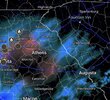
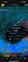
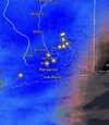
Radar returns are showing very light
snow in the upper levels across the Upstate. With the drier air
still in place, much of the snow is evaporating before it
reaches the ground. Over the next few hours, could see snow
bands setting up well south of I-85. Current mesoanalysis shows
a tight
gradient and modest
frontogenesis occurring just outside
the
CWA at the SC/
NC line. This could help uptick snow totals
as heavier bands setup later today, but again, right on the
fringe of our
CWA. Confidence in this system is low to medium as
small
mesoscale features will influence whether or not the area
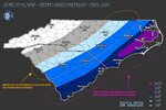
along and south of I-85 sees snow on the ground. At most, still
expecting up to an inch total.
Otherwise, the gulf low which we`ve been monitoring for several days
now still has the potential to produce some snow showers across our
southeastern zones this afternoon and tonight. More of the latest near-
term guidance now depicts a bit more
QPF along and south of the I-85
corridor. The best forcing and
moisture remains at mid and upper lvls,
while low levels remain dry. Mid-level
isentropic lift will spread NE
across the region this afternoon, but with such a dry and deep sub-
cloud layer, much of what falls from the mid-level clouds will
likely
be lost to
evaporation. Nonetheless,
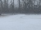
snow flurries are probable this
aftn/evening as this lift strengthens, and it`s looking like we may
see some accumulating snow along and south of I-85. After consulting
with our neighboring
fcst offices, we decided to go ahead and issue
a Winter
Wx Advisory for snow, that runs from 4 pm today until 9 am
Wed morning. This was largely driven by the potential impacts on roads.
With the cold air in place, any accumulating snow may cause significant
impacts on roadways. Temperatures, meanwhile, will continue to be well-
below
normal thru the period, barely getting above 32 degrees over much
of the
fcst area today.
-- End Changed Discussion --

