-
Hello, please take a minute to check out our awesome content, contributed by the wonderful members of our community. We hope you'll add your own thoughts and opinions by making a free account!
You are using an out of date browser. It may not display this or other websites correctly.
You should upgrade or use an alternative browser.
You should upgrade or use an alternative browser.
Wintry January 21-23 2025
- Thread starter SD
- Start date
SimeonNC
Member
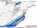
For any CLT folk interested
WxBlue
Meteorologist
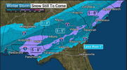
RAP and HRRR are epic for coastal Lowcountry GA/SC into OBX. Easily 6-10" region.
Tokenfreak
Member
I wonder how accurate these models have been though in past scenaros? 6-10" would be the most I think this areas has had since 1989 or 1973 maybe?RAP and HRRR are epic for coastal Lowcountry GA/SC into OBX. Easily 6-10" region.
NCWeatherhound
Member
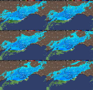
scrolling through TikTok live and there’s an ungodly amount of snow piling up along US-10 in Louisiana.
Tsappfrog20
Member
View attachment 166321
Current look at the Dendritic Layer RH
Man that looks like it’s going to set right up over the triangle later tonight
Sent from my iPhone using Tapatalk
I will say I'm getting reports from areas closer to the coast of up to 6 inches so far with some of the heavier banding. I'm on the northern drier zone of the precip, so accumulations near here have been lighter.
Savannah's modern record is 3.6, supposedly there were 18 inches in 1800I wonder how accurate these models have been though in past scenaros? 6-10" would be the most I think this areas has had since 1989 or 1973 maybe?
Belle Lechat
Member
- Joined
- Aug 29, 2021
- Messages
- 1,529
- Reaction score
- 1,215
rusrius
Member
Is CAE playing uno instead of forecasting Winter weather? I mean an inch or less? Lol
Double that I'd say.
Downeastnc
Member
Need it to find a way to go boom off the Carolina coast a hundred miles closer....it does certainly have that feel to it, old school where you watched TWC to see what was happening downstream.This storm is just like the good ol days when we didn’t have a clue what a storm would actually do until the very last second
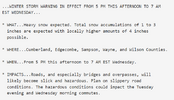
Do you think more counties get added to this along US-1? Or is this where they think the best chance is to reach WSW criteria or above that could occur?I cannot explain the 12Z NAM totals for the Sandhills, unless there's some anticipated frontogenesis shenanigans involved. But the NWS in Raleigh just put Cumberland and Sampson Co. under a WSW.
View attachment 166325
There was a livestream that showed up on my YT recommendations. These guys are driving just west of Lafayette, LA. The snow is really intense so far.
There was a livestream that showed up on my YT recommendations. These guys are driving just west of Lafayette, LA. The snow is really intense so far.
It’s showing 25F where he’s at, too! Insane for a snowfall on the Gulf Coast!!!
For any CLT folk interested
This seems reasonable. The FV3 and the latest HRRR really want to slow the back edge down for the southeast metro area and Stanly and Anson Counties.
Snow starting to fall in Auburn, AL
Tokenfreak
Member
WxBlue
Meteorologist
RAP very obvious showing FGEN banding over Midlands SC to give them a boost.
WxBlue
Meteorologist
For NC folks, dang just saw WRAL in-house model (futurecast) and it had snow back to 85 easily and snow over the region for a good 7 hours. Impressive!
For NC folks, dang just saw WRAL in-house model (futurecast) and it had snow back to 85 easily and snow over the region for a good 7 hours. Impressive!
Do you think they use the GRAF or is it something else?
ForsythSnow
Moderator
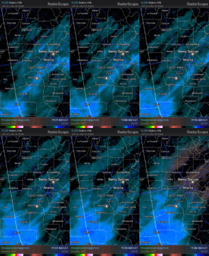
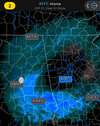
I'm seeing sun through the clouds here in Roswell. I expect it to thicken but that's not what I thought would happen.
My guess it is the GRAF or based off of it, really not sure, but seems that is what a lot of TV stations local "in-house" models useDo you think they use the GRAF or is it something else?
chuckhendo
Member
As someone who grew up in southern Lexington county, I thought moving north of I20 was how I was supposed to get all the goods lol.
Models combined with my gut makes me think that there's a stretch of Aiken, southern Lexington, and southern Richland that could get quite a bit more than they're anticipating
Models combined with my gut makes me think that there's a stretch of Aiken, southern Lexington, and southern Richland that could get quite a bit more than they're anticipating
beanskip
Member
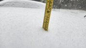
10 1/2 inches on the ground in Rayne, La.
Still snowing.
Still snowing.
wake4est
Member
- Joined
- Jan 3, 2017
- Messages
- 52
- Reaction score
- 138
It's called the Baron model. I have no idea what that is tho.My guess it is the GRAF or based off of it, really not sure, but seems that is what a lot of TV stations local "in-house" models use
So I think that puts them above the all-time record at the airport and they have a shot at beating their 1895 city record with the way the radar is looking.Saw this reported at New Orleans airport (MSY) - 3 inches on the ground, 2 inches in the last hour
KMSY 211653Z 01015G24KT 1/8SM +SN FZFG VV007 M03/M03 A3055 RMK AO2 PK WND 36026/1636 SLP349 SNINCR 2/3 P0004 T10281033 RVRNO
View attachment 166332
Downeastnc
Member
That's a brutal gradient over Pitt Co
Showmeyourtds
Member
Same thing here. Not sure about FFC’s note for areas north of town, but the fact that I have ground truth that nothing is under this band just south of Birmingham tells me that this one may just be done for the north metro/exurbsI'm seeing sun through the clouds here in Roswell. I expect it to thicken but that's not what I thought would happen.
Attachments
Ron Burgundy
Member
Just south of you at Abernathy & 400 and cloud deck has thickened up. Definitely looking like snow clouds. Be interested to see what happens with this band of heavier returns moving in from AL over the next hourI'm seeing sun through the clouds here in Roswell. I expect it to thicken but that's not what I thought would happen.
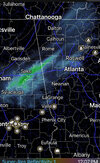
I had a brief part of the clouds in midtown, now its thickened up again and I am starting to see some very light flurries scattered about again here and there lol.I'm seeing sun through the clouds here in Roswell. I expect it to thicken but that's not what I thought would happen.

