-
Hello, please take a minute to check out our awesome content, contributed by the wonderful members of our community. We hope you'll add your own thoughts and opinions by making a free account!
You are using an out of date browser. It may not display this or other websites correctly.
You should upgrade or use an alternative browser.
You should upgrade or use an alternative browser.
Wintry January 21-23 2025
- Thread starter SD
- Start date
BKWRN29
Member
It is accounting for everything the radar shows to make it to the ground…. My house is covered on radar but it’s not snowing.any idea what its doing that hrrr and shorts arent ? Also for shorts, (Im at work) whos verifying currently closest to real ? Thats who we should ride good or bad
connorsclimate
Member
I actually think this is a relatively decent forecast. The amounts aren’t far off of what we are estimating
chase223322
Member
I know nothing but the live radar of the storm seems to show it on a direct path to NE GA / W NC but all of the projections show it going way south east of that trajectory. What causes that?
Last edited:
RollTide18
Member
Big flakes now! And it’s coming down
Is CAE playing uno instead of forecasting Winter weather? I mean an inch or less? Lol
well a dew point of 3 ain't helping
packfan98
Moderator
Not sure. I don't discount any of them. I don't put too much weight in the hrrr after about hour 6 or so. It changes as the lead times get closer.any idea what its doing that hrrr and shorts arent ? Also for shorts, (Im at work) whos verifying currently closest to real ? Thats who we should ride good or bad
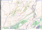
This is a good forecast for the Carolinas. I am really feeling good about the potential this system has now based on the observations seen in the Deep South so far. Hopefully some areas will get even more with the banding you mentioned.View attachment 166309
Second call forecast. May do one more minor adjustment or a few this afternoon before calling it my final forecast.
connorsclimate
Member
A lot of it is the timing of the storm and moisture available. We may have a slowing down of the storm or dryer air moving in soon. That’s what we are watching forI onow nothing but the love radar of the storm seems to show it on a direct path to NE GA / W NC but all of the projections show it going way south east of that trajectory. What causes that?
It’s already snowed with extremely light radar returns with dews in the single digits. So yeh..well a dew point of 3 ain't helping
Ron Burgundy
Member
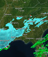
Precip shield is expanding on my (ridiculously over sensitive) Storm Shield radarWell if the GFS is right - Atlanta is shut down for a few days. I’m skeptical but hey who knows!
View attachment 166306
WolfpackHomer91
Member
I mean NAM, GFS, RAP all still look solid for I-85 for now atleast in NC ... so idk Like Mitch says theyre probably all useless at this moment lolNot sure. I don't discount any of them. I don't put too much weight in the hrrr after about hour 6 or so. It changes as the lead times get closer.
mjscott30
Member
Tiny little flakes here in MTGY.
Belle Lechat
Member
- Joined
- Aug 29, 2021
- Messages
- 1,529
- Reaction score
- 1,215
- Joined
- Jan 23, 2021
- Messages
- 4,602
- Reaction score
- 15,197
- Location
- Lebanon Township, Durham County NC
11AM
22/4

22/4

I would figure for areas centered on I-20 and slight north if that moisture back in Alabama could stay together and deepen moving across AL/GA and some of these out in front could help moisten the column and raise Dew Points it could do something but grasping here
RollTide18
Member
Models account for dry air in QPF outputs.I honestly think is accounting for everything on the radar hitting the ground which is not happening in my case. I’m in Dallas County Alabama and it’s covered in the radar but it’s not making it to the ground
Models account for dry air in QPF outputs.
Models account for dry air in QPF outputs.
Models account for dry air in QPF outputs.
Models account for dry air in QPF outputs.
Models account for dry air in QPF outputs.
Models account for dry air in QPF outputs.
I never post, only read and attempt to learn. I would like to share that a few snowflakes are flying around in Augusta, GA, in the vicinity of I-520 and Hwy 25.Not sure. I don't discount any of them. I don't put too much weight in the hrrr after about hour 6 or so. It changes as the lead times get closer.
BKWRN29
Member
Well…If it’s accurate then why isn’t it snowing?Models account for dry air in QPF outputs.
Models account for dry air in QPF outputs.
Models account for dry air in QPF outputs.
Models account for dry air in QPF outputs.
Models account for dry air in QPF outputs.
Models account for dry air in QPF outputs.
Models account for dry air in QPF outputs.
GeorgiaGirl
Member
Are you seeing anything accumulating, GG (Georgia Girl)?
View attachment 166318
Not at my work, maybe I can ask my parents.
It's funny because I figured I'd give a good look with these returns as they look good aaannnnddd nothing this time. There were worse returns earlier with a full blown light flizzard.
Because “Model” projection and radar are totally separate!Well…If it’s accurate then why isn’t it snowing?to get the amount the gfs suggests in my area we would need to be seeing what the radar is suggesting.
connorsclimate
Member
New HRRR projection for NC piedmont region is looking great
Radar shows it coming towards Columbia. We’ll find out soon enough.
Area Forecast Discussion
National Weather Service Peachtree City GA
1120 AM EST Tue Jan 21 2025
.UPDATE...
Issued at 1107 AM EST Tue Jan 21 2025
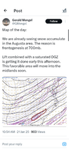
This morning the main question has been where will the dry air win out. We are doing an 18z sounding to get a better picture of this line and will have more of an update as that comes in. Currently there is a deep layer of dry air at 850mb but our dendritic growth zone is almost saturated at this point. We have been receiving reports of flurries despite this and are seeing a potential moisture surge coming in from Alabama. This along with the 12z models coming in gives us a little more confidence that the 850mb layer will moisten up but we will know more with this sounding. Have just slightly upped snowfall totals to account for this trend but only by a couple tenths of an inch. Will keep an eye on that though.
Seems most modeling has stopped with the overall NW adjustments for QPF but continue to increase QPF amounts near the back edge. Gonna be some lucky sweet spots under that 700mb fgen, on the NW fringes with the best ratios. I'm with others in thinking that sets up somewhere between US 1 and I-95 in NC. @SD might just jackpot with this one
Belle Lechat
Member
- Joined
- Aug 29, 2021
- Messages
- 1,529
- Reaction score
- 1,215
GarnerNC
Member
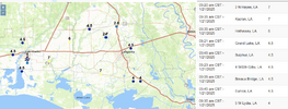
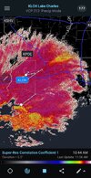
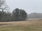
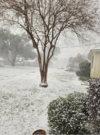
Man if you go on TikTok and find some of the people going live down in Southern Louisiana, it is absolutely coming down!
Sctvman
Member
GeorgiaGirl
Member
Yeah, I don't think this band that's over the area is doing what it could possibly do if it was just a tick wetter. No biggie since it's supposed to really start later.
Although I did see that Lincoln County is reporting 0.1" of snow already.
Although I did see that Lincoln County is reporting 0.1" of snow already.
Webberweather53
Meteorologist
This storm is just like the good ol days when we didn’t have a clue what a storm would actually do until the very last second

