SnowwxAtl
Member
Lower cloud deck is leading to pronounce flurries near the airport
I feel like a lot of that will be falling as Virga unfortunately.Combine light snow with peak traffic and I-77 and Charlotte drivers in Nissan Altimas/dodge chargers and infinitis and you have major issues View attachment 166297
Combine light snow with peak traffic and I-77 and Charlotte drivers in Nissan Altimas/dodge chargers and infinitis and you have major issues View attachment 166297
Practically a dusting lolYeah, but the Kuchera for Tallahassee is only 7 inches, so you know, no biggie ....
Is this even reliableOne of the Warf sisters showing SD and Met some love. Help calm there, Ill get screwed by 4.6 mile phobia syndrome LOL.
View attachment 166302
Not good I assume?dew point dropping CAE .
If the dew point is a couple degrees or so cooler then the actual temperature then it's fine.dew point dropping CAE .
yeh it's 3 lolIf the dew point is a couple degrees or so cooler then the actual temperature then it's fine.
Yeah we’ve lost some ground since the crazy NAM run this morning. I think if you start seeing a finger of moisture on the SW side of town around lunch time we’re in decent shape. If we don’t get that, we’re probably SOLATL folks - Are we thinking this over performs and we get something inside the perimeter? NAM and HRRR have me doubting that we get any accumulation.
Who knows maybe we will get like a footView attachment 166305
Hard to not see how 2-3" banding forms over Raleigh/US-1 corridor at this point. Just have to trust in the good ol' frontogenesis magic.
Yes and if you look at sounding that the latest NAM and FV3 initialized with, you can see that the dry is fairly shallow. It certainly explains why we’re seeing flurries reaching the ground under some of these returns a few hours earlier than expected
ATL folks - Are we thinking this over performs and we get something inside the perimeter? NAM and HRRR have me doubting that we get any accumulation.
I honestly think is accounting for everything on the radar hitting the ground which is not happening in my case. I’m in Dallas County Alabama and it’s covered in the radar but it’s not making it to the groundWell if the GFS is right - Atlanta is shut down for a few days. I’m skeptical but hey who knows!
View attachment 166306
I agree....Im thinking 20-30 miles south of the I20/85 corridor is where you will start to see light dustings across AL/GAJMO, but I think this ship has sailed for areas along and north of I-20.. Doesn't mean you may not see a flake or 2, but the hopes of any accumulation, even a car topper are probably close to zero
The NWS as a whole has been conservative, but it's the SE so I get it. Gotta assume they know what they're doing despite some of these models showing way more. I think mixing issues is part of it too.Anyone else feel like the CHS NWS office is underplaying this event?
View attachment 166307

Is CAE playing uno instead of forecasting Winter weather? I mean an inch or less? Lol
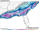
12z GFS says, hold my beer:View attachment 166301
Uhhhhhhh, I know its one model but isn't this HRRR pretty reliable at this range?

So being the ignorant one of this map.. would that be inside the dark green line?? Or inside those hatched green circles?I can already see where the band is gonna set up
View attachment 166295
I simply cannot fathom 6 inches of snow in Savannah, that doesn't compute in my brian
I wouldn’t fret too much. Over the years I’ve always noticed the hrrr is useless beyond like 6 hours for totalsStill bothered by the lower numbers on the HRRR for central NC
any idea what its doing that hrrr and shorts arent ? Also for shorts, (Im at work) whos verifying currently closest to real ? Thats who we should ride good or badWhat a trend. Please be right for the western areas!

Athens here but on a similar track as you. I'm thinking we get a trace amount if that at the rate this is tracking.ATL folks - Are we thinking this over performs and we get something inside the perimeter? NAM and HRRR have me doubting that we get any accumulation.
