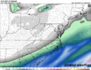
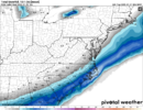
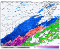
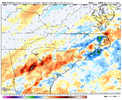
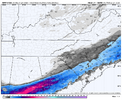
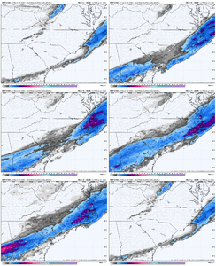
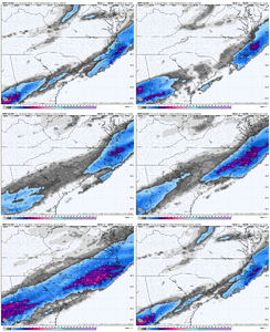
Based on ever uptick with hrrr I won’t be surprise if some spots in midlands of SC see maybe up to 8-12 inches of snow.Man the hrrr is cooking View attachment 166178
-
Hello, please take a minute to check out our awesome content, contributed by the wonderful members of our community. We hope you'll add your own thoughts and opinions by making a free account!
You are using an out of date browser. It may not display this or other websites correctly.
You should upgrade or use an alternative browser.
You should upgrade or use an alternative browser.
Wintry January 21-23 2025
- Thread starter SD
- Start date
Alrighty, the SREF has gone from like 20% chance of snow to 75% in CAE now. and some of the members are actually obnoxious.
Highest member: 1.00 inches of liquid.
Some other higher ones:
0.94
0.79
0.70
The mean is right at my best guess ceiling of 0.31 liquid precipitation.
This model, the HRRR, and the NAM/GFS/Euro are going to cause the local guys to expand watches/advisories etc here in the next little while. They like the 3-4AM to do it.
Shawn what would 1.00 inch of liquid equal too in snow inches in this setup?Alrighty, the SREF has gone from like 20% chance of snow to 75% in CAE now. and some of the members are actually obnoxious.
Highest member: 1.00 inches of liquid.
Some other higher ones:
0.94
0.79
0.70
The mean is right at my best guess ceiling of 0.31 liquid precipitation.
This model, the HRRR, and the NAM/GFS/Euro are going to cause the local guys to expand watches/advisories etc here in the next little while. They like the 3-4AM to do it.
13-15 inches for us. We would have a little less 850c temperature cold with that type of moisture, but somewhere around there.Shawn what would 1.00 inch of liquid equal too in snow inches in this setup?
Edit: correction. I actually think a bit lower between 11-13 tbh.
SnowDoomer21
Member

Let it cook!!!
Sent from my iPhone using Tapatalk
SnowDoomer21
Member

H

Here’s the other 2
Sent from my iPhone using Tapatalk
Erm. 06 NAM early on...... my maps suck but I see something very encouraging so far
SnowDoomer21
Member
Erm. 06 NAM early on...... my maps suck but I see something very encouraging so far
Can you show once it’s in range?
Sent from my iPhone using Tapatalk
Fro's got the good ones.Can you show once it’s in range?
Sent from my iPhone using Tapatalk
NBAcentel
Member
Nam bouta do it
Makeitsnow
Member
06z nam already has 2.2 inches of snow over ATL.....at 18 hours. Wow. Looks like FFC's thinking may play out over the Metro.
Dang, yellow dbz entering the FL panhandle
Can’t refresh this NAM run fast enough
yo, this nam is gonna get someone on our side with 10in+ it's just got to, looks nice.
NBAcentel
Member
Nam slower with the northern stream again… is it overdoing it at this point or we just gonna keep going ?!
this is the weenie nam run. hell yeah. this HAS to be the ceiling of the eventNam slower with the northern stream again… is it overdoing it at this point or we just gonna keep going ?!
Makeitsnow
Member
NBAcentel
Member
NBAcentel
Member
The half inch+ precip line is literally knocking on the CAE door this run.
0.64 in Richland county
0.64 in Richland county
Makeitsnow
Member
Nam has it snowing at my local for nearly 12 hours. And there is still time to go higher....but is it right or is it just the nam being the damn nam?
SnowDoomer21
Member
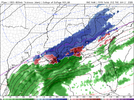
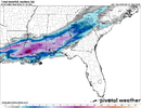
Southeast Alabama/Southwest Georgia Gets NAM

’d
Sent from my iPhone using Tapatalk

’d
Sent from my iPhone using Tapatalk
This has to be the absolute ceiling, but man, if this keeps up Canadian was right days ago.. even though it found it by accident.
Personally, I think what FFC has been alluding to is playing out in front of our eyes. If the NAM is to be believed, it doesn't take long to get the precip to the ground, just like FFC said could happen.Nam has it snowing at my local for nearly 12 hours. And there is still time to go higher....but is it right or is it just the nam being the damn nam?
NBAcentel
Member
I keep noticing each nam/hrrr run initializing with a stronger subtropical ridge nosing towards us at hr 0
I was missing a frame. CAE is officially .50+ qpf with 0.83 in Clarendon county.. CHS is like 1.6 inches.
This might actually be the gulf data that was sampled..So when does the real data come in?
Sent from my iPhone using Tapatalk
and we get another recon flight in the morning at/for 12z..
SnowDoomer21
Member
So the stuff coming in is from that!?!
Sent from my iPhone using Tapatalk
Sent from my iPhone using Tapatalk
I hope that warm advection is overdone with storm because I’m in Clarendon County and think it’s a mostly snow event.I was missing a frame. CAE is officially .50+ qpf with 0.83 in Clarendon county.. CHS is like 1.6 inches.
NBAcentel
Member
Supposedly they did a flight for some of the 00z modeling. I don't think they had time to get all the data for the 00z NAM though.So the stuff coming in is from that!?!
Sent from my iPhone using Tapatalk
SnowDoomer21
Member
This is unreal View attachment 166194View attachment 166195
This is something ya don’t see everyday crazy stuff man
Sent from my iPhone using Tapatalk
I already have virga that has developed overhead, not that it means much but it does seem to be a bit early for it to be arriving above us.
Expect big changes with watches/warnings/etc in the Midlands from NWS by dawn. Very cool trends today. The only bad results we had were some of the foreign modeling that isn't so great for our region.
So from 12z to 06z most modeling with more precip. that's an actual trend, finally.
So from 12z to 06z most modeling with more precip. that's an actual trend, finally.

