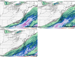
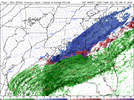
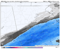
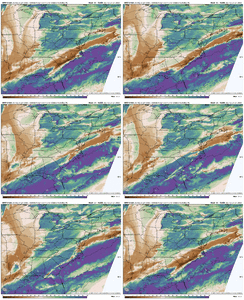
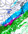
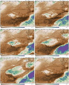
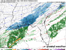
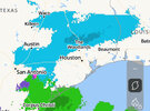
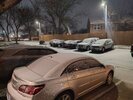
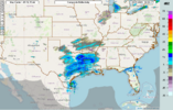
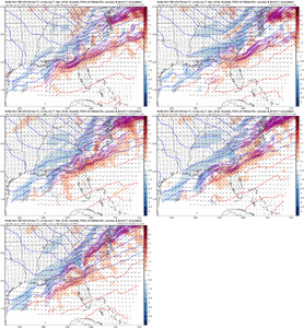
That coastal dry slot on 3k
-
Hello, please take a minute to check out our awesome content, contributed by the wonderful members of our community. We hope you'll add your own thoughts and opinions by making a free account!
You are using an out of date browser. It may not display this or other websites correctly.
You should upgrade or use an alternative browser.
You should upgrade or use an alternative browser.
Wintry January 21-23 2025
- Thread starter SD
- Start date
I doubt it, the plane just took off an hour ago I think.This NAM run has the new plane data right?
We were projected to reach 37 today over in Athens, and only barely made it to 34.22/0 I might make another run for the upper teens tonight before skies become overcast overnight. The forecast is 20. We still got a few hrs of radiational cooling to take advantage of.
25/-1 at the airport. It looks like the official high was 32 there today. I’m not sure if the airport will drop below 20, but it could be pretty close.
I doubt it, the plane just took off an hour ago I think.
Makeitsnow
Member
connorsclimate
Member
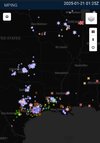
How many of you think the system is going to over perform to the point where everyone will get a decent snow? I mean it’s snowing in Dallas, TX rn and was that even forecasted 
beanskip
Member
It's NAM vs. the world on temps in Florida panhandle (NAM being a fateful degree or two warmer).
Unfortunately in my old age, I've seen the NAM pull some coups on just this type of thing.
Unfortunately in my old age, I've seen the NAM pull some coups on just this type of thing.
Okay, that may be the case, but there's no way it's flown that whole mission in one hour. Maybe it took off earlier than 0z, I don't know what each of the fields represents in that POTD.
ForsythSnow
Moderator
NBAcentel
Member
ForsythSnow
Moderator
One tick and it's 2014 2.0. It's possible too3K NAM gradient across metro Atlanta is insane. Nothing in Smyrna, 4 inches in McDonough? That would be wild
View attachment 166079
SnowwxAtl
Member
I can easily see this trending NW again in the morning.3K NAM gradient across metro Atlanta is insane. Nothing in Smyrna, 4 inches in McDonough? That would be wild
View attachment 166079
This feels bigger than 2022 tbh. .4” back near Florence?? With these temps could be big totals in the pee dee. Wonder how nws and local Mets will handle this after lowering totals
connorsclimate
Member
NBAcentel
Member
Same, I'd not be surprised to see 2-3 counties shift NW by morning. Bet the first flakes arrive a little sooner than projected earlier today as well.I can easily see this trending NW again in the morning.
Makeitsnow
Member
Looks like an 850mb warm front type deal from Atl to CLT over to RDU then ORFInteresting feature here showing up that’s seemingly allowing columns to moisten up faster on start up each run View attachment 166082
I’ll be curious to see GSPs discussion tn most of this forecast area is getting put under gun with these trends and even more if they don’t stop. Also with what fro posted above the atmosphere looks to be moistening quite quickly so my guess is we see at least some over performing
connorsclimate
Member
I may have spoke too soon, just dropped 2 degrees in 5 mins (8:50-8:55pm) at KATL. It’s 23/-1 now, maybe they will make a run for the upper teens down there too.22/0 I might make another run for the upper teens tonight before skies become overcast overnight. The forecast is 20. We still got a few hrs of radiational cooling to take advantage of.
25/-1 at the airport. It looks like the official high was 32 there today. I’m not sure if the airport will drop below 20, but it could be pretty close.
It’s 21/0 in NW Atlanta where I am. (According to a wunderground sensor located about a block away) I haven’t invested in my own yet unfortunately.
Atlanta, GA Weather Conditions | Weather Underground
Atlanta Weather Forecasts. Weather Underground provides local & long-range weather forecasts, weatherreports, maps & tropical weather conditions for the Atlanta area.
www.wunderground.com
AJ1013
Member
WRF outputting truly insane low temperatures over the modeled snowpack in LA, MS, and FL. Sub-0F!?


Brent
Member
albertwilsonjr
Member
What was your forecast
Sent from my iPhone using Tapatalk
Brent
Member
What was your forecast
Sent from my iPhone using Tapatalk
No real shot they had a 20 percent chance on the 4pm mostly west of here
- Joined
- Jan 5, 2017
- Messages
- 3,771
- Reaction score
- 5,974
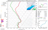
This looks like a moderate snow sounding to me, but the map output is light blue?That band isn't going to be light either when it comes in. That's looking like high-rate high-ratio snow.
View attachment 166076
we nudged to a better northern stream look which frankly is a tide that rise all ships. this pattern, likely due to the temp gradient, is very sensitive to minute changes. i'm happy we are basically getting the exact tweaks we need for a more widespread event. it puts into context the ripe environment we are dealing however and makes me a little sad we're not getting a historic storm. i don't think those cmc runs were out to lunch, given the background state, at all, it just didn't work outI feel like this shift was just prayed into existence…what is going on??? I’m over here with my heart racing for Charlotte and Raleigh
NBAcentel
Member
NothingWhat was your forecast
Sent from my iPhone using Tapatalk
19.9/3.8 here at my location in NE Cobb.I may have spoke too soon, just dropped 2 degrees in 5 mins (8:50-8:55pm) at KATL. It’s 23/-1 now, maybe they will make a run for the upper teens down there too.
It’s 21/0 in NW Atlanta where I am. (According to a wunderground sensor located about a block away) I haven’t invested in my own yet unfortunately.
Atlanta, GA Weather Conditions | Weather Underground
Atlanta Weather Forecasts. Weather Underground provides local & long-range weather forecasts, weatherreports, maps & tropical weather conditions for the Atlanta area.www.wunderground.com
Is it still snowing there?
connorsclimate
Member
32 KM showing a massive shift Northward which is great for the Carolina snow lovers
ForsythSnow
Moderator
Map outputs are not looking to be accurate. FFC has been going on all day about this possibility due to low temps and how the atmosphere reacts. If they're insisting snow with a drier surface and we see a full saturated column with a large DGZ, I'd bet more than anything it's a decent rate.This looks like a moderate snow sounding to me, but the map output is light blue?
KatrinaRuns
Member
That has to be good for central AL, right??
connorsclimate
Member
Yes this is extremely good for central ALThat has to be good for central AL, right??
ForsythSnow
Moderator

