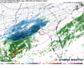
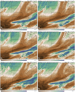
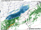
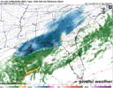
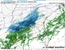
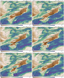
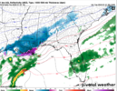
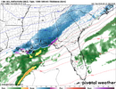
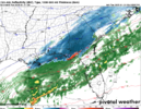
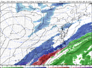
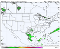
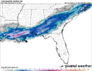
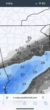
I don’t even care honestly. That’s a hrrrr clown map for the entire panhandle of Florida. We hardly even get those on 384 gfs. Just a remarkable eventThat’s going to be a lot of sleet I’m afraid
-
Hello, please take a minute to check out our awesome content, contributed by the wonderful members of our community. We hope you'll add your own thoughts and opinions by making a free account!
You are using an out of date browser. It may not display this or other websites correctly.
You should upgrade or use an alternative browser.
You should upgrade or use an alternative browser.
Wintry January 21-23 2025
- Thread starter SD
- Start date
SnowwxAtl
Member
The dry air in place...it is very bias or overdosed dry air...I think.HRRR also showed moisture up north but it all consolidated south by the time it got towards us. Is that because it actually expects that to happen or just because it is only applying the bounce here in the earlier hours and we might expect our bounce later?
Gut is telling me a bust on the low end bc of mixing is coming for coastal areas east of Pensacola until you get up towards the OBX. Probably mixing issues well inland
Dry air.
Yep. The question is if that might end up saturating or being less of an effect than predicted?
22/0 I might make another run for the upper teens tonight before skies become overcast overnight. The forecast is 20. We still got a few hrs of radiational cooling to take advantage of.
25/-1 at the airport. It looks like the official high was 32 there today. I’m not sure if the airport will drop below 20, but it could be pretty close.
25/-1 at the airport. It looks like the official high was 32 there today. I’m not sure if the airport will drop below 20, but it could be pretty close.
NBAcentel
Member
Thru 19 fv3 north and slightly faster w onset
That's an explosion of moisture. If we could just get some convection in the Gulf!
FV3 really nailed last event in like last 36 hoursFV3 incoming?
View attachment 166048
NBAcentel
Member
GeorgiaGirl
Member
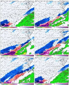
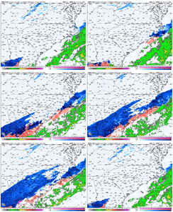
NAM way west with that initial band "finger" of snow, wow just wow
CNCsnwfan1210
Member
Look at the nam with that tongue of precip
View attachment 166058
Snow breaking out over eastern NC
Sent from my iPhone using Tapatalk
SimeonNC
Member
This NAM run has the new plane data right?
ForsythSnow
Moderator
That stream over N GA.... Notice how it's also acting like it's being held back a bit too. The shield is coming much further NW than the past 24 hours seemed to indicate and to me, I'm seeing a stream of more snow if that keeps trending. Have to check the soundings still.columns looking way better this nam run View attachment 166057
beanskip
Member
Among other things already being discussed, 0z NAM finally ending the streak of speeding this thing up. 12z run already had precip into Perry Fla at 21z Tuesday -- now it's back in Marianna.
NBAcentel
Member
Looks like the Western edge is all the way back to Charlotte on this run
Sent from my SM-S156V using Tapatalk
00z.
iGRXY
Member
As good as the FV3 and NAM run was, I personally still think it’s too dry on the NW side. The radar is already showing you that the column is fighting off the dry air more and more
I'm only at 27hrs on the 0z NAM, I'd argue 18z looked a little sharper and more favorable in the upper levels, however this run has relaxed the height fields slightly which is allowing more moisture to come north and west.
AH yeah, big time dryslot while everyone gets snow to my east and west. this is absolutely how it will actually work out here.
NBAcentel
Member
Does someone have the map of the latest ground truth for snowfall?
Brent
Member
Even the NAM is now on board with a more significant event for most of us. Today has been a epic ninth inning rally for many of us (me included) who had given up hope of any significant winter precipitation falling. The precipitation shield many end up reaching the foothills of NC and they might be in for a surprise.
Cbmatt2408
Member
This might be a crazy question, but with as cold as the temperatures are and the wind direction, could any of the larger lakes in the SE aide in snowfall in a pseudo lake-effect style. We’re not used to this setup this cold, but it is similar to the Great Lakes areas. Maybe the larger lakes like Lanier, Hartwell, Seminole or West Point.
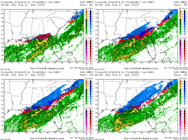
Watch out coastal Carolinas, the warm nose is here to hurt
really feel for the beach here with these trends this is becoming a sleet fest for them
GeorgiaGirl
Member
we happen to get a ridiculous 0% humidity dry layer @ 850mb over our area and it destroys our precip totals.Lake Murray ftw

