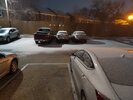
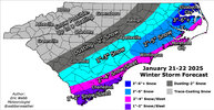
So what is causing the increase in precipitation to our west?
-
Hello, please take a minute to check out our awesome content, contributed by the wonderful members of our community. We hope you'll add your own thoughts and opinions by making a free account!
You are using an out of date browser. It may not display this or other websites correctly.
You should upgrade or use an alternative browser.
You should upgrade or use an alternative browser.
Wintry January 21-23 2025
- Thread starter SD
- Start date
albertwilsonjr
Member
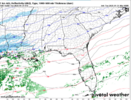
So what is causing the increase in precipitation to our west?
The digging of the NS energy out west
Sent from my iPhone using Tapatalk
SnowDoomer21
Member

Here’s a little prediction I have where I think the storm is maybe gonna overperform or where snow totals could be higher or lower
Sent from my iPhone using Tapatalk

Here’s a little prediction I have where I think the storm is maybe gonna overperform or where snow totals could be higher or lower
Sent from my iPhone using Tapatalk
Wow! I think you’ll definitely be right about it over performing somewhere in that area!
nice low level moisture surge
View attachment 012025.mp4
View attachment 012025.mp4
Showmeyourtds
Member
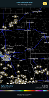
Ideally someone underneath those returns in Dallas/Ft Worth would be able to give us some ground truth. That would make things a smidge more interestingSure looks like that donut hole is shrinking quickly. Checking Mping for any ground truth. So far, Hubbard, TX is the farthest north I see any reports of Snow in TX.
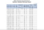
Currently overcast, 36.9/11. Might take some time for the atmosphere to moisten up for snow. Still, it wouldn't surprise me to start seeing some flurries in the next 2-3 hours if current trends continue.
SnowDoomer21
Member
Wow! I think you’ll definitely be right about it over performing somewhere in that area!
Just looking at some of the trends and it’s a possibility hoping everyone can get an 1 to 4 inches!!!
Sent from my iPhone using Tapatalk
I have an old co worker on project at Walmart in Bentonville, AR and they have snow flurries falling not forecasted that she is aware of. I checked the local NWS and indeed it shows light snow for Bentonville currently but not in the forecast. Intrigued a tad ha.
Agreed. Anecdotally, once the precip shield reaches NW to over Hwy 1, it usually continues to at least GSO/CLT. I can remember quite a few E NC specials which missed the Triangle or just grazed it. But have rarely seen it stop between Hwy 1 and the Triad.If the positive trends continue, I think at least an inch might be a good bet for much of Central North Carolina from Durham County west. Counties like Johnston and Harnett might get 2 inches in spots.
Sctvman
Member
Cantore just saw flakes
- Joined
- Jan 5, 2017
- Messages
- 3,771
- Reaction score
- 5,974
And there it is. Mping report of snow in Dallas.
J1C1111
Member
I wonder if any of it is reaching the ground on the far northern edge. Would be a good sign for us north of 85 if it is.nice low level moisture surge
View attachment 166015
Shaggy
Member
Would it be prudent to go back and review model runs from a few days ago to see which ones showed the real time snow breaking out
RollTide18
Member
MPing of snow already into SW Mississippi
WEATHERBOYROY
Member
I am liking the moisture feed on radar in LA. being from the SW instead of WSW. Get a lot more moisture a lot farther north!
The question of the night. Radar is outperforming models, and we are getting ground truth.
What are the chances of the precip that's showing up in Texas & Oklahoma holding up for us on I 20
Just went outside with a headlamp and looked up. Sure enough, I'm seeing very tiny flurries swirling past!
SnowDoomer21
Member
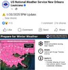
WOW what is this from!?!
Sent from my iPhone using Tapatalk
rburrel2
Member
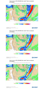
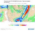
Another major shift West with qpf the 18z Euro AI for SC/NC.
Dallas Airport is reporting light snow flurries via Storm2k
Brent
Member
Snowing here and I thought the dry air would eat it up 
Downeastnc
Member
Powder keg. Gulf wants to go boom View attachment 166011
This run of a certain model that went on to do special things....
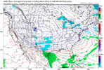
WpcWOW what is this from!?!
Sent from my iPhone using Tapatalk
Dang if you showed me that with no knowledge of the situation I would think we were about to get pasted.
Brent
Member
packfan98
Moderator
Nice! Was this predicted?
Brandon10
Member
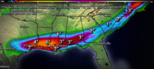
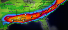
Anyone have snow map?AI trend and latest precip...looks like .2" back to 95'ish
View attachment 166025View attachment 166026
Showmeyourtds
Member
Look at SWL bringing the goods
Downeastnc
Member
Dang if you showed me that with no knowledge of the situation I would think we were about to get pasted.
It does not necessarily mean anything, its just funny that that frame of the monster CMC run matches up really well with the current radar....
Webberweather53
Meteorologist

