rburrel2
Member
Absolutely. Us in AL will be chasing or watching social media posts from the coast.Thing I notice is that you can tell the tilt is changing. You’re seeing larger inroads being made in the Carolinas vs. say Alabama
Atlantic Beach has gone from a dusting/coating to 8” in two runs within D2. Wow!!!Holy ---- View attachment 165953
Thought this was a good call by @rburrel2 here that it was a good sign if the Euro bumped north, signaling that additional bumps north (NW) were possible, rather than everything just consolidating on the Euro solutionFor this to be a north trend, the 12z euro needs to shift north a little bit. Otherwise, I view this as just everything coming in to line with the Euro.
If we get the the euro to tick north, we may not be done trending. Just my opinion.
Hello everyone. I have waited awhile to make my first call for Raleigh on this system. However, now that we are finally seeing the northwest trend, I am, at this time, placing Raleigh in a 60% probability for 1-2 inches of snow. Stay tuned!
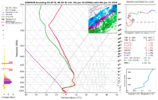
No MPing reports or any reports from the Storm2K Texas thread yet.Snow is reportedly reaching the ground west of Dallas with this sounding...View attachment 165957
It’s like when they asked Dale Jarrett what he thought about winning a million dollars for winning The Winston Race in Charlotte, and he said, “Another million never hurts”Someone correct me if I am wrong but the Upper Level energy here if this just moves a little further west and tilts neutral (think north-south) we go from a little jog NW to a whole actually overrunning look still time not impossible as models pick up its depection in real time this moves back about 75-100 miles and tilts another 25 degrees its a much bigger deal
Just looking at that orientation array you have to believe there is another adjustment or two left.Last 6 runs from the GFSView attachment 165961
For N. ALA, some minor adjustments and we will have some ground cover.Prolly too late to get big jumps but I’d love one
View attachment 165962
we keep getting these every 6hrs and it will add up more than you might expect.Prolly too late to get big jumps but I’d love one
View attachment 165962
Exactly Im on the northern extreme on these jogs to NW and sure a 1/3 of inch on cold ground and roads could be messy... but a little SE of me in Atlanta and a inch over this cold its gonna be nasty once surprise once againwe keep getting these every 6hrs and it will add up more than you might expect.
Probably won't have enough time to do so but if you look at Wild Weather Mongers map, you'll notice offshore off of Ga/SC, the arctic boundary isn't as far offshore as previous maps, indicating the boundary is getting hung up over the Gulf Steeam and the best baroclinicity is riding along that, which is closer than it was just 24 hours ago...Someone correct me if I am wrong but the Upper Level energy here if this just moves a little further west and tilts neutral (think north-south) we go from a little jog NW to a whole actually overrunning look still time not impossible as models pick up its depection in real time this moves back about 75-100 miles and tilts another 25 degrees its a much bigger deal
Trending back to 1-2” for RDU/CLT isn’t out of the equation here…. Especially if we continue to work on the tilt. I think after what we were given the last couple of days, that would be awesomeProlly too late to get big jumps but I’d love one
View attachment 165962

Of course it was just a run of the NAM you posted a bit back but that looked to be on a fairly fat line from ~Fay. to ~Ahoskie on a sw-->ne axis. Hope this moves west. We'll seeOverrunning precip with mid level warm advection that fades and transitions into cold advection as the surface low starts to develop off the coast, causes a heavier band of snow to pivot somewhere over east-central nc. Looks like that could be I-95 &/or the US-1 corridor based on the NAM.
Likely would see more than a few inches wherever that sets up
Focus on those back west. The axis going north likely is going to see more snow in general if moisture rapidly penetrates.Prolly too late to get big jumps but I’d love one
View attachment 165962
Reminds me of somethingOverrunning precip with mid level warm advection that fades and transitions into cold advection as the surface low starts to develop off the coast, causes a heavier band of snow to pivot somewhere over east-central nc. Looks like that could be I-95 &/or the US-1 corridor based on the NAM.
Likely would see more than a few inches wherever that sets up

That northern stream energy parking that extremely dry air over north AL is disgusting!Dynamics starting to out in some work, getting more divergence aloft which continues at 18z. Smells like a incoming overperfomer View attachment 165970View attachment 165971View attachment 165972
