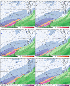
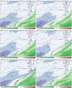
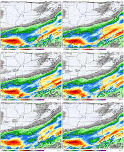
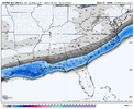
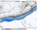
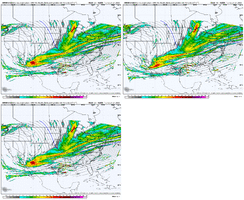
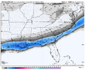
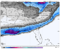
We used to post it a lot back in the early 2010s. The Meteocentre maps truly bring back the nostalgia with it. I’m not sure if it’s actually any good, but it was further NW last night with precip than a lot of models and seems that some of them have trended towards that now.Damn, I’ve never seen this model before but that looks magical.
-
Hello, please take a minute to check out our awesome content, contributed by the wonderful members of our community. We hope you'll add your own thoughts and opinions by making a free account!
You are using an out of date browser. It may not display this or other websites correctly.
You should upgrade or use an alternative browser.
You should upgrade or use an alternative browser.
Wintry January 21-23 2025
- Thread starter SD
- Start date
Wow I’m hoping it snows for everyone here, but man I think I actually believe SAV could get 2-3 inches which would be huge for us. Is there a way for it to keep trending north and for us to miss the the frozen rain, or is that just a pipe dream? Want to root with yall lol
Goodness gracious! GFS is forecasting temps in the single digits for a large swath of southern Louisiana Wednesday morning. I guess an Arctic high, clear skies, and a solid snowpack will do that.
Mahomeless
Member
Won’t amount to anything up our way. We need this 500mb look to be 150 west.That's a huge shift.
GFS advertises several hours of heavy snow (talking near 1"/hr rates) to get some of y'all down there in the 8-10" range. That's just unheard ofGoodness gracious! GFS is forecasting temps in the single digits for a large swath of southern Louisiana Wednesday morning. I guess an Arctic high, clear skies, and a solid snowpack will do that.
CNCsnwfan1210
Member

Looks like the northern stream trough is backing further north, while the southern piece is amplifying a bit…need more of that
Sent from my iPhone using Tapatalk
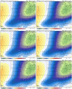
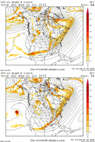
Here is the GFS run from 12z Saturday vs the 12z run from today. The more interaction the southern wave running thru the 4 corners and into TX has with the little bowling ball wave west of CA and the trough west of Baja, the slower the southern wave moves. In this trend loop, you can see that both the northern piece of the trough over the Ohio Valley and the southern piece have sped up. Ideally, the southern piece would have sped up and the northern piece slowed down - it looks like the wave running into WY is kicking the northern piece east a little quicker (that piece extends into Alberta).ive read through here.... however can someone explain in more detail about possible changes in Baja/N-stream ect and how it may be changing ? @Stormsfury @Mitch West @griteater @KyloG. I understand tilt and such but maybe someone is like me and halfway knows what to look at but not 100%
But bottom line, you can see the improvement in the height lines over GA to the Carolinas - more out of the SW. We're past the point of seeing major changes, but slight improvements can still help. Of course, if you are along the coast, more improvements with getting precip farther inland could very well present temperature issues there.
Shaggy
Member
Anyone have the gefs panels?
NBAcentel
Member
Mahomeless
Member
Euro appears unchanged at this point…
Further south for AL/GA
Further south for AL/GA
NBAcentel
Member
rburrel2
Member
North trend confirmed, let’s go!
Euro has .5” of snow in Atlanta. It’s just enough to keep me engaged
NBAcentel
Member
CNCsnwfan1210
Member
Can we keep this up though until go time ? And it not just be a blip View attachment 165836
What did the H5 trend on the Euro show?
Sent from my iPhone using Tapatalk
Sctvman
Member
NBAcentel
Member
Stormsfury
Member
Community notes time.
The 12z cycle results are in.
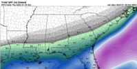
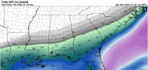
guidance has trended favorably in terms of QPF increases and has expanded the reach a bit further inland. Henceforth, has also increased snowfall totals as a result.
How reliable is it in this timeframe? Does anyone have its score in the short-range?Can we keep this up though until go time ? And it not just be a blip View attachment 165836
NBAcentel
Member
CNCsnwfan1210
Member
Hrrr slowly keeps looking better View attachment 165840
Yeah that northern trough backing up just a bit will help, get that southern piece to dig a little more would help
Sent from my iPhone using Tapatalk
Mahomeless
Member
Yep! Just noise within the margin of error.This just looks like minor wobbles. Honestly think my forecast map from yesterday is still in good shape.
View attachment 165838
I'm still not expecting a Carolina Crusher from 2000 by any means but the latest model runs are more encouraging than the meltdown we saw on Sunday. If somehow the RDU area could get an inch out of this storm, I would be ecstatic.
rburrel2
Member
I don’t mean it state the obvious, but in that area where the euro has .01-.10 of liquid, there will almost certainly be maxima’s of more and minimas of less. You’ll have bands waxing and waning as they reform further east. Some people will get 1.5-2.0 that perfectly position under where bands form, even far back to the west for places around gsp and Charlotte. (This is assuming we actually get the precip to the ground like the euro/gfs show).
lj0109
Member
chase223322
Member
Can someone tell me current expected time for this to reach ATL? I have a 2:00 pm flight out of Hartsfield and BADLY do not want to get stuck there if this thing keeps trending north
NoSnowATL
Member
You will be fineCan someone tell me current expected time for this to reach ATL? I have a 2:00 pm flight out of Hartsfield and BADLY do not want to get stuck there if this thing keeps trending north
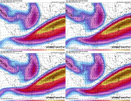
Good stuff there. Too bad we are running out of time!SREF trend at 300mb
View attachment 165847
jtgus2005
Member
What does that indicate? New here and have no idea what I'm looking at
With 20 to 1 ratio, Etowah will be rocking .2 of an inch.
Branch
Member
Winter storm watch to be canceled and replaced with advisory
NBAcentel
Member
packfan98
Moderator
RollTide18
Member
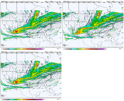
Not sure what model this is but
Correct me if I’m wrong but wasn’t it the HRRR that first picked up the H5 making improvements for the 1/22/22 storm?We are really trying. I’ll give it that View attachment 165855
NBAcentel
Member
Nah it was the rgem, then the NAM, then the HRRR for that oneCorrect me if I’m wrong but wasn’t it the HRRR that first picked up the H5 making improvements for the 1/22/22 storm?
It is the SREF but it did shift north with the snow mean in its latest run.

