• Hello, please take a minute to check out our awesome content, contributed by the wonderful members of our community. We hope you'll add your own thoughts and opinions by making a free account!

Wintry January 21-23 2025

Definitely think the chances of us seeing a dusting or even a coating in the Triangle are increasing. When we over perform it tends to be in these situations where we aren’t supposed to really get anything and we end up with a half inch or something. We never have it where we are supposed to get 3-6” and get 10”.
2018?
 
We just have to saturate that urinal cake layer and we will be good. History says that happens faster than modeled but you know the one time we want it to...
Truth, last system some thought we'd virga for hours, saturated column pretty quick and in less than an hour precip was falling. This is a much drier airmass sure but I'm still in the we can saturate column faster than modeled. I'm going down with the ship at this point
 
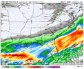
Not sure we have a trend, like to see more than the NAM showing this closer track, more precip for NC. NSSL and ARW looking better. Could GRAF be right?
Fwiw the Euro AI did tick NW also, not as much but the NAM had to make a massive jump to come more in line with what it was showing. I'd love to see slight NW ticks continue with rest of the 12z modeling suite
 
Fwiw the Euro AI did tick NW also, not as much but the NAM had to make a massive jump to come more in line with what it was showing. I'd love to see slight NW ticks continue with rest of the 12z modeling suite
That was the 06z Euro AI, right? I don’t think the 12z comes out until after the regular Euro?
 
How historical for the gulf

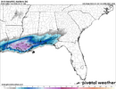
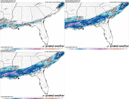
View attachment 165721


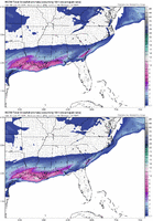
So if all of these cities get measurable snowfall, we'll be dealing with a 100-year snowstorm (aka Storm of the Century!). It's pretty darn cool to be around for that, even if it's not going to snow (much) on my head. Best of luck to our coastal brethren! I hope you all get buried.
 
We just have to saturate that urinal cake layer and we will be good. History says that happens faster than modeled but you know the one time we want it to...
Everyone turn your hoses up today soak that lower column haha... But seriously you cans seee light qpf all the way up to the TN/GA state line the further N this jogs the better feedback it gives to moisting the areas to North and help that leading edge further north to drop stuff and reach... Obs later today on moisture feedback and if actuallt getting thru areas higher then model depication will be crucial
 
Truth, last system some thought we'd virga for hours, saturated column pretty quick and in less than an hour precip was falling. This is a much drier airmass sure but I'm still in the we can saturate column faster than modeled. I'm going down with the ship at this point
I think there is truth to what FFC said. If you got -10C air it's holding capacity for moisture is significantly less than -1C air. You'd think the hi-res models take that in to account, but maybe that's a bias on their part.

"The common rule of thumb is that the moisture holding capacity of saturated air doubles for every 20°F increase in temperature."

So we're talking about roughly half as much moisture required to saturate dry layers in this set up, compared to when wetbulb temps are around freezing.
 
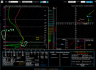
Ok, here is the sounding from the NAM at 1 pm tomorrow over my head. I think I understand what KFFC is explaining, but someone check me. The Omegas are pretty good at 500 mb and the air is saturated in the snow growth zone. We are printing snow at a good rate here, likely due to the enhanced lift from the 90 to 100 knot jet. As it falls, it enters a parcel of very dry air around 825 mb. This parcel is basically the same temp profile as the ones above, but not nearly holding as much water. What happens? Do all of the snowflakes sublimate to saturate this layer and nothing makes it to the ground? What if it takes very little moisture to saturate it? It's basically the same air as at 600 mb. -10C. If there is enough moisture from the upper layer to saturate another, thin parcel of dry, -10C air, then this snow makes it to the ground, where it's 24 degrees. Even a half inch of it will make driving problematic. This is the billion dollar question.

I'm betting the models have it right, though. It all evaporates.Screenshot 2025-01-20 094249.png
 
Ok, here is the sounding from the NAM at 1 pm tomorrow over my head. I think I understand what KFFC is explaining, but someone check me. The Omegas are pretty good at 500 mb and the air is saturated in the snow growth zone. We are printing snow at a good rate here, likely due to the enhanced lift from the 90 to 100 knot jet. As it falls, it enters a parcel of very dry air around 825 mb. This parcel is basically the same temp profile as the ones above, but not nearly holding as much water. What happens? Do all of the snowflakes sublimate to saturate this layer and nothing makes it to the ground? What if it takes very little moisture to saturate it? It's basically the same air as at 600 mb. -10C. If there is enough moisture from the upper layer to saturate another, thin parcel of dry, -10C air, then this snow makes it to the ground, where it's 24 degrees. Even a half inch of it will make driving problematic. This is the billion dollar question.

I'm betting the models have it right, though. It all evaporates.View attachment 165770
I think one problem with this line of thinking is you're not just having to worry about saturating static air. If a dry slot of air punches in from westerly winds at 700mb... you're resupplying dry air as fast as you're trying to saturate it.
 
-40 dewpoints at 875 are problematic View attachment 165754
Yeah that’s the one thing that I can look that’s killing this so much for those of us back west to at least get a dusting to an inch. With that jet overhead, you would certainly think at first glance that precip would make it back to the mountains for a time.
 
I think one problem with this line of thinking is you're not just having to worry about saturating static air. If a dry slot of air punches in from westerly winds at 700mb... you're resupplying dry air as fast as you're trying to saturate it.
Yes, I noticed that, too. I think that is the key difference here from previous setups. I believe that is why we won't have precip making it to the ground. If that's wrong, though, the parcels will basically be moving in tandem. The northern energy around 700mb is too robust, not aligned with layers above and below, and creating this westerly, dry, wind. As long as this layer exists and behaves this way, no snow makes it to the ground.

That's the explanation and I would feel very confident in cutting snow out of the forecast for Atlanta north, for sure, slight to good chance between Atlanta and Macon as you go south.
 
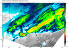
I know there was a lot of focus on the 3K NAM in N.C., but don't miss what happened along the Gulf Coast -- seems reasonable to at least ask if this type of trending were extended throughout future runs, what would the impact be downstream in Ga/SC/NC?

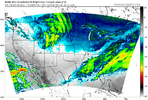
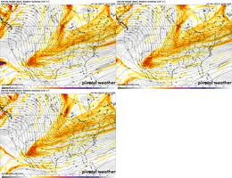
Regardless, pretty remarkable.View attachment 165773
Screenshot_20250120_100217_Samsung Internet.jpg
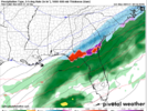
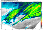
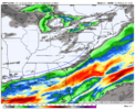
This right here in green area right here is the battleground today on modeling and observations. I think this represents the most extent could see returns by end of modeling if thing shakeout just right still a longer shot then not
 
Not predicting this or saying it’s even likely, but 2014 and 2018 was supposed to be mostly virga across AL and GA, but the atmosphere moistened enough to let it reach the ground. Food for thought.
I'm going by soundings on the modeling and based on that it may not be out of the question for an inch even up this way. Moisture for several hours is supposed to saturate all of N GA. If it's underdone we are going to see the shield shoot NW come verification.
 
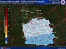
View attachment 165780
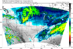
Doesn’t look like a decrease to me

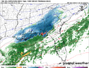
Dang....only like 10-15 miles away from accumulating snow here on the RGEM. Definitely trended better for my backyard. This will probably be a nowcast situation for me. I still think an inch is possble for me if this thing has even a slight overperformance.
 
Back
Top