• Hello, please take a minute to check out our awesome content, contributed by the wonderful members of our community. We hope you'll add your own thoughts and opinions by making a free account!

Wintry January 21-23 2025

afa3fd9423733510e34d6ec663296150.gif

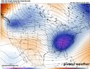
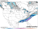
To me looks like the southern piece of energy is amplifying a bit causing a better QPF response upstream or a incremental increase of moisture inland.


Sent from my iPhone using Tapatalk
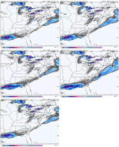
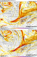
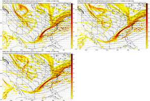
Meanwhile, the NAM is doing the exact opposite with the southern s/w. Now that it's clear the northern stream is going to outrun the southern energy, all we have left is to hope the GFS trend continues.
namconus_z500_vort_us_fh48_trend.gif
 
The postmortem on this "storm" will be a good time for us to examine what we know, or think we know, happened here and why every storm is different. But there are certain keys we need to recognize that are rules to follow early in the 5-6 day model window up to go time. Hope everyone on the gulf has some fun with this one considering the rarity of it.
 
FFC explains their reasoning…

With all that in mind, it is fair to wonder exactly how well hi-res guidance is handling the low-level dry air. As alluded to in the short term discussion above, it is possible that this guidance could underestimate the wet-bulb effect as precipitation falls through the layer of dry air near the surface. The evaporative cooling effect (with 2 phase changes) will still cause temperatures through the column to cool and dewpoints to rise. Dewpoint depressions at colder temperatures also tend to be nullified more quickly than we are often acclimated to here in the Southeast, as air at these lower temperatures already have a lower capacity of moisture carrying capacity per degree. This would make the wet-bulb effect more efficient and serve to saturate the dry layer more quickly. This is the means by which similar winter weather events, including the Snow Jam of January 2014, have overperformed the guidance in terms of forecast snowfall amounts.
Are they reasoning that less precipitation would be lost to sublimation rather than evaporation since the entire column is sub-freezing before onset?
 
Meanwhile, the NAM is doing the exact opposite with the southern s/w. Now that it's clear the northern stream is going to outrun the southern energy, all we have left is to hope the GFS trend continues.
View attachment 165714
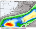
Even on the NAM run it looks like we have a SW flow aloft. Usually we're stressing over a warm nose; now we have a cold nose that's sucking up all our qpf before it gets to the surface. Ill keep watching for another 24 hours, hoping for a last minute trend back NW.
 
It’s too bad nothing else is trying to tick north. How many events have we seen tick NW 50-100 miles inside 48 hours…🤦‍♂️

But dang, the gulf coast is going to get a great one. ⛄

View attachment 165717
Pretty cool that this storm is going to spark the love of weather and snow in a ton of kids in the Deep South
 
Even on the NAM run it looks like we have a SW flow aloft. Usually we're stressing over a warm nose; now we have a cold nose that's sucking up all our qpf before it gets to the surface. Ill keep watching for another 24 hours, hoping for a last minute trend back NW.
Tomorrow will be more about watching radar and ground reports than model runs. That said, it sure would be nice to see some improvement over the next few runs.
 
Are they reasoning that less precipitation would be lost to sublimation rather than evaporation since the entire column is sub-freezing before onset?
I am not sure, maybe someone a lot smarter than me can elaborate what they are thinking. One thing is for sure, 2014 weighs heavily on their minds.
 
It’s too bad nothing else is trying to tick north. How many events have we seen tick NW 50-100 miles inside 48 hours…🤦‍♂️

But dang, the gulf coast is going to get a great one. ⛄

View attachment 165717
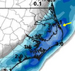
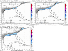
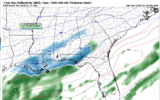
If anything, the trend line is to merge the lighter blues towards the GA and SC Coast. Almost like it's slowing down the lead wave a little or it's showing a little more beef along the coast.

Some of the mesoscale.modeling are a lot more beefy. Who knows at this point?
 
18.3 this morning! It is brisk. Last year's low was 11, so looks like we will stay safely above that mark. No snow tomorrow at all, but we might have a virga storm in the afternoon. Very happy for the gulf coast! That's an awesome event for them! Maybe something surprising will come out of the northern stream energy later this week, while we still have the cold air around?
 
How historical for the gulf

View attachment 165721


I don't know for sure, I've looked and can't find much records, but i'm guessing there will be lots of cities right along the coast that may set an all time record for snowfall. Pretty rare to not have boundary layer issues when you're surrounded by ocean water/marsh.
 
Greetings from Tallahassee!
Winter Storm Watch in effect, likely to be upgraded to a warning this afternoon.
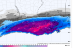
Between .6 and 1.1 inches of QPF currently modeled with all of that frozen, save for perhaps a tenth on the front end.
Incredibly, models trended a bit snowier, although I'll believe the warm nose doesn't win out when I see it.
I just googled "I-10 winter storm" and 3 results came up so the rarity of this us off the charts -- one in 200 years? 500?

Anyway, I know it's been a bummer for my old bretheren in N.C. as well as others who aren't going to cash in on this one (although hope abounds for a late NW trend) but I'll keep you posted on the historic impact of this storm near the Gulf coast. Hopefully we dodge the ZR and have a snow/sleet storm .....
Check out the 12z hrrr. It has an awful lot of snow in Florida. Good luck and stay safe!
 
Maybe we are getting a NW trend...it just wont make a difference to the 85 corridor.

View attachment 165731
Definitely think the chances of us seeing a dusting or even a coating in the Triangle are increasing. When we over perform it tends to be in these situations where we aren’t supposed to really get anything and we end up with a half inch or something. We never have it where we are supposed to get 3-6” and get 10”.
 
You think I didn't already see it??? ;-)
Was always trained to go with the NAM on warm nose/thermal profile issues, but a HRRR coup would be absoultely lovely.
I was in Tallahassee for the 2018 winter storm (which ended up being kind of a letdown, but was still cool to experience there). This one looks like it could be so much bigger than that one, which is crazy! It had been a quarter century since they’d seen accumulating snowfall before 2018 and now it looks like maybe even 1”+ isn’t out of the question, and 3”+, which would be the all-time record, isn’t impossible!? Let’s just hope for minimal ZR because the mossy oaks would be decimated.
 
This hrrr run is stupid.

Here’s the top 10 list of biggest snows ever in New Orleans:

  1. 5.0 inches, Valentine’s Day storm 1895 (Day 1), Feb. 14, 1895, 8.2 inches over two days (Feb. 14-15, 1895)
  2. 4.5 inches, New Year’s Eve, Dec. 31, 1963
  3. 4.0 inches, Jan. 12, 1853 (1-12-1853)
  4. 3.2 inches, Valentine’s Day storm 1895 (Day 2), Feb. 15, 1895
  5. 3.0 inches, Feb. 12, 1899
  6. 2.8 inches, Jan. 24, 1881
  7. 2.2 inches, Jan. 23, 1881
  8. 3.0 inches, Feb. 12, 1958
  9. 1.0 inch, Dec. 25, 2008
  10. 1.0 inch, Jan. 5, 1879

Screen Shot 2025-01-20 at 8.58.21 AM.png
 
I see the RAP is giving me the "finger" this morning. It's totally lost, but it's the RAP, so expected.
View attachment 165736
The RAP got the ATL finger last time. I wouldn't dismiss it necessarily if we have other models with similar outputs. Keep in mind what FFC said too about moisture.
 
My thoughts remain the same. This Arctic blast looks stronger than the last. There absolutely is a concern for Arctic air suppressing the storm too far south for many in the SE. Seen it many times before.

Best bet would be to wait for the cold air to relax and get a storm that runs into all the cold air.

But if you want those big fantasy storms spit out by yesterday’s euro… you better hope models start trending back NW soon.
There was help from destructive interference between the waves but look, credit where credit is due.
 
Back
Top