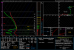
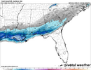
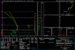
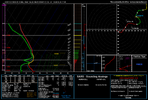
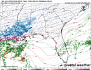
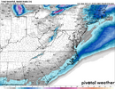
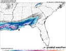
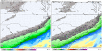
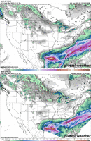
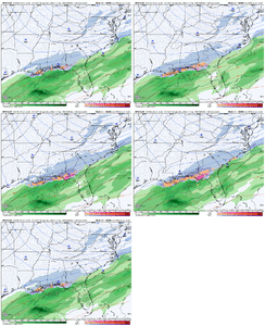
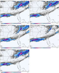
Fv3 is a beaut hr 49-53 in NC in pictures only. Prob virga
-
Hello, please take a minute to check out our awesome content, contributed by the wonderful members of our community. We hope you'll add your own thoughts and opinions by making a free account!
You are using an out of date browser. It may not display this or other websites correctly.
You should upgrade or use an alternative browser.
You should upgrade or use an alternative browser.
Wintry January 21-23 2025
- Thread starter SD
- Start date
Just wait until we start getting MPAS in rangeFV3 must be the GRAF's crazy cousin, probably be enough to keep the NBM from tanking tonight
Mixing for far south coastal guys. Nam sends main surface low south toward keys and pops another off se coast. Think its off at h5 , so id discountHow does that affect things
GeorgiaGirl
Member
NBAcentel
Member
Snowing at the homestead.
Well light snow, steady flurries.
Well light snow, steady flurries.
accu35
Member
Convinced this thing is based on prior model runs now…the lag is so pronounced both ways.Finally much more realistic, almost time to put this one out of it's misery.... at least I'll get to bed early and get some sleep tonight lol
View attachment 165683
BKWRN29
Member
Is this a short term model?
So we see the trough change a little bit in a few runs tonight and throwing more signaturs of precip further N a little...
If that continues and then maybe the qpf is undermodeled then thats how NW sections win and furthet to east
If that continues and then maybe the qpf is undermodeled then thats how NW sections win and furthet to east
Mahomeless
Member
QPF would have to be EXTREMELY under modeled to overcome the lower levels.So we see the trough change a little bit in a few runs tonight and throwing more signaturs of precip further N a little...
If that continues and then maybe the qpf is undermodeled then thats how NW sections win and furthet to east
Actually we know it is lol there basically a 6 hr lag. If the 0z suite tonight magically improved the next run would look better. It has to let all model data run before it can calculate it's final outputConvinced this thing is based on prior model runs now…the lag is so pronounced both ways.
snowlover91
Member
Drizzle Snizzle
Member
6" in Pensacola and Destin !
WxBlue
Meteorologist
I was able to get a little more information about NBM. It is taking account for previous iterations into its output so that's what it was slow to adjust to suppression. It wasn't supposed to knee-jerk to sudden shifts.
Sctvman
Member
Won’t take but 50 miles spread in the low to go from a I-95 east only storm to the entire state getting involved.
Even with the freezing rain on our forecasts you don’t have to go far from under an inch on Folly to 3” on James Island. That’s 5 or so miles on the map. A slight fluctuation of 0.05-0.1 QPF could mean a couple extra inches of snow in the Charleston area
-------- has Beaufort in 2-4”
Even with the freezing rain on our forecasts you don’t have to go far from under an inch on Folly to 3” on James Island. That’s 5 or so miles on the map. A slight fluctuation of 0.05-0.1 QPF could mean a couple extra inches of snow in the Charleston area
-------- has Beaufort in 2-4”
Tokenfreak
Member
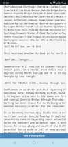
They'll probably do some changes in the morning considering the trends tonight.Surprised that KFFC just put this out at 1030pm tonight...
Won’t take but 50 miles spread in the low to go from a I-95 east only storm to the entire state getting involved.
Even with the freezing rain on our forecasts you don’t have to go far from under an inch on Folly to 3” on James Island. That’s 5 or so miles on the map. A slight fluctuation of 0.05-0.1 QPF could mean a couple extra inches of snow in the Charleston area
-------- has Beaufort in 2-4”
Bro has already made two forecast maps in 12 hours. So much has changed since this morning too. For future storms, I'd like to propose a new challenge: predict how many snowfall maps @wxBrad Pan0vich will issue.
Trends been all day FFC IMO is really reallt concerned with another Snowmaggdeon scenarioThey'll probably do some changes in the morning considering the trends tonight.
Forevertothee
Member
In case others could not read, like myself.Surprised that KFFC just put this out at 1030pm tonight...
It is becoming increasingly likely that a winter storm will impact
north and central Georgia Tuesday through early Wednesday.
Uncertainty remains regarding exact accumulation, but snow is likely
to be the dominant precipitation type. A Winter Storm Watch has been
issued for areas along and south of the I-20/I-85 interchange for the
potential for as much as 2-3" of snow accumulation. Please continue
to monitor for future updates.
Twister
Member
I would love to know what they are seeing to say this about N GA? It makes no sense whatsoeverIn case others could not read, like myself.
It is becoming increasingly likely that a winter storm will impact
north and central Georgia Tuesday through early Wednesday.
Uncertainty remains regarding exact accumulation, but snow is likely
to be the dominant precipitation type. A Winter Storm Watch has been
issued for areas along and south of the I-20/I-85 interchange for the
potential for as much as 2-3" of snow accumulation. Please continue
to monitor for future updates.
Yeah. This is a very different FFC from times past. They were once one of the more conservative offices. Even after 1/28/14. This is a fairly new thing. Of course hard to tell since the last 5-7 years never had much of an opportunity to show the shift.I would love to know what they are seeing to say this about N GA? It makes no sense whatsoever
NBAcentel
Member
Everything seemingly improving a little bit tonight. Hopefully we continue
Stormsfury
Member
4 to 5.6 around Mobile, AL... wow...
Some half foot blips on the Miss and AL beaches... wow.
This is when I expected the NW side of storm to start moving back west 0z models. NW trend will start tonight.Everything seemingly improving a little bit tonight. Hopefully we continue
Sctvman
Member
Even Dave Williams calling for “light snow/sleet accumulations.” And he’s the most conservative met here
jhoodatlga
Member
To be honest, I would be more cautious too. Given that potential snow chances are uncommon in the South, I actually think the KFFC SHOULD BE overly cautious because the consequences of not are just too impactful considering that they forecast for a MAJOR metro area.Yeah. This is a very different FFC from times past. They were once one of the more conservative offices. Even after 1/28/14. This is a fairly new thing. Of course hard to tell since the last 5-7 years never had much of an opportunity to show the shift.
Forevertothee
Member
Well this makes FFC's watch more and more valid, considering it won't take make precip to cause road issues with the temps we have had in place.
Can't wait for the CMC 
It's going to be hilarious if it bounces back a little.
It's going to be hilarious if it bounces back a little.
It’s about the sameCan't wait for the CMC
It's going to be hilarious if it bounces back a little.

