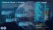
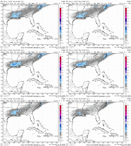
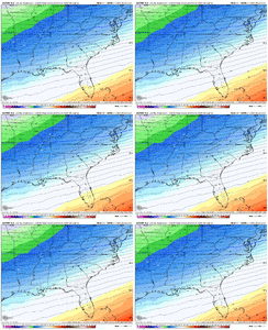
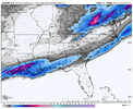
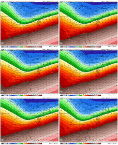
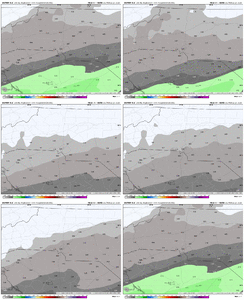
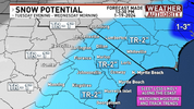
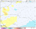
Looks like it is adjusting correctly to me as it ingests new data. May be lagging what we are discussing here in real time but by tomorrow....I still don’t get what the NBM is putting out. 15z cut totals as you’d expect across the core of the region but extended the 1”+ line way further north. I haven’t seen a single model go further north than Atlanta with a 1” line this morning. Anyone have ideas?
View attachment 165521
-
Hello, please take a minute to check out our awesome content, contributed by the wonderful members of our community. We hope you'll add your own thoughts and opinions by making a free account!
You are using an out of date browser. It may not display this or other websites correctly.
You should upgrade or use an alternative browser.
You should upgrade or use an alternative browser.
Wintry January 21-23 2025
- Thread starter SD
- Start date
rburrel2
Member
The GRAF isn't that far north either. They must have access to some modeling we don't see... and it must be way farther north. That's all I can figure.Only thing I can think of is maybe it's somewhat influenced by the GRAF?
Sent from my SM-S156V using Tapatalk
rburrel2
Member
Nah. There's not a single model or mean that has showed over an inch of snow in my county in the last 2 or 3 cycles. And that NBM has me at 1.7 inches.Looks like it is adjusting correctly to me as in ingests new data. May be lagging what we are discussing here in real time but by tomorrow....
Something doesn't add up.
Look at the snow over the gulf and north Florida, insane
The RGEM and UK whiffs may be on to something. Think we are looking at the AI solution at best vs a suppressed fast mover right off the Ga coast and ots only to blow up somewhere the Atlantic.Ai model looks really good for 95 east and Macon to New Orleans. This will be a major event for those locations...Im not buying the complete whiff the UK just spit out.
View attachment 165522
Forevertothee
Member
Seeing parts of Florida will have seen more snow in this event than parts of Upstate SC has seen in 3 years is mind boggling.Ai model looks really good for 95 east and Macon to New Orleans. This will be a major event for those locations...Im not buying the complete whiff the UK just spit out.
View attachment 165522
I would take the NAM's for what precip it is...AI snow maps on SV count ice too as snow.6-8" of snow in Tallahassee ?
NBAcentel
Member
Only thing I can think of is maybe it's somewhat influenced by the GRAF?
Sent from my SM-S156V using Tapatalk
GRAF isn't in NBM.. but NBM does have bias correction which is likely what's causing the differenceNah. There's not a single model or mean that has showed over an inch of snow in my county in the last 2 or 3 cycles. And that NBM has me at 1.7 inches.
Something doesn't add up.
Snow_chaser
Member
Still can’t help but believe the Atlanta office has these northern counties in the wsw because of what happened before
albertwilsonjr
Member

What are they seeing we are not
Sent from my iPhone using Tapatalk
EastmanGAWX
Member
The NAM was spitting out totals for my area that line up with the two historical gold standard storms in this area..1973 and 1914.
We've spent 2 weeks chasing high clouds and a light northwest breeze. I wonder if there are other hobbies where thinks like this happen? Sports, maybe.
Add the National Blend of Models to festering wasteland of unhelpful modern tools.
Add the National Blend of Models to festering wasteland of unhelpful modern tools.
buckinbronco
Member
Definitely possible. They took it on the chin back in 2014 and do not want it to unfold the same way again.Still can’t help but believe the Atlanta office has these northern counties in the wsw because of what happened before
That’s what happens when cold dumps to the westSeeing parts of Florida will have seen more snow in this event than parts of Upstate SC has seen in 3 years is mind boggling.
It was issued before the 6z and 12z runs. Things are trending away from that 'broad' forecast except around bayou country
What are they seeing we are not
Sent from my iPhone using Tapatalk
That's the million dollar question rn
What are they seeing we are not
Sent from my iPhone using Tapatalk
worse or better than 0z and 06z?
rburrel2
Member
They're betting on the WAA/overrunning biases that webber's been harping on. They know.
RollTide18
Member
They're betting on the WAA/overrunning biases that webber's been harping on. They know.
The Mets thinking one thing while the models say another (and even they’re a little spread apart) leads to me believe that we really won’t know much until we see the radar returns Tuesday morning. Snow in the south never goes as forecast, both in a good and bad way.
NBAcentel
Member
Claycochaser
Member
I think that instead of rooting for the "NW Trend", us poor souls on the northern fringes need to root for a stronger LP. In fact, an LP at all on some of these models would help! The baroclinic zone is in the middle of the gulf so we need a strong LP to throw moisture north and actually use the Jet structure to widen the precip field. Attm we have basically a weak wave on the boundary which is why there's such a sharp cutoff.
RollTide18
Member
Post from Jason Simpson last night:
beanskip
Member
Well the Euro just took away my massive ice/sleet storm. Nobody can have any toys apparently.
rburrel2
Member
Where this gets weird is the difference between .01/.02 and .15/.20 liquid is like nothing.... a slight dry bias in overrunning regimes can get you there. and if this was a rain event no one would even notice or care.
But of course flurries and 2.5 inches of snow are vastly different... so it matters a lot in this circumstance.
But of course flurries and 2.5 inches of snow are vastly different... so it matters a lot in this circumstance.
njbarrineau
Member
They're betting on the WAA/overrunning biases that webber's been harping on. They know.
Is this comparable to the situation in 2014? If I remember correctly the low passed closer to Columbia but I could be mistaken.
Sent from my iPhone using Tapatalk
rburrel2
Member
This is the kind of event where hi-res models can have literally nothing but virga and you wind up getting an inch or two of snow out of no where, and that's not entirely hopium based. And i'm not saying it will happen here or in NC, but it's definitely on the table and some unbiased people believe it is as well.
WolfpackHomer91
Member

What are they seeing we are not
Sent from my iPhone using Tapatalk
Climo. History ….
Sent from my iPhone using Tapatalk
I’m not sure about 2014, but I remember 1/22/2022 the low didn’t so much trend NW as it was the short range models latching on to the jet dynamics and seeing the precip shield would be much more expansive NW. This is actually a similar situation as all models have a similar jet set up now as well.Is this comparable to the situation in 2014? If I remember correctly the low passed closer to Columbia but I could be mistaken.
Sent from my iPhone using Tapatalk
Edit: Something to remember it was within 36-48 hrs that the short range models starting latching on. So if we’re going to see that here, you would expect to start seeing it with the 0z runs tonight
rburrel2
Member
Also... we're still 60hrs away from this event even starting. That's an eternity for things to trend better. We're not even 3km NAM range yet.
No one seems to notice what anyone says but one met on here but that’s what has been discussed for days by several of us. This is the area to watch. Same thing happened back in December and led to a 1-2” event.I’m not sure about 2014, but I remember 1/22/2022 the low didn’t so much trend NW as it was the short range models latching on to the jet dynamics and seeing the precip shield would be much more expansive NW. This is actually a similar situation as all models have a similar jet set up now as well.
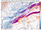
No one seems to notice what anyone says but one met on here but that’s what has been discussed for days by several of us. This is the area to watch. Same thing happened back in December and led to a 1-2” event.
View attachment 165539
Do you expect this to come in play for those of us further west as well or are you primarily speaking for the eastern sections of the board?
Lol it’s not that deep. They are simply covering all ground just in case. But no this isn’t happening
What are they seeing we are not
Sent from my iPhone using Tapatalk
Downeastnc
Member
This was just issued like 20 mins ago....again this seems counter as hell to the model outputs....
rburrel2
Member
The thing with the WAA... look at our last storm. It pushed not only farther north than any model showed 48hrs out... but it was literally way stronger and farther north than models were showing at initialization during the event. That doesn't always happen, but you can't bet against it.
NBAcentel
Member

