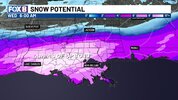
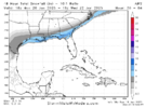
This is a big time improvement from last night.View attachment 165508
NW trend gonna get us back fellas. Still got time.
-
Hello, please take a minute to check out our awesome content, contributed by the wonderful members of our community. We hope you'll add your own thoughts and opinions by making a free account!
You are using an out of date browser. It may not display this or other websites correctly.
You should upgrade or use an alternative browser.
You should upgrade or use an alternative browser.
Wintry January 21-23 2025
- Thread starter SD
- Start date
rburrel2
Member
Best I can tell going back to 1948. The biggest snowfall in Savannah, Georgia was 3.6 inches in December 1989. That is definitely at risk of falling to this storm.
The last run of the Euro is dropping 3.7 inches of kuchera snow there for example.
The EPS mean is a little over 4 inches.
The last run of the Euro is dropping 3.7 inches of kuchera snow there for example.
The EPS mean is a little over 4 inches.
I think all the weather offices in the SE are atpLiterally CAE's discussion is a big "we have no idea". They're tired of the models flip flopping, as they call it, it seems.
Sent from my SM-S156V using Tapatalk
tlokpmalone
Member
Every time we get bad model runs for this storm, I say well hopefully the next batch will be better, but we are now at the point where these next few models runs are pretty much our last chance for any significantly good trends, especially for me just north of metro atl. I was hoping that the 00z and 6z GFS and CMC would start to trend back north, but they haven’t done anything. So I guess this means the 18z and next 00z will have to show something drastically different.
Shaggy
Member
Aren't we all? This was modeled as a big event for a while and now has been evaporatingLiterally CAE's discussion is a big "we have no idea". They're tired of the models flip flopping, as they call it, it seems.
This is a big time improvement from last night.
Definitely a pretty big move, we just can’t afford to take anymore steps back. I’d like to think we could get a 5-10 mile north shift each model suite leading up to the event but that’s my wishcasting at the moment. Hard to believe we let it slip this far, but it’s what we are good at doing.
tlokpmalone
Member
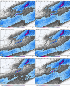
How do you get that ensemble graphic? Is it only on weatherbell where you have to pay?View attachment 165508
NW trend gonna get us back fellas. Still got time.
rburrel2
Member
Seems pretty simple to me.I’d argue that CAE probably has one of the toughest forecast challenges out of anyone out there with this storm.
2 to 4 inches. Very unlikely it's more or less than that amount, imo.
CAE is in the perfect spot for where things will over perform expectations.
tlokpmalone
Member
No way New Orleans gets more snow then me in metro atl
tlokpmalone
Member
How do you see those ensemble graphics with all of the members?
albertwilsonjr
Member
Sent from my iPhone using Tapatalk
https://weather.cod.edu/forecast/ you have to pick GEFS under ensemble models and then the option under Winter on the left column, there is a lot there. so play aroundHow do you get that ensemble graphic? Is it only on weatherbell where you have to pay?
NEGaweather
Member
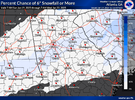
I hate that these maps exist. Gives me hope View attachment 165513
That’s actually a better chance than last night

Sent from my iPhone using Tapatalk
Twister
Member
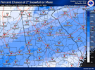
My guess is that it would be much higherWhat are the chances for 2 inches, asking for a friend
Sent from my iPhone using Tapatalk
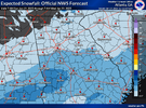
These can be found here ——-> https://www.weather.gov/ffc/winterWhat are the chances for 2 inches, asking for a friend
Sent from my iPhone using Tapatalk
ForsythSnow
Moderator
The crazy part? FFC actually did mildly acceptable last storm which makes me really question what reality will be. If we see the Euro swing more NW and keep seeing a trend to a near or phase, which is within 100 miles in some cases of happening, this axis could be realistic.I hate that these maps exist. Gives me hope View attachment 165513
rburrel2
Member
I hate to say it... but in the end, the Euro AI was leading us the in the right direction for this event in the day4/5/6 timeframe.
I hope you are right. Because nothing I see says 2-4 inches for us & if I was cae, I definitely wouldn’t forecast that amount lolSeems pretty simple to me.
2 to 4 inches. Very unlikely it's more or less than that amount, imo.
CAE is in the perfect spot for where things will over perform expectations.
That's the most confusing part about this whole thing for me not just there but this whole eventWhat I don't understand, is that places like Atlanta have a better chance of 6" or more, but places like Columbus and Macon have a better chance than Atlanta of getting 2" or more.
Sent from my SM-S156V using Tapatalk
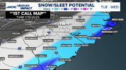
From NWS Raleigh
Sent from my SM-S156V using Tapatalk
Call me skeptical if you like but those percentages are generous in my view based on what we are seeing here come out. Granted, they really don't tell you much of anything anyway. Not a real meaningful value product. imho
ukmet is worst case scenario for everyone
Worst? Hell I thought we lost the UKMET days ago lmaoukmet is worst case scenario for everyone
It even starts shafting TX/LA.Worst? Hell I thought we lost the UKMET days ago lmao
rburrel2
Member
As long as the Euro holds the line, ya'll are fine.
I'm a bit skeptical because just looking at it I'm going ok based on these trends unless we see something drastic in the next 12-24 hrs how do we have a better chance percentage wise of seeing 4 or 6 inches of snowfall then say Atlanta?Call me skeptical if you like but those percentages are generous in my view based on what we are seeing here come out. Granted, they really don't tell you much of anything anyway. Not a real meaningful value product. imho
Sent from my SM-S156V using Tapatalk
GeorgiaGirl
Member
UKMET went from being a tweak or two from being basically back at 0z to being essentially nothing. It really only shows deep, deep, deep in LA getting good snows.
that nam run was such a tease
rburrel2
Member
It's been one step forward, two steps back with this storm ever since it looked so good in the long range.that nam run was such a tease
Are u serious?It even starts shafting TX/LA.
Sent from my SM-S156V using Tapatalk
Snow footprint is a smaller area, it seems.Are u serious?
Sent from my SM-S156V using Tapatalk
dusting-to-2" on the safe side, and readjust to 2" to 4" as you stated if they realize the storm is over performing in CAE and surrounding areas.Seems pretty simple to me.
2 to 4 inches. Very unlikely it's more or less than that amount, imo.
CAE is in the perfect spot for where things will over perform expectations.
Nerman
Member
It will be really impressive if it nails the track two systems in a row. It would be the new King imoI hate to say it... but in the end, the Euro AI was leading us the in the right direction for this event in the day4/5/6 timeframe.
It looks like it's just confined to New Orleans and that's allSnow footprint is a smaller area, it seems.
Sent from my SM-S156V using Tapatalk
Only thing I can think of is maybe it's somewhat influenced by the GRAF?I still don’t get what the NBM is putting out. 15z cut totals as you’d expect across the core of the region but extended the 1”+ line way further north. I haven’t seen a single model go further north than Atlanta with a 1” line this morning. Anyone have ideas?
View attachment 165521
Sent from my SM-S156V using Tapatalk

