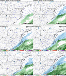
-
Hello, please take a minute to check out our awesome content, contributed by the wonderful members of our community. We hope you'll add your own thoughts and opinions by making a free account!
You are using an out of date browser. It may not display this or other websites correctly.
You should upgrade or use an alternative browser.
You should upgrade or use an alternative browser.
Wintry January 21-23 2025
- Thread starter SD
- Start date
NEGaweather
Member

Sent from my iPhone using Tapatalk
rburrel2
Member
Round Oak Weather
Member
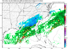
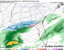
I’ve never thought I’d be needing a NW trend this late but just a few ticks and I’d be in it. South GA still looks pretty good for a lot of people who have never seen much snowSpeaking as a homer - would take about a 60 mile shift on the NAM to bring significant impacts to ATL. So 60 miles in the next 60 hours. Feels pretty doable? But also not likelyView attachment 165478
packfan98
Moderator
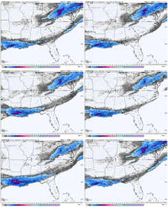
ICON is perking up too.
ForsythSnow
Moderator
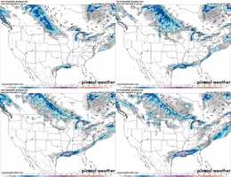
If I'm correct, the NBM came back north? That's the latest I'm assuming since the last one was much further south.
Sent from my iPhone using Tapatalk
ForsythSnow
Moderator
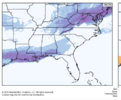
Just a little trend. Keep in mind what I had posted yesterday. We looked bad 36 hours out on the Euro in 2017. Setups like this can change in a snap. One run and the ICON brings its snow 75 miles or so inland. If we see another tick forward on the same path here, we could see 18Z showing snow much further north.Icon actually much farther n here than 06z
View attachment 165483
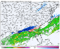
The GRAF actually handled the precipitation in the Charlotte area pretty well. It kept showing the initial band drying up/delaying it. Having said that, if somehow we end up with something, I’m done with these models. All of them have been utterly terrible with this storm. Let’s see what happens though. Maybe the short range models will give us some love.
Rgem sucks as bad as 06z unfortunately
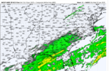
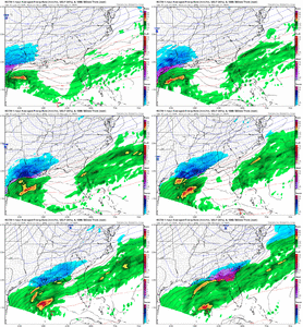
I see you RGEM, show the way!View attachment 165490
Literally a fly fart away. 12z RGEM
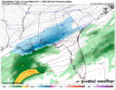
ICON definitely back northAnd we are now getting the ICON back! What you got GFS!?!?!
View attachment 165487
marginal improvements with southern stream were counteracted by the northern stream hauling out of the picture keeping the sheared look unfortunatelyRgem sucks as bad as 06z unfortunately
how id quantify these runs so far- its not "we're so back" but we're definitely in a position to be less over
If we can just get a little something positive from GFS and/or Eurohow id quantify these runs so far- its not "we're so back" but we're definitely in a position to be less over
I will say for areas in the CLT region, GSP, and Atlanta, if we get any unexpected measurable snow, especially on the roads, even if it's a half inch or so. We might end up having an January 2014 situation when it comes to traffic that next morning.
Jan ‘14 was snowmageddon in ATL because the snow came down around lunch time after a normal morning commute. When businesses started letting their people go it was too late. The roads were already screwed upz.
NEGaweather
Member
If I'm correct, the NBM came back north? That's the latest I'm assuming since the last one was much further south.
Yes that’s from this morning
Sent from my iPhone using Tapatalk
Jeez I didn’t remember it being nothing this late in the game on that one. I’d be pretty surprised for a comeback like that one, I believe this cold press is strongerWent back and looked at 2022 just 48hrs out. This tells a story if how we shifted west w precip. I ain’t giving up
View attachment 165493
View attachment 165494
I lived in northern nash county during that event. Brutal watching snowplows on the evening news with what amounted to a heavy frost outside the window. Roads where white from the dusting it was so cold, but you couldnt hardly see it in the grassy dead bermuda.I saw this type of gradient with the December 1989 coastal snow event. I had about 3", 20 miles to my west, just a trace. One county east was 10"+.
View attachment 165476
Showmeyourtds
Member
Really wonder what they’re leveraging. Must know something we don’tYes that’s from this morning
Sent from my iPhone using Tapatalk
The timing with this one looks similar. I'm not a fan of starting precip in the early afternoon as forecasted (hopefully) here. With such meager moisture, I don't want to waste even one flake on an above-freezing surface.Jan ‘14 was snowmageddon in ATL because the snow came down around lunch time after a normal morning commute. When businesses started letting their people go it was too late. The roads were already screwed upz.
I don't understand it either.Really wonder what they’re leveraging. Must know something we don’t
Stormsfury
Member
It trended west yesterday from Eastern Alberta to Western Alberta.NAM looks a lot better, even I need this north trend for more precip
Here's what our brethren, Webber, presumed what'll occur (with his quote below):
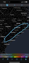

I’ll produce an initial forecast map later today once I see all the 12z guidance this morning, but we are largely beginning to settle into a solution with the upcoming winter storm in the Carolinas.
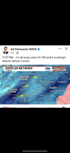
I think here that the snowy sweet spot will be somewhere between the coast and I-95 & US-1. Closer to the coast, mixing with sleet is a concern.
albertwilsonjr
Member
Experts know something we don’t
Sent from my iPhone using Tapatalk
albertwilsonjr
Member

They know something
Sent from my iPhone using Tapatalk
Experts know something we don’t
Sent from my iPhone using Tapatalk
It can and will change at some point (for better or worse).
Atlanta didn't have adequate equipment /resources for brining the roads then either. Since that time they build massive salt storage tents all around the city, and the have a ton more trucks available to treat the roads.Jan ‘14 was snowmageddon in ATL because the snow came down around lunch time after a normal morning commute. When businesses started letting their people go it was too late. The roads were already screwed upz.
Drizzle Snizzle
Member
Experts know something we don’t
Sent from my iPhone using Tapatalk
This is a confusing map. Look at the colors and then the forecasted amounts. Columbia, for example, is shaded in the lightest shade which would indicate 0.1-1” but then it says <4”.
Mahomeless
Member
1047mb HP in Texas??? Yea, ok! LolView attachment 165490
Literally a fly fart away. 12z RGEM
Hard to see how any of the physics models can bump futher north, cause the artic boundary is forcasted to be across central GOM and out to sea in the atlantic. Naturally thats where slp is gonna track. If that boundary ends up 50-75 miles futher north and or it can bend more at a ne angle coming out in the Atlantic. Then that would be gravy. This isnt what i call a coastal track. Its an Out to sea track. Big diff.
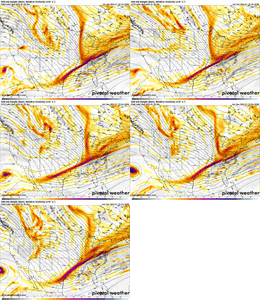
At H5 best thing to root for is ns to slow down and hook up with ss futher west better to get better tilt. That nw kicker maybe gets delayed is the only thing i see that could help this happen.
At H5 best thing to root for is ns to slow down and hook up with ss futher west better to get better tilt. That nw kicker maybe gets delayed is the only thing i see that could help this happen.
Last edited:
TigerSnow
Member
It’s a range map. They are saying anywhere in between those amounts.This is a confusing map. Look at the colors and then the forecasted amounts. Columbia, for example, is shaded in the lightest shade which would indicate 0.1-1” but then it says <4”.

