-
Hello, please take a minute to check out our awesome content, contributed by the wonderful members of our community. We hope you'll add your own thoughts and opinions by making a free account!
You are using an out of date browser. It may not display this or other websites correctly.
You should upgrade or use an alternative browser.
You should upgrade or use an alternative browser.
Wintry January 21-23 2025
- Thread starter SD
- Start date
Six Mile Wx
Member
N/W trends should start today.
Love the positivity its all we got at this pointN/W trends should start today.
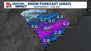
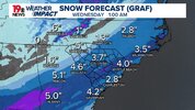
How did the GRAF do for our area for the January 10 storm? I do know it was one of the few that showed the precipitation starting earlier than the other forecast. As I didn’t understand why schools still didn’t go to elearning the night before when it kept showing sleet starting during the time of the early dismissal.
GRAF is banking on a NW trend is what I assume here
Sent from my SM-S156V using Tapatalk
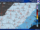
Given where model guidance is at this point I agree, but if we’re going to entertain the scenario of higher snowfall ratios up here w/ little precipitation I don’t think it’s that unlikely. My main concern would be virga even if we also entertain the scenario of a last second NW trend. I remember a weak disturbance swept through here back in early December 2010 and was nothing but a wall of white on radar w/ nothing but a couple flakes flying here and there. As always with any winter storm of any scenario we always introduce another problem while fixing another. If we didn’t luck out on the January 10th storm the way we did, I would be more pissed about this one ngl only because it is a much better setup on paper, but I can’t even be mad. We got our fair share, if we get whiffed to our south I ain’t mad at it. I’m hoping all the snow lovers on this board get their turn one way or another.NWS forecast just updated. First forecast below. Having a hard time believing Atlanta gets more snow than Columbia. But who knows.
View attachment 165424
GeorgiaGirl
Member
How did the GRAF do for our area for the January 10 storm? I do know it was one of the few that showed the precipitation starting earlier than the other forecast. As I didn’t understand why schools still didn’t go to elearning the night before when it kept showing sleet starting during the time of the early dismissal.
I'd say it did decent tbh. It was one model showing the possibility of a bout of snow when I was saying no, naaahhhh.
It's just tough to buy here even if it looks similar to at least one short range model I've seen.
What we need is some unforeseen mesoscale processes to help us out.
ForsythSnow
Moderator
Take it as you will but the NAM looks a touch better so far. There's less interaction with the pacific low and I really think nothing is going to be dead set on the energy until it's cleared. The window is narrowing however.
Take it as you will but the NAM looks a touch better so far. There's less interaction with the pacific low and I really think nothing is going to be dead set on the energy until it's cleared. The window is narrowing however.
I am usually not that great at reading the 500mb side of the models but I felt that it had less interaction at 06z from 00z as well. Hopefully we can keep that trend up from here on out and get that northern stream to help us out. At least what does fall will accumulate quickly for us. Just need to squeeze out every bit of liquid that we can.
Trying to post the same, but my internet is dumb. Pretty big shift.
Been known to happen.What we need is some unforeseen mesoscale processes to help us out.
Well slight adjustments along with models probably under doing extent of precip shield NW, they struggle with fgen we've seen, and yeah not far off from a nice NW jump of the sn footprintTake it as you will but the NAM looks a touch better so far. There's less interaction with the pacific low and I really think nothing is going to be dead set on the energy until it's cleared. The window is narrowing however.
Dang if we get just a day worth of the trends on the NAM, we are all much better off. They just don’t seem to stick…
ITUSETOSNOW
Member
Still say Atl is going to get pasted.
rburrel2
Member
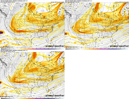
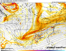
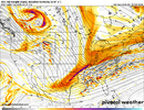
Southern portion of the trough is farther east and sucking in to the northern trough more on the 12z NAM, a shame the northern trough has trended weaker/faster/further north. Otherwise we'd be cooking with a big dog.
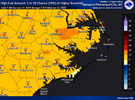
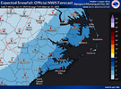
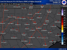
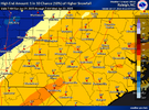
Well then.... It's either nothing or Raleigh gets shut down for a weekOfficial from Rah and yeah, goodness look at the high end amountstalk about a spread
View attachment 165445
View attachment 165448
View attachment 165450

 Or an in-between scenario not yet seen
Sent from my SM-S156V using Tapatalk
rburrel2
Member
Snow returns in Arkansas on 42 hrs on the nam that weren’t there at 06z. Let’s see how that translates east.
It's just too far back, guys
we are losing the most important thing which is time
it will still be left behind but the trend with the southern energy is refreshing to say the least. northern stream isn't getting the memo but should be some marginal improvements upstream for this runI'm probably being dumb but it sorta looks like the NAM is going for it with hooking them up here? It's at least a big improvement and should have the precip shield more robust i'd think.
View attachment 165457
Much better returns over northern la at 48
hang on.. dont disagree.. but want to see what this thing cookswe are losing the most important thing which is time
Sctvman
Member
Weird how it shows higher snows on the barrier islands but that is a legit possibility. Tybee, James, Mt. Pleasant, IOP all in the 2” contourFrom the CHS NWSView attachment 165436
To the naked eye it looks a good clip better here. Total miss on the ULL and tilt looks better. I’d imagine we get a good FGEN finger here
Hemidawg
Member
Are these the same people that had Helene coming over Atlanta when most models had it going way east?I honestly trust the NWS/NOAA more than any raw model output
beanskip
Member
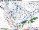
Pretty nice looking precip shield on 12z NAM at 54 hours -- somewhat improved from prior runs, esp. yesterday's.
Eagleflies
Member
NS press backed off here?
I think it did pretty good with it. If you ask Bonds, I think he would concur...How did the GRAF do for our area for the January 10 storm? I do know it was one of the few that showed the precipitation starting earlier than the other forecast. As I didn’t understand why schools still didn’t go to elearning the night before when it kept showing sleet starting during the time of the early dismissal.
with all due respect one mediocre forecast should not make you discount the most capable meteorological brain trust we haveAre these the same people that had Helene coming over Atlanta when most models had it going way east?

