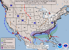
We are gonna give it everything we got to bring this back today. Woke up, went outside, shot a prayer up to the big man & now we keep the faith & see what happens.You gonna bring the goods with the NAM and GFS?
-
Hello, please take a minute to check out our awesome content, contributed by the wonderful members of our community. We hope you'll add your own thoughts and opinions by making a free account!
You are using an out of date browser. It may not display this or other websites correctly.
You should upgrade or use an alternative browser.
You should upgrade or use an alternative browser.
Wintry January 21-23 2025
- Thread starter SD
- Start date
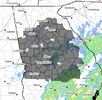
No bueno for the Midlands unless idk what I’m looking at. Idk how to link it.
SnowDoomer21
Member
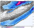
The latest NAM model

Sent from my iPhone using Tapatalk

Sent from my iPhone using Tapatalk
SnowDoomer21
Member
Wonder when the NWS offices in AL Will issue theirs
Sent from my iPhone using Tapatalk
LATER TODAY OR MONDAY MORNING ID SUSPECTWonder when the NWS offices in AL Will issue theirs
Sent from my iPhone using Tapatalk
SnowDoomer21
Member
LATER TODAY OR MONDAY MORNING ID SUSPECT
Central AL Will probably be under one later today and then south AL will be under it Monday or tonight
Sent from my iPhone using Tapatalk
Drizzle Snizzle
Member
Your NWS office is in Tallahassee, Florida.Wonder when the NWS offices in AL Will issue theirs
Sent from my iPhone using Tapatalk
Winter Storm
Member
URGENT - WINTER WEATHER MESSAGE
National Weather Service Birmingham AL
301 AM CST Sun Jan 19 2025
ALZ029>050-192115-
/O.NEW.KBMX.WS.A.0002.250121T1200Z-250122T1200Z/
Randolph-Sumter-Greene-Hale-Perry-Bibb-Chilton-Coosa-Tallapoosa-
Chambers-Marengo-Dallas-Autauga-Lowndes-Elmore-Montgomery-Macon-
Bullock-Lee-Russell-Pike-Barbour-
Including the cities of Tuskegee, Marion, Centreville,
Moundville, Demopolis, Fort Deposit, Troy, Prattville,
Montgomery, Union Springs, Alexander City, Lafayette, Tallassee,
Auburn, Wetumpka, Phenix City, Selma, Opelika, Livingston,
Clanton, Lanett, Eutaw, Valley, Hayneville, Greensboro, Roanoke,
Linden, Rockford, Dadeville, and Eufaula
301 AM CST Sun Jan 19 2025
...WINTER STORM WATCH IN EFFECT FROM TUESDAY MORNING THROUGH LATE
TUESDAY NIGHT...
* WHAT...Light to moderate snow is forecast with total accumulations
up to three inches possible.
* WHERE...Autauga, Barbour, Bibb, Bullock, Chambers, Chilton, Coosa,
Dallas, Elmore, Greene, Hale, Lee, Lowndes, Macon, Marengo,
Montgomery, Perry, Pike, Randolph, Russell, Sumter, and Tallapoosa
Counties.
* WHEN...From Tuesday morning through late Tuesday night.
* IMPACTS...Roads, and especially bridges and overpasses, will
likely become slick and hazardous. Travel could be very difficult.
The hazardous conditions could impact the Tuesday morning and
evening commutes, as well as the Wednesday morning commute.
PRECAUTIONARY/PREPAREDNESS ACTIONS...
Monitor the latest forecasts for updates on this situation.
&&
$$
40/Sizemore
SnowDoomer21
Member
Your NWS office is in Tallahassee, Florida.
I know hist wondering when they’re gonna release their watch
Sent from my iPhone using Tapatalk
DAWG4LIFE
Member
URGENT - WINTER WEATHER MESSAGE
National Weather Service Peachtree City GA
330 AM EST Sun Jan 19 2025
Forsyth-Hall-Banks-Jackson-Madison-Paulding-Cobb-North Fulton- Gwinnett-Barrow-Clarke-Oconee-Oglethorpe-Wilkes-Carroll-Douglas- South Fulton-DeKalb-Rockdale-Walton-Newton-Morgan-Greene- Taliaferro-Heard-Coweta-Fayette-Clayton-Spalding-Henry-Butts- Jasper-Putnam-Hancock-Warren-Troup-Meriwether-Pike-Upson-Lamar- Monroe-Jones-Baldwin-Washington-Glascock-Jefferson-Harris-Talbot- Taylor-Crawford-Bibb-Twiggs-Wilkinson-Johnson-Emanuel-Muscogee- Chattahoochee-Marion-Schley-Macon-Peach-Houston-Bleckley-Laurens- Treutlen-Stewart-Webster-Sumter-Dooly-Crisp-Pulaski-Wilcox-Dodge- Telfair-Wheeler-Montgomery-Toombs- Including the cities of Soperton, Franklin, Hawkinsville, Columbus, Decatur, Covington, Montezuma, Marietta, Atlanta, Sparta, Vidalia, Gray, Homer, Monticello, Warrenton, Eatonton, Ellaville, Talbotton, Toomsboro, Winder, Sandersville, Cumming, Dublin, Vienna, Alamo, Griffin, Pine Mountain, Greensboro, GIbson, West Point, Swainsboro, Mcrae, Eastman, Wrightsville, Athens, Madison, Jackson, Louisville, Newnan, Lawrenceville, Fort Moore, Fort Valley, Buena Vista, Watkinsville, Monroe, Crawfordville, Mount Vernon, Preston, Zebulon, Washington, Comer, East Point, Cochran, Dallas, Gainesville, Jeffersonville, Stockbridge, Cordele, Milledgeville, Abbeville, Macon, Forsyth, Douglasville, Lumpkin, Barnesville, Manchester, Americus, Riverdale, Warner Robins, Crawford, Peachtree City, Commerce, Conyers, Carrollton, Butler, Thomaston, and Roberts 330 AM EST Sun Jan 19 2025
...WINTER STORM WATCH IN EFFECT FROM TUESDAY MORNING THROUGH WEDNESDAY MORNING...
* WHAT...Periods of snow that could be moderate to heavy at times. Total snow accumulations between 1 and 3 inches possible. Light sleet and freezing rain will be possible in portions of east central Georgia late Tuesday night. Ice accumulations less then 0.1 inch possible.
* WHERE...Portions of central, east central, north central, northeast, northwest, southeast, and west central Georgia.
* WHEN...From Tuesday morning through Wednesday morning.
* IMPACTS...Plan on slippery road conditions. The hazardous conditions could impact the Tuesday evening and Wednesday morning commutes.
PRECAUTIONARY/PREPAREDNESS ACTIONS...
Monitor the latest forecasts for updates on this situation.
&&
Kinda surprises me they say 1-3 inches when every model is trending southURGENT - WINTER WEATHER MESSAGE
National Weather Service Peachtree City GA
330 AM EST Sun Jan 19 2025
Forsyth-Hall-Banks-Jackson-Madison-Paulding-Cobb-North Fulton- Gwinnett-Barrow-Clarke-Oconee-Oglethorpe-Wilkes-Carroll-Douglas- South Fulton-DeKalb-Rockdale-Walton-Newton-Morgan-Greene- Taliaferro-Heard-Coweta-Fayette-Clayton-Spalding-Henry-Butts- Jasper-Putnam-Hancock-Warren-Troup-Meriwether-Pike-Upson-Lamar- Monroe-Jones-Baldwin-Washington-Glascock-Jefferson-Harris-Talbot- Taylor-Crawford-Bibb-Twiggs-Wilkinson-Johnson-Emanuel-Muscogee- Chattahoochee-Marion-Schley-Macon-Peach-Houston-Bleckley-Laurens- Treutlen-Stewart-Webster-Sumter-Dooly-Crisp-Pulaski-Wilcox-Dodge- Telfair-Wheeler-Montgomery-Toombs- Including the cities of Soperton, Franklin, Hawkinsville, Columbus, Decatur, Covington, Montezuma, Marietta, Atlanta, Sparta, Vidalia, Gray, Homer, Monticello, Warrenton, Eatonton, Ellaville, Talbotton, Toomsboro, Winder, Sandersville, Cumming, Dublin, Vienna, Alamo, Griffin, Pine Mountain, Greensboro, GIbson, West Point, Swainsboro, Mcrae, Eastman, Wrightsville, Athens, Madison, Jackson, Louisville, Newnan, Lawrenceville, Fort Moore, Fort Valley, Buena Vista, Watkinsville, Monroe, Crawfordville, Mount Vernon, Preston, Zebulon, Washington, Comer, East Point, Cochran, Dallas, Gainesville, Jeffersonville, Stockbridge, Cordele, Milledgeville, Abbeville, Macon, Forsyth, Douglasville, Lumpkin, Barnesville, Manchester, Americus, Riverdale, Warner Robins, Crawford, Peachtree City, Commerce, Conyers, Carrollton, Butler, Thomaston, and Roberts 330 AM EST Sun Jan 19 2025
...WINTER STORM WATCH IN EFFECT FROM TUESDAY MORNING THROUGH WEDNESDAY MORNING...
* WHAT...Periods of snow that could be moderate to heavy at times. Total snow accumulations between 1 and 3 inches possible. Light sleet and freezing rain will be possible in portions of east central Georgia late Tuesday night. Ice accumulations less then 0.1 inch possible.
* WHERE...Portions of central, east central, north central, northeast, northwest, southeast, and west central Georgia.
* WHEN...From Tuesday morning through Wednesday morning.
* IMPACTS...Plan on slippery road conditions. The hazardous conditions could impact the Tuesday evening and Wednesday morning commutes.
PRECAUTIONARY/PREPAREDNESS ACTIONS...
Monitor the latest forecasts for updates on this situation.
&&
SnowDoomer21
Member
Kinda surprises me they say 1-3 inches when every model is trending south
That’s what I’m thinking maybe they’re seeing something we’re not
Sent from my iPhone using Tapatalk
CAE went down to less than an inch since the 0z models. So they are on board for the Midlands.
Tokenfreak
Member
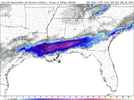
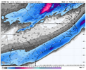
Why is that different than the one shared above?The latest NAM is still a hit for the Deep South and costal areas.
View attachment 165407
Edit: nvm that dark is only a trace amt.
Nerman
Member
Euro Ai has been relatively consistent again. We may not see any NW trend with this one, quite the opposite.
I think that’s become clearEuro Ai has been relatively consistent again. We may not see any NW trend with this one, quite the opposite.
SnowDoomer21
Member
URGENT - WINTER WEATHER MESSAGE
National Weather Service Mobile AL
342 AM CST Sun Jan 19 2025
ALZ051>060-261>266-FLZ201>206-MSZ067-075-076-078-079-191745-
/O.NEW.KMOB.WS.A.0001.250121T1200Z-250122T1200Z/
Choctaw-Washington-Clarke-Wilcox-Monroe-Conecuh-Butler-Crenshaw-
Escambia-Covington-Mobile Inland-Baldwin Inland-Mobile Central-
Baldwin Central-Mobile Coastal-Baldwin Coastal-Escambia Inland-
Escambia Coastal-Santa Rosa Inland-Santa Rosa Coastal-Okaloosa
Inland-Okaloosa Coastal-Wayne-Perry-Greene-Stone-George-
Including the cities of Daphne, Grove Hill, Silas, Pine Hill,
Leakesville, Saraland, Ensley, Chatom, Wiggins, Andalusia,
Millry, Theodore, Fort Morgan, Century, Milton, Flomaton,
Brantley, Homewood, Richton, McLain, Lucedale, Gulf Breeze,
Waynesboro, Seminole, Wright, Thomasville, Grand Bay, Gulf
Shores, Molino, Lisman, Bayou La Batre, Dauphin Island,
Niceville, Spanish Fort, Luverne, Atmore, Fairhope, Crestview,
Prichard, Mobile, Jay, Citronelle, Beaumont, Pensacola Beach,
Brewton, Monroeville, Eglin AFB, Pensacola, Fort Pickens, Fort
Walton Beach, Valparaiso, Perdido Bay, Navarre, New Augusta,
Foley, Greenville, Beulah, Destin, Walnut Hill, Jackson,
Evergreen, Bagdad, Opp, Stockton, Orange Beach, Bay Minette,
Butler, and Camden
342 AM CST Sun Jan 19 2025
...WINTER STORM WATCH IN EFFECT FROM TUESDAY MORNING THROUGH LATE
TUESDAY NIGHT...
* WHAT...Heavy mixed precipitation possible. Total snow and sleet
accumulations between 1 and 3 inches and ice accumulations around
a light glaze possible.
* WHERE...Portions of south central and southwest Alabama, northwest
Florida, and southeast Mississippi.
* WHEN...From Tuesday morning through late Tuesday night.
* IMPACTS...Plan on slippery road conditions, especially on bridges
and overpasses. The hazardous conditions could impact the Tuesday
morning and evening commutes, as well as the commute on Wednesday.
PRECAUTIONARY/PREPAREDNESS ACTIONS...
Monitor the latest forecasts for updates on this situation.
&&
$$
Sent from my iPhone using Tapatalk
Not enough moisture further upstate to capitalize on all this cold air. There are gonna be a lot of losers and sad faces come Tuesday
If this thing does come back to us like 2022, it's going to be fun in here over the next 48 hours. All jokes aside, I really hope we can all get back somehow with this. I don't know if I have ever seen us completely lose a storm like this to the South that was showing something else prior. I guess you can say many in here never really had it, but us in CAE & surrounding areas certainly did. I mean I know the 2018 Jan 3rd event had a pretty sharp cut off here in the Midlands. But even that came West in NC. Just hard to imagine the snow won't be further North & West.
"Guidance tends to have a
southeastward bias with coastal low events, so it is hard to peg
exactly where we will end up with this event."
Someone showed me this clip out the CAE discussion also.
Just trying to keep a little hope going.
southeastward bias with coastal low events, so it is hard to peg
exactly where we will end up with this event."
Someone showed me this clip out the CAE discussion also.
Just trying to keep a little hope going.
SimeonNC
Member
SimeonNC
Member
Basically all of NWS, NOAA or any of the experts are North of model guidance.Hm that’s way north of the models
Sent from my iPhone using Tapatalk
DAWG4LIFE
Member
Yeah, it seems like because of past storms…they are anticipating the storm to track further north and to trend Northwest?Basically all of NWS, NOAA or any of the experts are North of model guidance.
That's likely the case. They are the experts for a reason.Yeah, it seems like because of past storms…they are anticipating the storm to track further north and to trend Northwest?
I think the rain this morning, will actually help the next system. I’ve gotten over an inch since yesterday which was an over performer. I think I-20 south will see some measurable snowfall.If this thing does come back to us like 2022, it's going to be fun in here over the next 48 hours. All jokes aside, I really hope we can all get back somehow with this. I don't know if I have ever seen us completely lose a storm like this to the South that was showing something else prior. I guess you can say many in here never really had it, but us in CAE & surrounding areas certainly did. I mean I know the 2018 Jan 3rd event had a pretty sharp cut off here in the Midlands. But even that came West in NC. Just hard to imagine the snow won't be further North & West.
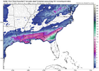
They look the same to meThe Euro stopped some of the bleeding & improved very slightly for areas on the Northern side of this system.
View attachment 165410View attachment 165411
Cad Wedge NC
Member
Not sure I see this .... From GSP this morning:
"Overall, precip chances have trended up a bit roughly along and south of
the I-85 corridor".
What do they know that we don't?
"Overall, precip chances have trended up a bit roughly along and south of
the I-85 corridor".
What do they know that we don't?
DAWG4LIFE
Member
I think a lot of people are trying to figure out what the NWS and NOAA are seeing that we don’t with the trends ?Not sure I see this .... From GSP this morning:
"Overall, precip chances have trended up a bit roughly along and south of
the I-85 corridor".
SimeonNC
Member
It's obvious that all of the official offices such as the WPC and NOAA are seeing something we aren't with this systemNot sure I see this .... From GSP this morning:
"Overall, precip chances have trended up a bit roughly along and south of
the I-85 corridor".
SimeonNC
Member
I honestly trust the NWS/NOAA more than any raw model output
CNCsnwfan1210
Member
We still have at least 36 more hours to go, all the short term high resolution models haven’t got in range yet, and the pieces of energy (esp the Pacific) have just gotten into the upper air network. Adjustments are still possible IMO.
Sent from my iPhone using Tapatalk
Sent from my iPhone using Tapatalk
CNCsnwfan1210
Member
The upper air balloons that are launched by the NWS offices capture and take measurements of the pieces of energy in the upper atmosphere, then that data from what I gather are injested into the weather models. This process rolls forward as more and more measurements are taken and models change or update as that happens.
Sent from my iPhone using Tapatalk
Sent from my iPhone using Tapatalk
SimeonNC
Member
CNCsnwfan1210
Member

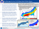
Here’s the latest National Blend of models snowfall forecast
Sent from my iPhone using Tapatalk

Here’s the latest National Blend of models snowfall forecast
Sent from my iPhone using Tapatalk
2-4" seems like a good call for central/eastern NC.
Edit: For now, of course.

